DECEMBER Happy First Day of December  01ST 1831 The coldest December of record in the northeastern U.S. commenced. Temperatures in New York City averaged 22 degrees, with just four days above freezing, and at Burlington VT the temperature never did get above freezing. The Erie Canal was closed the first day of December, and remained closed the entire month. (Ref. David Ludlum) 1896 The temperature at Kipp, MT rose a little more than 30 degrees in just seven minutes, and 80 degrees in a matter of a few hours. A thirty-inch snow cover was melted in half a day. (Ref. The Weather Channel) Kipp, Montana, saw the temperature rise 80 degrees in about 15 hours, entirely melting 30" of snow. (Extreme Weather p. 68, by Christopher C. Burt) (Ref. Wilson Wx. History) 1913 A six-day Front Range snowstorm began. It produced a record total of 46 inches at Denver CO. (Ref. David Ludlum) (Ref. Wilson Wx.- More Information) 1925 An extremely rare late November hurricane began to affect the west coast of Florida as it strengthened during the day. The storm made landfall very early on this date south of Tampa Bay, weakened to a tropical storm as it crossed central Florida, and exited around St. Augustine. The storm regained Hurricane strength off Jacksonville later in the day. Heavy rain continued over northeast Florida on the 2nd. Gale force winds were reported from the Keys to Jacksonville and over 50 people lost their lives, mostly on ships at sea. Damage along the coast south of Jacksonville was heavy and excessive rain and wind seriously damaged citrus and truck crops. (Ref. Wilson Wx. History) 1962 An upper level ridge over the Ohio Valley brought record high temperatures from the northern Plains, Midwest to the Ohio Valley and New York. The following locations reported their warmest December temperatures: Hatfield, WI: 64 °F, Decorah, IA: 63 °F and Charles City, IA: 62 °F. See other daily record high temperatures for the date included on reference link: (Ref. Wilson Wx. History) 1964 On this date through the 2nd, a severe windstorm hit the Canadian Maritimes packing winds gusting to 100 mph. Three fishing vessels and 23 lives were lost. Total damage due to high seas, wind and flooding was estimated at over $1 million dollars. (Ref. Wilson Wx. History) 1966 (1st-2nd) Helped by a Lake Erie temperature of 45 degrees, lake-effect snows deposited 55 inches in Mayville and 60 inches in Copenhagen, NY. Amazing snowfall rates on 2nd in Copenhagen: 6 inches/hour for 30 minutes, then 12 inches/hour between 2-3 p.m. today. Visibility reduced to 50 feet. (Ref. Weather Guide Calendar with Phenomenal Weather Events 2011 Accord Pub. 2010, USA) 1970 High pressure provided a warm flow out ahead of a strong cold front bringing record high temperatures from the southern Plains to the Ohio Valley and Great Lakes region. Temperatures ranged from the 60’s in the Ohio Valley to 70’s and 80’s across parts of the south. Record high temperatures for the date are included on the reference link: (Ref. Wilson Wx. History) 1978 A small tornado cut a path 6 miles long near Zephyrhills, FL. Three mobile homes were destroyed and 17 others were damaged. Five brooder houses were also destroyed, resulting in the death of about 3,000 chickens. A powerful winter storm began to produce heavy snows across mainly the Nebraska panhandle. By the time it ended the next day, Bridgeport, NE reported 15 inches and Scottsbluff, NE reported 11.5 inches. (Ref. AccWeather Weather History) 1982 6.6 Inches snow in Washington, DC is only above average snow for December in the last 12 years. (Ref. Washington Weather Records KDCA) 1985 A storm produced more than six inches of snow from the Northern and Central Plains to parts of Michigan, with 36.4 inches reported at Marquette, MI. Many roads were blocked by snow. A family was stranded for 25 hours south of Colome, SD. Drifts twelve feet high were reported in north central Nebraska. (Ref. The Weather Channel) (Ref. Wilson Wx.- Additional information) 1987 A powerful storm hit the northwestern U.S. Winds gusted to 80 mph at Cape Disappointment WA, and reached 94 mph at Cape Blanco, OR. Thunderstorms in western Washington State produced wind gusts to 60 mph, and dime size hail at Hoquiam. Stevens Pass, in the Cascade Mountains of Washington, received seven inches of snow during the morning hours. (The National Weather Summary) (Storm Data) 1988 Squalls in the Great Lakes Region produced up to a foot of snow in Ashtabula County OH, up to ten inches in Erie County PA, and up to a foot of snow in western New York State. (Storm Data) (The National Weather Summary) 1989 Heavy snow blanketed the mountains of New Mexico, with 12 inches reported at the Angel Fire Ski Basin. Strong northerly winds ushering cold air into the north central U.S. gusted to 55 mph at Devils Lake ND. Low pressure over the Gulf of Alaska produced wind gusts to 69 mph at Kodiak Island. (Storm Data) (The National Weather Summary) 1998 An unprecedented late autumn heat wave shattered records from the Rockies to the East Coast courtesy of an upper level ridge extending from off the southeast coast to the southern Plains. More than 70 record highs were set in the first 8 days of December alone, as temperatures rose into the 70s as far north as South Dakota and Maine. Locations setting their all-time December high temperature record on this date included: Austin, MN and Mondovi, WI hit 65 °F, establishing their warmest December temperature. Other locations reporting daily record highs are included in the reference link: (Ref. Wilson Wx. History) 2002 The game-time temperature at Lambeau Field in Green Bay, WI was 23 °F. That meant a virtually guaranteed win for the Packers with QB Bret Favre starting. The Packers won the game against the Chicago Bears 30-20, making Favre 34-0 at home when the temperature was 34 °F or below. Favre's streak would come to an end a month later in a playoff game against the Atlanta Falcons. (Ref. AccWeather Weather History) 2006 A major ice sleet and snow storm blanketed the St. Louis, Missouri area. An estimated 500 or more homes and businesses were without power after storm's end. For many people, this was the second time in six months power was lost for a prolonged period of time during extreme weather. (Weather Guide Calendar with Phenomenal Weather Events 2007 Accord Publishing, USA) |
|
DECEMBER 2ND 1896 An early season snow and ice storm struck the southeastern U.S. It produced 11 inches of snow at Charlotte NC, and six inches at Atlanta GA. (Ref. David Ludlum) 1925 A late season hurricane caused extensive damage across the Florida peninsula, then moved off the Georgia coast crossing Cape Hatteras as a tropical storm. The storm produced whole gales along the Middle Atlantic and Southern New England coast. Winds gusted to 60 mph at Block Island RI, and reached 64 mph at Atlantic City NJ. (Ref. David Ludlum) (Ref. Wilson Wx. History) 1940 The high temperature of 78 °F at Las Vegas, NV set the all-time warmest temperature in December. (Ref. Wilson Wx. History) 1942 Boston, Massachusetts recorded its lowest December pressure of 28.49 inches of mercury. (Ref. NOAA Boston Weather Events) 1950 Southern Illinois: Three tornadoes swirl across Illinois counties of Bond, Macoupin and Madison; three die and 25 are injured. One death occurs in a car tossed 200 yards near Mt Olive. (Ref. WxDoctor) A late season tornado killed four persons in Madison County and Bond County, east of St Louis, MO. Three tornadoes touched down in Illinois that afternoon, compared to just half a dozen tornadoes in the month of December in 115 years of records up until that time. Thunderstorms also produced hail, which caused more than four million dollars damage in the St Louis area; it was the most damaging hailstorm of record for Missouri. (David Ludlum) (The Weather Channel) (Ref. Wilson Wx. More Information) A tornado causing F2 damage moved through Madison and Macoupin counties in Illinois. One person was killed and 3 more were injured in a car that was carried 200 yards near Mt. Olive. (Ref. Wilson Wx. History) 1964 The first major snowstorm of the season covered parts of northwest Oklahoma with as much as 9 inches of snow through the 3rd. Most roads became snow packed and hazardous, which caused schools across the area to close for one to two days. Just south of the heavy snow area, freezing rain and sleet iced highways and bridges along a belt 100 miles wide, from southwest to northeast Oklahoma. Temperatures in the teens and 20s helped to maintain the snow cover for a week. (Ref. Wilson Wx. History) 1970 A tornado, 400 yards in width, touched down about one mile below the summit of Timpanogos Divide. Trees up to 18 inches in diameter were snapped, and some of the 38-inch snow cover was carried 1000 feet above the ground as the tornado traveled one mile. (Ref. The Weather Channel) 1974 Big snows occurred across the lower Great Lakes and Ohio Valley. One of the more remarkable amounts was 19.5 inches at Detroit, MI. (Ref. AccWeather Weather History) 1977 High winds buffeted the Colorado Rockies. Wind gusts were clocked at 104 mph at Nederland, CO, 100 mph at Morrison, CO and 62 mph at Rocky Flats, CO. (Ref. Wilson Wx. History) 1982 A tornado destroyed a home four miles south of Eastwood, MO. The owners were not injured in that tornado, but ironically one was killed Christmas Eve when another tornado hit the replacement mobile home on the same site. (Ref. The Weather Channel) A tremendous rainstorm in central Illinois brought 6.12 inches of rain to Springfield during a 24 hour period through the 3rd. Jacksonville, IL had 4.80 inches and Peoria, IL recorded 2.89 inches during this period. Lake Springfield rose two feet over the old record stage, flooding nearby land. $100,000 dollars damage occurred to the dam at the lake, due to the tremendous flow of water. (Ref. Wilson Wx. History) The following locations recorded their warmest December temperature on record: Fort Wayne, IN: 71 °F (the only time Fort Wayne ever reached 70° in December), South Bend, IN: 71 °F, Goshen, IN: 69 °F, Elkader, IA: 65 °F, Genoa, WI: 65 °F, Prairie du Chien, WI: 65 °F, Alma, WI: 64 °F, Dodge, WI: 64 °F, Hillsboro, WI: 64 °F, Lynxville, WI: 64 °F, Neillsville, WI: 63 °F, Trempealeau, WI: 63 °F, Viroqua, WI: 63 °F, Caledonia, MN: 62 °F and Theilman, MN: 62 °F. (Ref. Wilson Wx. History) 1985 Richmond, Virginia had its latest freezing day of autumn on this date in 1985 when the temperature fell to 30 °F. The average first freezing day in autumn is October 29th. (1971 to 2000 average) (Ref. Richmond Weather Records KRIC) The significant snow storm from the previous day continued to effect the region, with snow totals including: Dorchester, IA: 18 inches (their greatest one-day snowfall), Hatfield, WI: 16 inches, Soldiers Grove, WI: 15 inches (their greatest one-day snowfall), Sparta, WI: 15 inches, Viroqua, WI: 15 inches (2.2 inches liquid equivalent, their wettest December day), Waukon, IA: 14 inches (their greatest one-day snowfall), La Crescent, MN: 13 inches, Preston, MN: 12.5 inches, Owen, WI: 11 inches (their greatest one-day snowfall, Dodge, WI: 11 inches, Goodrich, WI: 11 inches, Mather, WI: 10 inches, Fayette, IA: 8.5 inches. (Ref. Wilson Wx. History) 1987 A powerful storm over the Gulf of Alaska continued to produce high winds and heavy rain along the northern and central Pacific coast. Winds gusted to 80 mph south of Port Orford, OR, Stevens Pass WA was blanketed with sixteen inches of snow, and Blue Canyon CA was soaked with 1.63 inches of rain. (Storm Data) (The National Weather Summary) 1988 Squalls in the Great Lakes Region produced ten inches of snow at Union City PA. Gale force winds gusted to 55 mph at Buffalo NY. (The National Weather Summary) (Storm Data) 1989 Squalls produced heavy snow in the Great Lakes Region. Totals in Upper Michigan ranged up to 20 inches at Ironwood. Heavy snow and high winds caused 150 auto accidents in Michigan, resulting in sixteen deaths and 22 injuries. Strong northwesterly winds gusted to 73 mph at Johnstown PA, and Lowville, PA received 20 inches of snow in 36 hours. (The National Weather Summary) (Storm Data) 1999 Severe thunderstorms produced three tornadoes in central Oklahoma. Two tornadoes occurred in Logan County near Guthrie, and one tornado touched down near Perry, in Noble County. The tornadoes damaged trees, power poles, barns, outbuildings, and one of them unroofed homes near Guthrie. The December tornado event capped off a record year for tornadoes in Oklahoma, as 145 twisters were observed. (Ref. Wilson Wx. History) 2001 A strong winter storm dropped 50 inches of snow at Gin Flat, CA in 34 hours and 31 inches of snow at Big Flat, CA in 20 hours. Yosemite Valley, CA recorded 7 inches of snow in just 10 hours. (Ref. Wilson Wx. History) 2005 Over the east-central North Atlantic, Epsilon reached hurricane intensity with maximum sustained winds of 80 mph. Hurricane force winds persisted for five days. Epsilon is only the sixth December hurricane ever recorded in the Atlantic Basin. (Ref. Wilson Wx. History) 2007 Seaside, Oregon: A giant Sitka spruce known as the "Klootchy Creek Giant" snaps nearly in half under strong winds. The tree, the largest, in Oregon, stood 200 feet tall and wa estimated to be 500 to 750 years old, near the end of its life cycle. (Ref. WxDoctor) |
|
DECEMBER 3RD 1838 Cleveland Abbe was born on this date in New York City. Abbe was a meteorologist who pioneered in the foundation and growth of the U.S. Weather Bureau, later renamed the National Weather Service. (Ref. AccWeather Weather History) 1856 A severe blizzard began to rage across Iowa and Kansas. It produced as much as 16 inches of snow in Iowa. (Ref. David Ludlum) 1886 December 3rd through 6th - Southern Appalachian Mountains: Great snowstorm dumps up to 42 inches (107 cm) in mountains. 33 inches falls on Asheville, North Carolina and 25 inches at Rome, Georgia. (Ref. WxDoctor) 1926 Yuma, AZ was soaked with 1.10 inch of rain, and by the 10th of the month had received 4.43 inches, making it the wettest December of record. The average annual rainfall for Yuma is 3.38 inches. (3rd-10th) (Ref. The Weather Channel) 1957 Beginning on this date and ending on the 4th, snow fell across the Mid-Atlantic States. Snowfall totals included: Washington, DC: 11.1 inches, Baltimore, MD: 7.8 inches, Philadelphia, PA: 7 inches and Richmond, VA: 2.1 inches. (Ref. Wilson Wx. History) 1970 An upper level west-southwest flow brought record high temperatures from the Plains to southern New England. Locations recording their warmest December temperatures included: St. Louis, MO: 76, Quincy, IL: 72 and Waukon, IA: 63. - Other temperatures - 75 degrees F Dulles, 74 degrees F Baltimore (Ref. Wilson Wx.- Many additional temperatures given) 1971 A small low pressure area moving across the Florida Peninsula dumped heavy snow in North and South Carolina. Tryon, NC checked in with 18 inches for their heaviest total. Asheville, NC recorded 16.3 inches which set a new 24 hour snowfall record and Landrum, SC reported 14 inches. The cold front trailing from the low pressure area pushed southeastward through Sarasota and Manatee County in Florida preceded by thunderstorm winds, heavy rain and at least five tornadoes. Roofs were ripped off, trees and utility lines downed. A tornado moved across the Venice Airport damaging three planes, and into the winter quarters of the Ringling Bros. and Barnum Bailey Circus collapsing two large tents. 3.19" of rain fell at Venice and 2.65" at Sarasota causing some water damage. Ten people were injured by the tornadoes. (Ref. Wilson Wx. History) 1973 (3rd-4th) An ice storm in extreme southeast NE toppled 1,000 poles, uprooted trees, and cut power to 25 towns (worst damage SE of a line from Superior to Plattsmouth). Some rural areas were without power for 4 to 6 days. Similar damage in adjacent Kansas and Iowa. (Ref. Weather Guide Calendar with Phenomenal Weather Events 2011 Accord Pub. 2010, USA) 1982 The 24-hour rainfall record for Arkansas was set as 14.06 inches fell at Big Fork. (Ref. AccWeather Weather History) An unseasonable ridge of high pressure off the southeast coast brought record heat from the Plains to the East Coast and southern Canada. Across southern Ontario Canada, high temperatures reached 73 °F at Hamilton and 68 °F at Toronto. Many locations in the U.S. set record highs for December including: Huntington, WV: 80 °F (broke previous record by 10 degrees), Charleston, WV: 80 °F-Tied (broke previous daily record by 10 degrees), Nashville, TN: 79 °F, Cleveland, OH: 77 °F (broke previous daily record by 12 degrees), Youngstown, OH: 76 °F (broke previous daily record by 15 degrees). (Ref. Wilson Wx.- Additional temperatures given) 1983 Birmingham AL was drenched with 9.22 inches of rain in 24 hours. The rains caused severe flash flooding which literally submerged traffic. (Ref. The Weather Channel) 1987 Stormy weather in the northwestern U.S. finally began to abate, but not before Gold Beach, OR was drenched with 7.94 inches of rain in 24 hours. Low pressure spread snow from the Upper Mississippi Valley to the Central Appalachians. (Storm Data) (The National Weather Summary) 1988 Gale force winds ushered cold air into the northeastern U.S., and produced snow squalls in the Lower Great Lakes Region. Winds gusted to 48 mph at Buffalo NY. (The National Weather Summary) (Storm Data) 1989 Heavy snow and high winds created blizzard conditions in northern New England. Snowfall totals in Maine ranged up to 31 inches, at Limestone. Presque Isle, ME reported a record 30 inches of snow in 24 hours, along with wind gusts to 46 mph. (The National Weather Summary) (Storm Data) 1990 Weather Channel Meteorologist Marny Stanier delivered the network's first live broadcast from a snowstorm as she broadcast during a raging blizzard at Milwaukee, WI. Low pressure moved eastward from the Rockies bringing heavy snow to the Midwest. Wind gusts up to 60 mph created whiteout conditions across a large part of the Upper Midwest. 22 inches fell at Adams, WI. (Ref. AccWeather Weather History) Madison, WI set their 24 hour snowfall record with 17.3 inches and drifts reached 7 feet. Dubuque, IA recorded 15 to 17 inches and 13 inches piled up at Green Bay, WI. Generally, 6 to 18 inches of snow fell. Due to the weight of the snow, the dome roof of a sports stadium collapsed in Iowa City causing about $2 million dollars in damage. For a large portion of Iowa, this was the worst snowstorm in several years. (Ref. Wilson Wx. History) 1992 An intensifying low pressure area south of New England dumped a surprise heavy, wet snow across northern Connecticut, western Massachusetts, and east-central New York. This was an elevation storm with the big snow accumulations primarily above 1,000 feet. Monterey, MA recorded 19 inches of snow. This 19 inch amount was the biggest single snowfall in a storm in Massachusetts in nearly 5 years. Other snowfall amounts in Massachusetts included 16 inches at Great Barrington and 15 inches at Peru. 14 inches of snow was recorded in Stephentown, NY. (Ref. AccWeather Weather History) 1996 Heavy snows across the Carolinas. 18 inches fell at Tryon NC. 16.3 inches fell at Asheville NC to set a new 24-hour record. (Ref. AccWeather Weather History) 1998 The most consecutive days of 70 °F or warmer in the winter season was 6 days in 1998 from December 3rd to December 8th in Richmond, VA Also a maximum temperature of 81 °F occurred in Richmond on the 6th and 7th in this period the December record high temperature. (Ref. Richmond Weather Records KRIC) Upper level high pressure ridging across the southeast brought record high temperatures from the Plains to the East Coast. Necedah, WI set their record high for December with 63 °F. Other high temperatures for the date include Sterling (Dulles Airport), VA: 74 °F , Baltimore, MD: 72 °F, (Ref. Wilson Wx.- Many additional temperatures given) 1999 On this date through the 4th, heavy snow fell over the Foothill and Denver, CO. The heaviest snowfall occurred in the Foothills south of I-70 and near the Palmer Divide. Snowfall totals included: 25 inches near Tiny Town, 18 inches at Conifer, 15 inches near Evergreen, 14 inches at Chief Hosa & Blackhawk, 12 inches at Pine Junction, 11 inches atop Floyd Hill & Roxborough and 10 inches at Castle Rock. Around the Denver metro area, totals included: 10 inches at Highlands Ranch, 9 inches at Parker and 8 inches at Aurora and Wheat Ridge. (Ref. Wilson Wx. History) 2002 Lake Charles, LA recorded 6.19 inches of rain on this day to bring their yearly rainfall total to 81.89 inches, their wettest year ever. The old record was 79.88 inches set in 1919. (Ref. Wilson Wx. History) 2007 Temperatures in Pincher Creek, Alberta Canada go on a fast rollercoaster ride this December day. At 2 PM local time, the temperature stood at 7 °F, but in less than an hour, it had soared to the freezing mark. The "warmth" increased to 45 °F by 7:30 PM then plunged to 9 °F less than 20 minutes later. (Ref. Wilson Wx. History) |
|
DECEMBER 4TH 1786 The first of two great early December storms began. The storm produced 18 inches of snow at Morristown, NJ, and twenty inches of snow at New Haven CT. It also resulted in high tides at Nantucket, which did great damage. (Ref. David Ludlum) 1886 Heavy snow fell on parts of the South and southern Appalachians through the 6th. Montgomery, AL recorded their greatest snow on record as 11 inches fell. An amazing 33 inches fell at Asheville, NC and 25 inches fell at Rome, GA. (Ref. AccWeather Weather History) 1952 On this date through the 9th, London's Great Fog disaster occurred. A beautiful, chilly morning turned deadly as high pressure caused the atmosphere over London, England to stagnate. By the next day, a thick "fog" covered the city. Residents started to complain of a burning sensation in their throats. Hundreds of people were admitted to hospitals because of respiratory distress. Over 4,000 people died over the next 7 days. Other major toxic fogs affected the city in December 1873, January 1880 and in 1892, but the 1952 is London's worst ever smog event. (Ref. Wilson Wx. History) 1953 An ice storm occurred in the Southeast, MN. 2 inches of ice formed on telephone wires. (Ref. AccWeather Weather History) 1957 Early season snow; 11 inches DC, 8 inches Baltimore, 14 inches Loudoun Co. A weak wave of low pressure moves east from Kentucky to the Atlantic Ocean where warm Gulf Stream waters caused very rapid development. Snow rapidly spread throughout the metropolitan area during the morning of the 4th and some became heavy. The blinding snow continued into the afternoon and finally ended during the evening, with 11.4 inches of snow measured at National Airport. That was the heaviest snowfall at National Airport since the spring snowstorm of March 1942. Up to 14 inches was reported in the suburbs. Most of the snowfall took place with temperatures hovering at or near 32 degrees Fahrenheit. (p. 66 Washington Weather Book 2002 by Ambrose, Henry, Weiss) 1964 A big ice storm was in progress across the Northeast. Ice accumulated as much as an inch and a half thick in some places in Massachusetts and eastern New York. Over 80,000 homes were without power after the storm. Some customers did not get their power back for five days. (Ref. AccWeather Weather History) 1972 Winds gusting to 70 mph sent the temperature at Livingston, MT plunging from 52 degrees to 18 degrees in just twenty minutes. (Ref. The Weather Channel) 1973 Southwest Iowa was in the midst of experiencing one of their worst winter storms in history. A large number of power lines and trees were downed due to ice and snow causing power outages lasting several days. Travel was nearly impossible and most schools closed for two days. Several towers were also toppled in Hamilton and Hardin Counties. (Ref. Wilson Wx. History) 1982 The temperature in New York City's Central Park reached 72 degrees to establish a record high for December. The month as a whole was also the warmest of record for NY. A ridge of upper level high pressure off the southeast coast pumped warm south to southwesterly winds from the Tennessee Valley to New England bringing record high temperatures. Other daily record highs included: Richmond, VA: 77 °F, Cape Hatteras, NC: 76 °F, Roanoke, VA: 76 °F, Charleston, WV: 76 °F, Washington, DC: 75 °F, Lynchburg, VA: 75 °F, Baltimore, MD: 74 °F, Sterling (Dulles Airport), VA: 74 °F, Hartford, CT: 71 °F, Wallops Island, VA: 71 °F, Elkins, WV: 70 °F, Portland, ME: 69 °F (broke previous record by 12 degrees), and Bridgeport, CT: 61 °F. (Ref. The Weather Channel) Boston, Massachusetts had a 57 °F the warmest low temperature for the month of December. (Ref. NOAA Boston Weather Events) (Ref. Wilson Wx. - Many additional temperatures are given at this link) 1987 A cold front crossing the Pacific Coast Region brought high winds and heavy rain to California. Thunderstorm winds gusted to 55 mph at Newport Beach CA, and Mount Wilson CA was drenched with 2.17 inches of rain in six hours. Gale force winds prevailed along the Northern Pacific Coast, and winds in the Tehachapis Mountains of southern California gusted to 60 mph. (Storm Data) (The National Weather Summary) 1988 Gale force winds continued to usher cold arctic air into the northeastern U.S. Winds gusted to 65 mph at Windsor Locks CT. Up to a foot of snow blanketed the higher elevations of Vermont. (The National Weather Summary) (Storm Data) 1989 Seventeen cities in the eastern U.S., including nine in Florida, reported record low temperatures for the date. Lakeland FL reported a record low of 31 degrees, and Watertown NY was the cold spot in the nation with a low of 20 degrees below zero. (The National Weather Summary) (Storm Data) 1992 The western and southwestern U.S. was in the middle of a major four day winter storm. Flagstaff, AZ was buried under 23 inches of snow and 22 inches piled up at Sandia Peak, NM. (Ref. AccWeather Weather History) Up to six inches of rain was reported in some mountain locations of southern California with a half to two inches in the valleys. Local flooding, mud slides, standing water, and road closures resulted. Six inches to two feet of snow fell in the higher elevations in the mountains. Flooding in Tijuana, Mexico killed four and left hundreds homeless. Two days earlier, the same storm produced two F1 tornadoes near Santa Rosa, CA. The storm moved out in to the southern Plains during the late afternoon/early evening hours lingering through the 5th killing at least four people. The storm brought 4 to 9 inches of snow to northwest and north-central Oklahoma, and 1 to 4 inches of snow and sleet to much of central Oklahoma. Snow, sleet, and freezing rain fell over a large part of northeast Oklahoma. Behind the cold front and storm, bitterly cold temperatures were felt from the northern Rockies to the Pacific Northwest. Record low temperatures for the date included: West Yellowstone, MT: -36 °F, Rawlins, WY: -26 °F, Pocatello, ID: -22 °F, Laramie, WY: -20 °F, Ennis, MT: -17 °F, Elk Mountain, MT: -12 °F, Scottsbluff, NE: -10 °F, Centennial, MT: -10 °F, Burns, OR: -7 °F, Salt Lake City, UT: 3 °F and Olympia, WA: 19 °F. (Ref. Wilson Wx. History) 1994 Widespread rainfall of 3 to 7 inches, with a maximum of 14.33 inches was measured across east Palm Beach County, Florida during a 24-hour period. Roadways were flooded and minor water damage was reported to some businesses in Delray Beach and Boca Raton. The combination of heavy rains and low astronomical tides caused many sea walls along canals to collapse. Sugar cane harvesting was halted due to the flooding of fields. A few record highs were set in Florida including: Fort Myers, FL: 87 °F, Tampa, FL: 86 °F and Vero Beach, FL: 84 °F. (Ref. Wilson Wx. History) 1996 A persistent westerly flow aloft produced high winds across and near the Front Range Foothills in Colorado. Several locations reported hurricane force wind gusts of 100 to 120 mph. The high winds downed trees and power lines, blew a semi truck over and caused structural damage. Some of the highest winds gusts included: Blackhawk: estimated at 120 mph, Aspen Springs: 115 mph, Eldora Ski Resort: 100 mph, Atop Shanahan Ridge near Boulder: 75 mph, Conifer: 74 mph and 71 mph at the Rocky Flats Environmental Test Facility. (Ref. Wilson Wx. History) 1998 An unseasonable upper level ridge extended from off the southeast coast across Florida into the Gulf of Mexico bringing record high temperatures from the Plains to the East Coast. The temperature soared to 76 °F at Washington, DC to establish a new all-time December high temperature record. The record was to be short-lived, however, as the temperature would top out at 78 °F on the 6th and 79 °F on the 7th. Other daily record highs for the date included: Richmond, VA: 77 °F-Tied, Atlanta, GA: 76 °F, Sterling (Dulles Airport), VA: 75 °F, Athens, GA: 75 °F-Tied, Lynchburg, VA: 75 °F-Tied, New York (Central Park), NY: 74 °F, Atlantic City, NJ: 73 °F, Bridgeport, CT: 72 °F (broke previous record by 11 degrees), Hartford, CT: 71 °F, Boston, MA: 70 °F, Chicago, IL: 66 °F. (Ref. Wilson Wx.- Many additional temperatures given at this link) 2002 A total solar eclipse was experienced by millions of people from Africa to Australia, and from space. Some of the coolest images of the eclipse were from the International Space Station, where people onboard were able to observe the shadow created by the moon as it raced across the Earth's surface at 1,243 mph. (Ref. Wilson Wx. History) The Baltimore-Washington area was under Winter Storm Watches as low pressure developed along a stalled front across the Gulf Coast that moved through two days before. Low pressure moved from the Louisiana coast on the 4th to off the Carolina coast on the 5th. When it was over BWI/Marshall had picked up 7.4 inches, 6.2 inches at Dulles Airport in Sterling, VA and 6.1 inches at National airport in Washington, DC. An early season winter storm brought an expansive shield of snow and ice through much of the eastern U.S., from the lower Ohio Valley, southern Appalachians and into the Northeast. Snow accumulations of 4-8 inches were common along the northern edge of the precipitation shield, while a significant accrual of glaze occurred in the Carolinas. The storm caused at least 17 fatalities, mostly from traffic accidents (CNN). In the Carolinas, electric utilities provider Duke Power characterized the ice storm as the worst in the company's history, with 1.2 million customers or nearly half its entire customer base without power on the morning of the 5th. This surpassed electrical outages inflicted by Hurricane Hugo as it swept through the central Carolinas in September 1989. (Ref. AccWeather Weather History) 2009 SE TX received its earliest snow of record. Houston officially reported 1.0 inch (old record: 1.4 inches on 12/10/2008 and a trace on 12/10/1944). 4 inches in Lake City and Boling were the greatest amounts reported; Bay City reported 2.0 inches while 0.2 inches was reported in Victoria. (Ref. Weather Guide Calendar with Phenomenal Weather Events 2011 Accord Pub. 2010, USA) |
|
DECEMBER 5TH 1886 Snowstorm hits SE, Rome GA 18.5 inches, Knoxville, TN 22.5 and 11 inches at Montgomery AL. (Sandra and TI Richard Sanders - 1987) 1913 Snowstorm hits Denver, Colorado from the 1st to the 6th piling up 46 inches of snow with most of the snow falling on the 4th and 5th. This is still the record for Denver as of 2010. (Ref. Denver Blizzard of 1913) 1941 The temperature at Enosburg Falls soared to 72 degrees to establish a state record for Vermont for the month of December. (Ref. The Weather Channel) 1953 A killer tornado hit Vicksburg MS killing 38 persons, injuring 270 others, and causing 25 million dollars damage, the most damage since the forty-seven days of continuous shelling the town received in the Civil War. (David Ludlum) 1968 High surf from an intense storm near Alaska swept rocks and seawater into pavilions at Onekahakaha Beach near Hilo, HI. Water reached 150 feet above the high-tide mark at Napili Beach and swept into the swimming pool and ground floor of a hotel there. (Ref. AccWeather Weather History) 1972 A deep upper level low over central Canada created an incredible dip in the northern branch of the jet stream. This brought in a surge of brutally cold arctic air from the Plains to the West Coast. Record low temperatures for the date included: Glasgow, MT: -29 °F, Williston, ND: -28 °F, Helena, MT: -28 °F, Pocatello, ID: -25 °F, Aberdeen, SD: -22 °F, Rapid City, SD: -22 °F (broke previous record by 15 degrees), Great Falls, MT: -19 °F, Missoula, MT: -18 °F, Fargo, ND: -17 °F, Colorado Springs, CO: -16 °F, Billings, MT: -16 °F, Denver, CO: -15 °F (broke previous record by 10 degrees), Pueblo, CO: -15 °F, Valentine, NE: -14 °F, Ely, NV: -14 °F, Burns, OR: -14 °F, North Platte, NE: -13 °F, Reno, NV: -12 °F, (broke previous record by 21 degrees). (Ref. Wilson Wx. - Additional Temperature Records are Listed on this Link) 1975 An F3 tornado struck Tulsa, OK during the late afternoon hours injuring 38 people and destroyed numerous structures, including homes and businesses. (Ref. Wilson Wx. History) 1981 An explosively deepening ocean storm southeast of New England caught forecasters off guard and unloaded heavy snow over New England. By the time it was all over on the 6th, Boston, MA was buried under 12.9 inches of snow. Some places south and west of Boston and in Rhode Island had over 2 feet. (Ref. AccWeather Weather History) 1982 An unseasonable upper level ridge off the southeast coast was responsible for record high temperatures from the Ohio Valley to the East Coast including: Orlando, FL: 84 °F, Jacksonville, FL: 82 °F, Augusta, GA: 78 °F, Norfolk, VA: 78 °F, Richmond, VA: 77 °F, Cape Hatteras, NC: 77 °F, Wilmington, NC: 77 °F, Columbia, SC: 77 °F, Savannah, GA: 77 °F-Tied, Raleigh, NC: 76 °F, Charleston, WV: 75 °F, Charlotte, NC: 73 °F, Atlantic City, NJ: 73 °F, Lynchburg, VA: 73 °F, Huntington, WV: 73 °F, Washington, DC: 72 °F, Wilmington, DE: 72 °F, Greensboro, NC: 72 °F, Baltimore, MD: 71 °F, Sterling (Dulles Airport), VA: 71 °F, Elkins, WV: 71 °F, Harrisburg, PA: 70 °F, Philadelphia, PA: 70 °F, Bristol, TN: 70 °F. (Ref. Wilson - Additional Temperatures Records Listed on This Link) 1984 A heavy snowfall, which began on the 4th, came to an end over central and northern Oklahoma. 6.1 inches fell at Oklahoma City, which set a new record for the heaviest snowfall for so early in the season. 10 inches of snow was measured at Skiatook, OK. (Ref. AccWeather Weather History) 1987 Heavy snow blanketed parts of the north central U.S., and freezing drizzle produced a coat of ice up to half an inch thick in northwestern Minnesota and eastern North Dakota. Snowfall totals ranged up to seven inches at Grand Rapids MN, and 12 inches at Seney, MI. High winds in the north central U.S. gusted to 63 mph at Pellston, MI and reached 70 mph at Makinaw Bridge, MI. (The National Weather Summary) (Storm Data) 1988 There was only a "flurry" of activity, as for much of the nation winter remained on hold. The cold and snow of winter was primarily confined to the northeastern U.S. Five cities in the north central U.S. reported record high temperatures for the date, including Norfolk NE with a reading of 65 degrees. (The National Weather Summary) 1989 A warm Pacific storm system brought high winds and heavy rain to western Washington and western Oregon. Up to ten inches of rain deluged the western slopes of the Cascade Mountain Range in Washington State over a three day period, and 500 persons had to be evacuated due to flooding along the Skagit River. Up to five inches of rain drenched northwest Oregon, and winds gusted to 71 mph at Netarts. (The National Weather Summary) (Storm Data) 1996 The first of two major storms brought extremely heavy snows to interior New England. Over a foot of snow fell from Northeastern Pennsylvania to Western Massachusetts through the 6th. (Ref. AccWeather Weather History) 1998 An strong upper level and surface high pressure ridge extended from off the southeast coast bringing widespread record high temperatures from the Plains & Midwest to the East Coast. Locations setting their all-time December high temperature record included: La Crosse, WI: 67 °F, Winona, MN: 65 °F and New Hampton, IA: 63 °F. Locations reporting daily record high temperatures included: Orlando, FL: 84 °F-Tied, Montgomery, AL: 83 °F-Tied, Columbia, SC: 81 °F, Augusta, GA: 80 °F, Wilmington, NC: 80 °F, Charleston, SC: 80 °F, Huntsville, AL: 79 °F, Savannah, GA: 79 °F, Mobile, AL: 79 °F-Tied, Pensacola, FL: 79 °F-Tied, Washington, DC: 75 °F, Charlotte, NC: 75 °F, Sterling (Dulles Airport), VA: 75 °F, Atlanta, GA: 75 °F-Tied, Asheville, NC: 72 °F, Harrisburg, PA: 72 °F, Baltimore, MD: 71 °F-Tied, Toledo, OH: 66 °F, Mansfield, OH: 63 °F, New York (Central Park). (Ref. Wilson - Other High Temperatures Listed on This Link) 2001 A strong low pressure system moved northeast from southeast South Dakota into northeast Minnesota. At the same time, a strong cold front moved east across the Upper Mississippi Valley. Strong thunderstorms developed along the cold front. The winds gusted to 50 mph at New Lisbon, WI and a severe thunderstorm produced nickel size hail just south of Eyota, MN. Strong southerly winds ahead of this cold front helped temperatures to climb into the lower and middle 60s across the region. Many record high temperatures were established for the date. Locations setting record high temperatures for December included: Holland, MI: 70 °F, Flint, MI: 70 °F, Grand Rapids, MI: 69 °F, Lansing, MI: 69 °F, Sparta, WI: 66 °F and Prairie du Chien, WI: 66 °F. Locations reporting daily record high temperatures for the date included: Richmond, VA: 78 °F, Sterling (Dulles Airport), VA: 77 °F, Charleston, WV: 77 °F, Lynchburg, VA: 76 °F, Roanoke, VA: 76 °F, Raleigh, NC: 76 °F-Tied, Washington, DC: 75 °F, Baltimore, MD: 75 °F, Elkins, WV: 74 °F, Wallops Island, VA: 72 °F, Philadelphia, PA: 71 °F, New York (Central Park), NY: 70 °F, Chicago, IL: 68 °F, Bridgeport, CT: 62 °F. (Ref. Wilson Wx. - Other High Temperatures Listed on This Link) 2003 On this date through the 7th, the greatest Nor'easter snowstorm in recent memory struck New York and New England. 14 inches fell in Central Park in New York City. Providence, RI recorded its greatest single snowfall with 17 inches. The greatest accumulation buried Pinkham Notch at Mount Washington, NH with 47 inches. (Ref. Wilson Wx. History) 2007 Grand Forks, North Dakota:.The morning temperature at Grand Forks bottoms out at -19 °F shattering the previous record low set in 1972. It is the third time in five days that Grand Forks has set a low temperature record. (Ref. WxDoctor) 2009 Snow in parts of TX and the Deep South (4th) followed by today’s 4-8 inches in the central Appalachians/Mid-Atlantic piedmont. Parts of New England set record late first measurable snowfalls on the 7th. Record AK highs today: Cold Bay (46 degrees) and McGrath (37). (Ref. Weather Guide Calendar with Phenomenal Weather Events 2011 Accord Pub. 2010, USA) |
|
DECEMBER 6TH 1886 On December 6 an unprecedented snowstorm hit the Southern range of the Appalachian Mountains - and it lasted for three, unrelenting days. When the skies cleared - there were 25 inches of snow in Rome, Georgia 33 inches in Asheville, North Carolina - and twice that much in the mountain passes. Columbia, South Carolina had a record-breaking 11 inches of snow - and on top of that, like icing on a cake - another two inches of frozen sleet! Dec. 3-6, 1886: A southern storm dumped heavy snow in far southwest Virginia. The storm dumped 11 inches in Montgomery, Ala., 22.5 inches in Knoxville, Tenn., 26 inches in Asheville, NC and 16 inches in Wytheville, Va., causing some roofs to collapse. (Ref. Virginia Weather History) 1913 December 1st through the 6th, Denver, Colorado: A six-day, front-range snowstorm dumps a record total of 45.7 inches on Denver, the most snow ever recorded in a single Denver snowstorm. (Ref. WxDoctor) 1926 On December 4th through the 6th 13.1 inches of snow fell over the Boston, Massachusetts area. (Ref. NOAA Boston Weather Events) 1950 A winter storm brought heavy snow to parts of the northern Plains and Midwest. Duluth, MN set their 24-hour snowfall record with 25.4 inches. Otherwise snowfall amounts generally ranged from 6 to 12 inches. (Ref. AccWeather Weather History) 1970 A windstorm toppled the National Christmas Tree at the White House. (Sandra and TI Richard Sanders - 1987) 1972 Most of the country was under the influence of a massive deep upper level trough. Florida escaped the deep freeze with record high temperatures courtesy of an upper level ridge extending from off the southeast coast into the northern Caribbean. Some of the coldest December temperatures in history was recorded with some low temperatures well into the 20’s and 30’s below zero. Record low temperatures for the date included: Roundup, MT: -35 °F (also occurring two days later), Broadus, MT: -32 °F, Havre, MT: -31 °F, Medicine Bow, WY: -31 °F, Helena, MT: -30 °F, Williston, ND: -30 °F, Aberdeen, SD: -30 °F, Rochester, MN: -28 °F, Bismarck, ND: -28 °F, Sheridan, WY: -28 °F (broke previous record by 15 degrees), Miles City, MT: -27 °F, St. Cloud, MN: -27 °F, Fargo, ND: -26 °F, Lander, WY: -26 °F (broke previous record by 11 degrees) Escaping the relentless cold, locations in Florida reported record high temperatures for the date including: West Palm Beach, FL: 87 °F, Fort Myers, FL: 86 °F, Orlando, FL: 86 °F and Daytona Beach, FL: 85 °F. (Ref. Wilson - Additional Temperatures Listed On This Link) 1981 On December 5th through the 6th 12.9 inches of snow fell over the Boston, Massachusetts area. (Ref. NOAA Boston Weather Events) 1982 High pressure off the East Coast brought record high temperatures from parts of the Ohio Valley to the East Coast including: Orlando, FL: 86 °F-Tied, Cape Hatteras, NC: 77 °F, Newark, NJ: 72 °F, Boston, MA: 70 °F (followed by a record high December minimum of 57 °F), Harrisburg, PA: 70 °F, Sterling (Dulles Airport), VA: 70 °F, Wilmington, DE: 69 °F, New York (Central Park), NY: 68 °F, Syracuse, NY: 68 °F, Hartford, CT: 67 °F. (Ref. Wilson - Additional Temperatures Listed On This Link) Boston, Massachusetts had a 57 °F (again) the warmest low temperature for the month of December. (Ref. NOAA Boston Weather Events) 1987 Another in a series of storms brought high winds and heavy rain to the northwestern U.S., with heavy snow in some of the higher elevations. In northern California, Crescent City was drenched with 2.58 inches of rain, and winds gusted to 90 mph. Up to fourteen inches of snow blanketed the mountains of northern California, and snow and high winds created blizzard conditions around Lake Tahoe NV. (Storm Data) (The National Weather Summary) 1988 The morning low at Bismarck ND was eleven degrees warmer than the record low of 25 degrees at Meridian MS, and during the afternoon. Half a dozen cities in the north central and northwestern U.S. reported record high temperatures for the date, including Alpena, MI with a reading of 57 degrees. (Storm Data) (The National Weather Summary) 1989 Heavy snow blanketed the Central Rocky Mountain Region. Totals in the southern foothills of Colorado ranged up to 17 inches at Rye. Arctic air invaded the north central U.S. Lincoln NE, which reported a record high of 69 degrees the previous afternoon, was 35 degrees colder. International Falls MN was the cold spot in the nation with a morning low of 9 degrees below zero, and temperatures in northern Minnesota hovered near zero through the daylight hours. (The National Weather Summary) (Storm Data) 1994 An intense winter storm blasted areas of the south-central Plains to the Midwest bringing everything from ice to heavy snow. A significant ice storm struck much of southwest Kansas coating surfaces with one half to 1 inch of ice. A tremendous amount of tree damage occurred. One traffic fatality was blamed on icy roads. A heavy snow and ice event covered most of the northern two-thirds of Iowa. Much of the southern third of Iowa received freezing rain and sleet bringing down many trees and tree limbs as well as numerous power lines. At one time or another, nearly 300,000 residents lost power, some for as long as four days. To the north of the ice, heavy snow fell with 6 to 12 inches common. Dubuque and Ames received nearly a foot. Damage was well into the millions of dollars across the state of Iowa from this event. (Ref. Wilson Wx. History) 1996 A tightly wrapped 29.23 inches of mercury low dumped unexpected heavy wet snow over eastern Pennsylvania, southeastern New York, and southern New England. Snowfall totals included 19 inches at Tobyhanna, PA, 18 inches at Cornwall, CT, 17.6 inches at Worthington, MA, and 16 inches at East Jewett, NY. Winds gusted to 75 mph at Nantucket, MA and to nearly 100 mph offshore from a ship on Georges Bank. (Ref. Wilson Wx. History) 1998 The highest temperature ever recorded in Richmond, VA in December was 81 °F that occurred on two dates. The other date is December 7th in 1998. (Ref. Richmond Weather Records KRIC) One of the worst cold season long lasting wind storm to ever recorded hit northern Indiana and northwest Ohio. Strong storms damaged a house in Elkhart, blew down trees and power lines in Markle, and spread 70 to 100 mph winds throughout northeast Indiana and northwest Ohio. 82 mph winds were observed at Grissom Air Reserve Base, where the roof was ripped off of a warehouse. Widespread damage to structures, trees and power lines were reported. Phoenix, AZ saw their first snow since 1994 and Las Vegas picked up its heaviest snow since 1967 with 2 inches. Over 45 accidents were reported in just a 3 hour period. A tremendous upper level ridge brought widespread record highs from the Plains to the East Coast. The following locations in Wisconsin recorded their highest December temperatures: Platteville, WI: 64 °F, Richland Center, WI: 64 °F and Mauston, WI: 63 °F. Other daily record highs included: Brownsville, TX: 85 °F-Tied, Tampa, FL: 83 °F-Tied, Augusta, GA: 82 °F, Columbia, SC: 82 °F, Wilmington, NC: 81 °F, Charleston, SC: 81 °F, Richmond, VA: 81 °F, New Orleans, LA: 81 °F-Tied, Shreveport, LA: 81 °F-Tied, Savannah, GA: 80 °F, Raleigh, NC: 80 °F, Roanoke, VA: 80 °F, Galveston, TX: 79 °F, Pensacola, FL: 79 °F, Norfolk, VA: 79 °F, Sterling (Dulles Airport), VA: 79 °F, Washington, DC: 78 °F, Charlotte, NC: 78 °F, Lynchburg, VA: 78 °F, Baltimore, MD: 77 °F, Charleston, WV: 75 °F, Huntington, WV: 75 °F-Tied, Cincinnati, OH: 73 °F, Asheville, NC: 73 °F-Tied, Lexington, KY: 72 °F, Dayton, OH: 72 °F, Elkins, WV: 70 °F-Tied. (Ref. Wilson - Additional Temperatures Listed On This Link) 2001 The ridge off the southeast coast held a cold front at bay bringing one more day of record warm temperatures. Atop Mount Washington, NH (elevation 6,288 feet), the temperature reached 47 °F, setting their highest temperature ever recorded in the month of December. Other daily record highs included: Tampa, FL: 83 °F-Tied, Atlanta, GA: 75 °F, Hartford, CT: 74 °F, Newark, NJ: 74 °F, Atlantic City, NJ: 73 °F, Wilmington, DE: 72 °F, Boston, MA: 72 °F, Concord, NH: 72 °F, New York (LaGuardia), NY: 72 °F, Syracuse, NY: 72 °F, Philadelphia, PA: 72 °F, Providence, RI: 72 °F, Wallops Island, VA: 72 °F, Portland, ME: 71 °F (broke previous record by 10 degrees), New York (Central Park), NY: 71 °F, Milton, MA: 70 °F, New York (Kennedy Airport), NY: 70 °F. (Ref. Wilson - Additional Temperatures Listed On This Link) |
|
DECEMBER Pearl Harbor Day 7TH 1740 In early December two weeks of mild and rainy weather culminated in the worst flood in fifty years in the Lower Connecticut River Valley. The Merrimack River swelled to its highest level, and in Maine the raging waters swept away mills, carried off bridges, and ruined highways. (Ref. David Ludlum) 1830 The winter of 1830-31 was known as the "Winter of the Deep Snow" in Illinois. Records from Fort Armstrong (presentt-day Moline), Fort Dearborn (persont-day Chicago), and Augusta indicated that heavy snowfall of 2 to 3 feet had fallen during the month of December. This severe winter, along with a poor corn harvest, compelled northern Illinoisans to seek grain in southern parts of the state, which had escaped the extreme conditions of the north. The furnishing of grain led to the use of the term "Little Egypt" being used to describe southern Illinois. (Ref. Wilson Wx. History) 1927 Blizzard hits the arrowhead with heavy snows and 70 mph winds at Duluth, MN. (Ref. AccWeather Weather History) 1935 Severe flooding hit parts of the Houston, TX area. Eight persons were killed as one hundred city blocks were inundated. Satsuma reported 16.49 inches of rain. The Buffalo and White Oak Bayous crested on the 9th. (6th-8th) (Ref. The Weather Channel) 1972 Brutal record cold prevailed from the Lakes to the Pacific Northwest. Record low temperatures for the date included: Great Falls, MT: -30 °F, Williston, ND: -30 °F, Bismarck, ND: -28 °F, Rochester, MN: -28 °F, Helena, MT: -28 °F, Green Bay, WI: -21 °F, Minneapolis, MN: -20 °F, Billings, MT: -20 °F, Casper, WY: -18 °F, Sheridan, WY: -18 °F. Most of Florida escaped the deep freeze and a few locations reported record high temperatures for the date including: Vero Beach, FL: 87 °F, Fort Myers, FL: 86 °F and Tampa, FL: 85 °F-Tied. (Ref. Wilson Wx. - Additional Temperature Records Listed) 1987 Heavy rain fell across eastern Puerto Rico, with 19.41 inches reported at Las Piedras. Flooding caused five million dollars damage. Another in a series of storms hit the northwestern U.S., with wind gusts above 100 mph reported at Cape Blanco, OR. While snow and gusty winds accompanied a cold front crossing the Rockies, strong westerly winds, gusting to 93 mph at Boulder CO, helped temperatures in western Kansas reach the 60s for the sixth day in a row. Freezing drizzle in northeastern slowed traffic to 5 mph on some roads in Morrow County. (The National Weather Summary) (Storm Data) 1988 An outbreak of cold arctic air brought up to 18 inches of snow to the Colorado Rockies, with 14 inches at Boulder CO, and seven inches at Denver. Heavy snow blanketed New Mexico the following day, with 15 inches reported near Ruidoso. (Storm Data) (The National Weather Summary) 1989 A storm moving out of the Central Rocky Mountain Region spread snow across Kansas and Oklahoma into Arkansas and Tennessee. Snowfall totals ranged up to 7.5 inches at Winfield KS. Freezing rain on trees and power lines cut off electricity to 24,000 homes in northeastern Arkansas, and 40,000 homes in the Nashville TN area were without electricity for several hours. (Storm Data) (The National Weather Summary) 1996 A rapidly deepening coastal storm crossed New England, giving the region its second heavy snowfall in as many days. 20.5 inches of snow fell at Groton, VT, 19.5 inches was recorded at New Ipswich, NH, 18 inches piled up at Ashburnham, MA, and 16.5 inches was measured at Union, CT. Over eastern Massachusetts and southern New Hampshire, the snow was extremely wet. Snow was still on trees and other objects from the previous day's storm, and this combined with the new snow and some rain mixing in resulted in an enormous amount of tree damage. Over 900,000 people lost power with 500,000 in Massachusetts alone. 113,000 people in Massachusetts were without power for several days. This was the most extensive and costliest weather related power outage in New Hampshire's history as 94,000 lost power during the storm. (Ref. AccWeather Weather History) 1998 The highest temperature ever recorded in Richmond, VA in December was 81 °F that occurred on two dates. The other date is December 6th in 1998. (Ref. Richmond Weather Records KRIC) Overall, 70 all-time December temperature records and 700 daily records were broken during the first 8 days of the month as an unprecedented late autumn heat wave occurred from the Rockies to the East Coast. The following locations set their all-time December record high: Wilmington, NC: 82 °F, Richmond, VA: 81 °F-Tied, Washington, DC: 79 °F, Lynchburg, VA: 79 °F-Tied, Greensboro, NC: 78 °F-Tied, Atlantic City, NJ: 77 °F, Islip, NY: 77 °F (broke previous daily record by 19 degrees), Providence, RI: 77 °F (broke previous daily record by 14 degrees), Baltimore, MD: 77 °F-Tied, Newark, NJ: 76 °F, Boston, MA: 76 °F (broke previous daily record by 10 degrees), Windsor Locks and Bridgeport, CT: 76 °F (broke daily record by 14 degrees), Hartford, CT: 76 °F (broke previous daily record by 14 degrees), New York (Central Park), NY: 75 °F, New York (Kennedy Airport), NY: 75 °F (broke previous daily record by 16 degrees), New York (LaGuardia), NY: 75 °F, Harrisburg, PA: 75 °F-Tied, Milton, MA: 74 °F (broke previous record by 12 degrees), Concord, NH: 73 °F, Philadelphia, PA: 73 °F-Tied, Worcester, MA: 72 °F and Portland, ME: 71 °F-Tied (broke previous daily record by 12 degrees). (Ref. Wilson Wx.- Additional Temperature Records Listed at This Link) 2002 Fog reduced visibility on I-65 near the Tennessee River in Northern Alabama during the early morning hours. A tractor trailer jackknifed, leading to a chain reaction accident that involved 18 vehicles. (Ref. Wilson Wx. History) 2003 December 5th through the 7th, New York and New England: The greatest Nor'easter snowstorm in recent memory strikes New York and New England. In Central Park, New York City, the accumulation reaches 14 inches. The greatest accumulation buries Pinkham Notch at Mount Washington in New Hampshire: 47 inches. (Ref. WxDoctor) 2006 December 7th through the 8th, Valentine, Nebraska: Valentine residents experience and 80 °F temperature rise over two days as the recorded low of -14 °F Thursday morning is followed by a 66 °F high on Friday. (Ref. WxDoctor) |
|
DECEMBER 8TH 1783 On Dec. 8th a mild period set in and by the 11th all the snow had melted and a diary entry on Dec. 8th described the mild period as "Indian Summer." Today, "Indian Summer" refers to mild fall weather after the season's first frost has occurred. (Washington Weather Book 2002 by Ambrose, Henry, Weiss) 1804 John Sayer at the Snake River Fir Trading Post near present day Pine City mentions: "Cold day. Thermometer 10 degrees below freezing." Lewis and Clark also noted this cold wave at their winter quarters in Ft. Mandan, North Dakota near present day Bismarck. (Ref. AccWeather Weather History) 1876 The term BLIZZARD first employed in government “Monthly Weather Review” (Ref. AccWeather Weather History) 1892 A tremendous icefall occurred at Gay Hill, TX. Ice averaged four to six inches in diameter. (Ref. David Ludlum) (Ref. AccWeather Weather History) 1914 On December 7th through the 8th a northeast gale with a heavy glaze caused much damage in the Boston, Massachusetts area. (Ref. NOAA Boston Weather Events) 1938 The temperature at La Mesa, CA soared to 108 °F to set a U.S. record for the month of December. Los Angeles reached 91 °F, the only time a 90 °F reading was reached in December in that city's history. (Ref. The Weather Channel) (Intellicast) 1946 Many locations from the Missouri Valley, Midwest to the Great Lakes set record high temperatures. Charles City and Osage, IA recorded their highest December temperatures on record with 63 °F and 62 °F respectively. Other daily record highs included: Topeka, KS: 70 °F, St. Louis, MO: 70 °F, Kansas City, MO: 69 °F, Des Moines, IA: 69 °F, Omaha, NE, 68 °F, Springfield, IL: 67 °F, Evansville, IN: 67 °F, Fort Wayne, IN: 65 °F, Indianapolis, IN: 65 °F and Chicago, IL: 64 °F. (Ref. Wilson - Additional Temperatures Listed On This Link) 1963 Lightning caused the crash of a jet airliner killing 81 persons at Elkton MD. The lightning apparently caused an explosion in one of the outboard wing tanks. (Sandra and TI Richard Sanders - 1987) (Ref. Wilson Wx. History) 1971 6.8 inches of snow fell at Tucson, AZ for the city's biggest snowstorm on record. (Ref. Wilson Wx. History) 1972 Brutal record cold held a firm grip from the Rockies to the West Coast. The low at Billings, MT was a record at -25 °F, and the high was only -14 °F. This was the 3rd straight day that the high temp did not exceed -11 °F. Record low temperatures for the date included: Great Falls, MT: -36 °F, Helena, MT: -35 °F (broke previous record by 11 degrees), Havre, MT: -33 °F, Sheridan, WY: -30 °F, Billings, MT: -25 °F, Winnemucca, NV: -25 °F, Pocatello, ID: -24 °F (broke previous record by 15 degrees), Rapid City, SD: -23 °F, Fargo, ND: -21 °F, Kalispell, MT: -20 °F, Burns, OR: -20 °F, Missoula, MT: -19 °F, Boise, ID: -19 °F (broke previous record by 17 degrees), Casper, WY: -19 °F, Eugene, OR: -12 °F (broke previous record by 30 degrees), Salem, OR: -12 °F (broke previous record by 29 degrees), Reno, NV: -12 °F (broke previous record by 12 degrees), Pendleton, OR: -11 °F (broke previous record by 14 degrees). The sunshine state lived up to its name with a few locations reporting record highs including: Fort Myers, FL: 88 °F, Orlando, FL: 86 °F and Tampa, FL: 86 °F. (Ref. Wilson - Additional Temperatures Listed On This Link) 1978 Record cold prevailed from the Rockies to the west coast thanks to a strong and deep upper level trough. Alamosa, CO tied their December record low with -42 °F. Other daily record lows for the date included: Flagstaff, AZ: -23 °F (broke previous record by 15 degrees), Pueblo, CO: -23 °F (broke previous record by 14 degrees), St. Cloud, MN: -22 °F, Sioux City, IA: -19 °F, North Platte, NE: -17 °F, Colorado Springs, CO: -14 °F, Grand Junction, CO: -12 °F (broke previous record by 15 degrees), Goodland, KS: -11 °F, Winslow, AZ: -10 °F (broke previous record by 15 degrees), Denver, CO: -10 °F, Clayton, NM: -7 °F, Roswell, NM: -7 °F (broke previous record by 13 degrees). Meanwhile, an upper level ridge off the southeast coast brought record high temperatures to parts of the southeast including: Fort Myers, FL: 90 °F, Orlando, FL: 88 °F, Daytona Beach, FL: 85 °F, Key West, FL: 85 °F, Vero Beach, FL: 85 °F-Tied, Jacksonville, FL: 83 °F, Columbia, SC: 83 °F, Savannah, GA: 82 °F, Charleston, SC: 82 °F, New Orleans, LA: 82 °F-Tied, Meridian, MS: 81 °F, Pensacola, FL: 80 °F, Wilmington, NC: 80 °F, Columbus, GA: 79 °F, Raleigh, NC: 78 °F, Bristol, TN: 77 °F, Chattanooga, TN: 77 °F, Richmond, VA: 77 °F, Norfolk, VA: 77 °F-Tied, Atlanta, GA: 76 °F, Tupelo, MS: 76 °F-Tied, Knoxville, TN: 75 °F-Tied, Cape Hatteras, NC: 74 °F, Washington, DC: 74 °F, Roanoke, VA: 73 °F, Sterling (Dulles Airport), VA: 72 °F and Oak Ridge, TN: 72 °F-Tied. (Ref. Wilson - Additional Temperatures Listed On This Link) 1987 A cold front crossing the northwestern U.S. continued to produce high winds along the coast, and heavy snow blanketed parts of the western U.S. Snowfall totals in the mountains of western Nevada ranged up to 18 inches at Heavenly Valley, and near the Boreal Ski Resort, and winds at Reno NV gusted to 56 mph. Thunderstorms over southern Florida deluged the Florida Keys with up to five inches of rain. Strong winds, gusting to 48 mph at Gage OK, ushered wintry weather into the Central High Plains. Goodland KS, which one-day earlier was 63 degrees, was blanketed with two inches of snow. (The National Weather Summary) (Storm Data) 1988 Santa Ana winds buffeted southern California, with gusts to 92 mph reported at Laguna Peak. The high winds unroofed buildings, and downed trees and power lines, igniting five major fires, and numerous smaller ones. Damage was estimated at 15 to 20 million dollars. (The National Weather Summary) (Storm Data) 1989 A winter storm spread snow and freezing rain across much of the Atlantic Coast Region, from Georgia to New Jersey. Snowfall totals ranged up to seven inches, at Staunton, VA and Tobacco, MD. Up to six inches of snow blanketed the mountains of northern Georgia. More than one hundred auto accidents were reported in Gwinnett County GA. (Storm Data) (The National Weather Summary) 1991 A late-season outbreak of severe thunderstorms ahead of a cold front moved across central Illinois. Baseball-size hail was reported at Manito in Mason County, as well as Tremont in Tazewell County. In Menard County, tennis-ball size hail was reported at Petersburg. A tornado touched down near the town of McLean and moved east to near Heyworth. This tornado caused some damage to a manufacturing plant, as well as several outbuildings on farms along the storm's path. (Ref. AccWeather Weather History) 1996 The same coastal storm the dumped heavy snow over central and northern New England produced 3 inches of rain at the Blue Hill Observatory in Milton, MA. This pushed its yearly rainfall to 65.77 inches. This set a new record for yearly rainfall for a site that has kept records at a relatively unchanged climatological location for 110 years. This new record was broken only two years later, in 1998. (Ref. Wilson Wx. History) 1998 The most consecutive days of 70 °F or warmer in the winter season in Richmond, Virginia was 6 days in 1998 from December 3rd to December 8th. Also a maximum temperature of 81 °F occurred on the 6th and 7th in this period. (Ref. Richmond Weather Records KRIC) 2000 California braced for blackouts as the state continued to experience an electrical power crisis. Abnormally cold temperatures, 10 to 20 degrees below normal, pushed power demands to critical levels. The state warned that it was facing a Staff 3 crisis, where mandatory blackouts would occur. (Ref. Wilson Wx. History) 2002 A tragedy unfolded as residents in North Carolina started using unorthodox methods to keep warm during the state's worst ice storm ever. Over 100 people were hospitalized and two died from carbon monoxide poisoning. One man died after using a charcoal grill to heat his home and another died while using a generator in an enclosed sun-porch area. National Guardsmen went door to door to caution residents about heating their homes improperly and to notify them about the availability of shelters. (Ref. Wilson Wx. History) 2017 On December 8th and 9th 2017 Glen Allen had 8-9 had 5.2 inches. A cold front passed on December 7th and became stationary along the coast. It first looked like it would be just a little snow as weak low waves would move up the front and the precipitation would hardly reach inland to the Glen Allen area. But then a low pressure formed over SE Texas giving SE Texas about 5 inches of snow and tracked NE and produced a good snowstorm for the Glen Allen area. The precipitation started as a mix of rain and snow around 1350 on December 8. The mix changed to all snow at 1440 and snow became heavy at 1530 giving 1.1 inches in one hour. After 1830 the snow rate was about 0.3 of an inch per hour adding up to 3.8 inches by midnight and 0.56 inches of liquid. The snow tapered to very light flurries about 2300. The little snow that fell during the morning hours of the 9th melted as it fell. The temperature was near freezing during the storm but never fell below freezing. During the day of the 9th there was generally about 0. 2 inches of snow per hour with melting giving a total of 1.4 inches by the time it ended at 1900 hours. The models had trouble with this storm first predicting too little snow and by the end predicting too much snow. (Snow pictures- The snow really stuck to trees |
|
DECEMBER 9th 1786 A second great snowstorm in just five days brought another 15 inches of snow to Morristown, NJ, on top of the eight inches which fell on the 7th and 8th, and the 18 inches which fell on the 4th and 5th. The total snowfall for the week was thus 41 inches. New Haven CT received 17 inches of new snow in the storm. Up to four feet of snow covered the ground in eastern Massachusetts following the storms. (9th-10th) (David Ludlum) (The Weather Channel) 1879 December 9th through the 10th, Chicago, Illinois: Chicago sets record highs for both 9 and 10 December, and they occur but minutes apart. During the late evening of the 9th, southerly winds bring warm air into the city. The thermometer peaks at 62 °F just before midnight and remains there into the wee hours of the 10th before a cold front brings colder temperatures that morning. (Ref. WxDoctor) 1917 A severe winter storm struck the Ohio Valley and the Great Lakes Region. It produced 25 inches of snow and wind gusts to 78 mph at Buffalo NY. The storm produced 26 inches of snow at Vevay IN, with drifts fourteen feet high. By the 16th of the month people could walk across the frozen Ohio River from Vavey into Kentucky. (8th-9th) (David Ludlum) (The Weather Channel) 1961 Snowstorm hits central Minnesota. Mora, MN gets about a foot of snow. (Ref. AccWeather Weather History) 1987 The fifth storm in nine days kept the northwestern U.S. wet and windy. Winds along the coast of Washington gusted to 75 mph at Oceans Shores and at Hoquiam, and the northern and central coastal mountains of Oregon were drenched with three inches of rain in ten hours, flooding some rivers. Snowfall totals in the Cascade Mountains of Washington State ranged up to 36 inches in the Methow Valley. High winds in Oregon blew a tree onto a moving automobile killing three persons and injuring two others at Mill City. (The National Weather Summary) (Storm Data) 1988 A winter storm blanketed the Southern and Central Appalachians with up to ten inches of snow. Arctic air invaded the north central U.S. bringing subzero cold to Minnesota and North Dakota. (The National Weather Summary) (Storm Data) 1989 A strong storm produced wind gusts of 40 to 65 mph from the Alaska Peninsula to the North Gulf Coast of Alaska. Southeasterly winds gusted to 75 mph in the Anchorage hillside. Gusty winds associated with a strong cold front caused a power outage across much of the island of Hawaii. (The National Weather Summary) (Storm Data) 1995 Record 24-hour snowfalls of 38 inches in Buffalo, NY and of 28 inches in Sault Ste. Marie, MI on December 9-10 which were due to lake-effect snowstorms. (Ref. AccWeather Weather History) 2003 Although it never threatened land, a subtropical storm became Tropical Storm Peter approx. 700 miles WNW of the Cape Verde Islands. Combined with Tropical Storm Odette from earlier in the month, this is the first time since 1887 that 2 tropical storms formed in the Atlantic Basin in December. (Ref. Weather Guide Calendar with Phenomenal Weather Events 2011 Accord Pub. 2010, USA) 2017 On December 8th and 9th 2017 Glen Allen had 8-9 had 5.2 inches. A cold front passed on December 7th and became stationary along the coast. It first looked like it would be just a little snow as weak low waves would move up the front and the precipitation would hardly reach inland to the Glen Allen area. But then a low pressure formed over SE Texas giving SE Texas about 5 inches of snow and tracked NE and produced a good snowstorm for the Glen Allen area. The precipitation started as a mix of rain and snow around 1350 on December 8. The mix changed to all snow at 1440 and snow became heavy at 1530 giving 1.1 inches in one hour. After 1830 the snow rate was about 0.3 of an inch per hour adding up to 3.8 inches by midnight and 0.56 inches of liquid. The snow tapered to very light flurries about 2300. The little snow that fell during the morning hours of the 9th melted as it fell. The temperature was near freezing during the storm but never fell below freezing. During the day of the 9th there was generally about 0. 2 inches of snow per hour with melting giving a total of 1.4 inches by the time it ended at 1900 hours. The models had trouble with this storm first predicting too little snow and by the end predicting too much snow. (Snow pictures- The snow really stuck to trees 2018 The Richmond International Airport had 11.5 inches of snow on December 9, 2018 which was the second heaviest single-day December snowfall on the Richmond records. The record was December 22nd 1908 when 15 inches occurred. Yesterday’s snowfall total also already makes December the 6th snowiest December on record. Dec Totals, 1st-1908 17.2, 2nd-1917 15.3, 3rd-1958 12.5, 4rd-1935 12.3, 5th-1966 12.2, 6th-2018 11.5 The snow started at 7:35AM and lasted until 2100 and was all snow with a liquid equivalent of 1.16 inches. The maximum snowfall rate was about 2 inches per hour from 1505 to 1530. This was also Richmond's 12 largest snowstorm since 1897. The models did not predict the high snowfall totals. To see pictures of this storm copy this address into the address bar ---- https://photos.app.goo.gl/rhkxa16bLTjK13J87. This was also Richmond's 12 largest snowstorm since 1897 and the 7th largest single day storm. (Ref. See the Chart of the 25 Greatest Snowstorms) (Ref.Springfield Park Station)See pictures of this snowstorm (Ref. Springfield Park Station)See hourly observations for this snowstorm (Ref. Springfield Park Station)See video taken around 3 PM of the 9th during the snowstorm. |
|
DECEMBER 10TH 1699 A severe ice storm hit Boston, MA causing much damage to orchards. (Ref. The Weather Channel) 1904 7.0 inches of snow occurred in in Washington, DC and 10.0 inches in Baltimore, MD. (Ref. Washington Weather Records - KDCA) 1919 Bend, Oregon: A new 24-hour snowfall record for the state is set when Bend records 28 inches. (Ref. WxDoctor) Cheyenne, WY reported the last of five straight days of snow. On this date, they set a daily record with 9.3 inches and 18.6 inches over the five days. Record low temperatures were set from the Plains to the West Coast including: Glasgow, MT: -32 °F, Waterloo, IA: -29 °F (broke previous record by 14 degrees), Havre, MT: -28 °F, Williston, ND: -27 °F, Bismarck, ND: -26 °F, Norfolk, NE: -26 °F, Duluth, MN: -23 °F, Scottsbluff, NE: -22 °F, Rochester, MN: -21 °F, Lander, WY: -21 °F: Tied, Great Falls, MT: -20 °F--- While Gainesville, FL set a record high with 83 °F. (Ref. Wilson - Additional Temperatures Listed On This Link) 1946 The temperature at New York City soared to 70 degrees. (Ref. David Ludlum) High pressure along the southeast coast brought a south to southwesterly flow of unseasonably warm air to the east. Record high temperatures for the date included: Roanoke, VA: 73 °F, Newark, NJ: 72 °F, Harrisburg, PA: 71 °F, Baltimore, MD: 70 °F, Allentown, PA: 70 °F, New York (Central Park), NY: 70 °F, Lynchburg, VA: 69 °F-Tied, Atlantic City, NJ: 68 °F, Philadelphia, PA: 68 °F, Wilmington, DE: 67 °F, Hartford, CT: 67 °F. (Ref. Wilson - Additional Temperatures Listed On This Link) 1949 The barometric pressure at Las Vegas NV reached a record low reading of 29.17 inches (987.8 millibars). (Ref. The Weather Channel) 1963 A winter storm moved across Oklahoma through the 11th. Freezing rain and sleet glazed highways, along with snow depths reaching two inches on top of the ice. 100 traffic accidents occurred at Oklahoma City alone during the evening rush hour the next day, and more than 14 injuries were reported due to falls on the ice. Ice accumulations on telephone lines knocked out service to parts of northwest Oklahoma. (Ref. Wilson Wx. History) 1967 During the overnight hours, a tornado struck Ft. Walton Beach, FL and Ocean City in Okaloosa County destroying 35 homes and nine businesses. One person was killed and 40 people injured. 33 businesses and 290 homes were damaged. An hour later, a tornado touched down briefly at Tyndall Air Force Base and again across the Bay in Parker and Callaway. One fatality occurred at Tyndall AFB as did most of the severe damage with 34 injuries. 39 homes at Tyndall were destroyed. A few hours later, a tornado destroyed four farmhouses and several barns in the rural area between Blountstown and Altha, FL. (Ref. Wilson Wx. History) 1971 A strong ridge across the Florida Straits brought unseasonably warm temperatures from the Great Lakes to the Southeast. Charleston, WV tied their record high for December with 80 °F. Other daily record highs for the date included: Orlando, FL: 85 °F, Montgomery, AL: 78 °F, Pensacola, FL: 78 °F, Huntington, WV: 76 °F, Bristol, TN: 76 °F, Nashville, TN: 74 °F, Beckley, WV: 73 °F, Knoxville, TN: 73 °F, Birmingham, AL: 72 °F-Tied, Columbus, OH: 72 °F, Elkins, WV: 72 °F, Lexington, KY: 72 °F, Paducah, KY: 72 °F, Louisville, KY: 71 °F, Oak Ridge, TN: 71 °F, Evansville, IN: 70 °F. (Ref. Wilson - Additional Temperatures Listed On This Link) 1972 A deep upper level trough extending from the Rockies to the West Coast continued to bring brutally record cold. Yosemite, CA reported their earliest sub-zero temperature on record with -1 °F. Las Vegas, NV recorded a high temperature of 32 °F. This was the coldest high temperature ever recorded in December. (Ref. Wilson - Many Additional Temperatures Listed On This Link) 1977 The eastern two-thirds of Iowa struggled with blizzards from the 8th ending on this date as 5 to 12 inches of snow fell. Locally heavier amounts fell over the northeast portion of the state. Bitterly cold temperatures of -10 degrees below zero combined with winds of 50 mph to produce wind chills of around -70 °F. Drifts piled up to 10 feet. The blizzard closed roads, stranded motorists and caused equipment to be brought in from western Iowa to help clear roads. The winds broke power lines shutting off heat and water for some residents. (Ref. Wilson Wx. History) 1987 A cold front brought high winds to the eastern slopes of the Northern and Central Rockies. Winds gusted to 97 mph at Mines Peak CO. In Wyoming, up to a foot of snow blanketed the Teton Village Ski Resort, northwest of Jackson. Strong chinook winds in the Central High Plains Region, gusting to 61 mph at Scottsbluff NE, warmed temperatures to near 70 degrees. (Storm Data) (The National Weather Summary) A few locations in Virginia and New York reported record high temperatures for the date including: Norfolk, VA: 73 °F, Islip, NY: 58 °F and New York (Kennedy Airport), NY: 58 °F. (Ref. Wilson Wx. History) 1988 Squalls produced heavy snow in the Lower Great Lakes Region. Totals in northeastern Ohio ranged up to 14 inches at Harpersfield, and totals in western New York State ranged up to 14 inches at Sodus. In the snowbelt of Upper Michigan, the Ontonogon area reported two feet of snow in two days. (Storm Data) (The National Weather Summary) 1989 Heavy snow fell across the northern and central mountains of Colorado, with 24 inches reported at Steamboat Springs. Six to twelve inches of snow fell in the Denver and Boulder area delaying plane flights and snarling traffic. Heavy snow also spread across the Central Plains into the Mississippi Valley. Winner, SD received 11 inches of snow, and more than ten inches of snow was reported north of Sioux City IA. (The National Weather Summary) (Storm Data) 1992 Sending home Federal workers in Washington, DC early because of weather can cost as much as $60 million per day. On this date, as a winter storm threatened the nation's capital, volunteer storm spotters were used to identify precipitation falling between Washington DC and Richmond, VA. The spotters' identification of the type of precipitation as sleet instead of snow allowed forecasters to accurately predict that the precipitation would change to rain, calling off the shutdown and saving taxpayers. Brownsville, TX tied their record high for the date with 85 °F. (Ref. Wilson Wx. History) A slow-moving Nor'easter storm batters the northeast U.S. coast killing 19 people. (Ref. AccWeather Weather History) 1994 In Bainbridge, GA, lightning hit a utility pole, travelled through the wiring into a house trailer, and injured a woman inside when she touched a door handle electrified by the bolt. She had faint “spider web” marks on her hand which vanished the next day. (Ref. Weather Guide Calendar with Phenomenal Weather Events 2011 Accord Pub. 2010, USA) 1995 Intense lake effect snow squalls buried Buffalo, NY under 37.9 inches of snow in 24 hours, the city's greatest 24 hour snowfall and biggest snowstorm ever. Watertown, NY recorded 39 inches of snow in just 12 hours, and had 4 inches of snow an hour for 6 consecutive hours. (Ref. Wilson Wx. History) 1998 Santa Ana winds started on the 9th and ended on this day across southern California. Gusts reached 101 mph at Modjeska Canyon, 93 mph at Fremont Canyon, 83 mph at Ontario and 52 mph at Santa Ana. Trees and power lines were downed, vehicles overturned, and property damage was done to property. (Ref. Wilson Wx. History) 2002 Greek Television reported that a shower of tiny fish rained down on the village of Korona located in the mountains of northern Greece after a strong thunderstorm. Experts reported that the unexpected bounty was probably caused when a waterspout picked up the small fish from Lake Doirani. (Ref. Wilson Wx. History) 2007 A strong upper level ridge extending from off the southeast coast to the eastern Gulf of Mexico brought unseasonably warm temperatures from the south to Virginia. The following locations set or tied their all-time December highs: Raleigh, NC: 81 °F, Charlotte, NC: 80 °F and Greensboro, NC: 78 °F-Tied. Locations reporting daily record highs for the date included: Lake Charles, LA: 82 °F, Montgomery, AL: 82 °F, Baton Rouge, LA: 82 °F-Tied, New Orleans, LA: 81 °F-Tied, Birmingham, AL: 79 °F, Athens, GA: 79 °F, Richmond, VA: 79 °F, Wilmington, NC: 78 °F, Norfolk, VA: 78 °F, Atlanta, GA: 77 °F, Lynchburg, VA: 75 °F, Asheville, NC: 74 °F, Oak Ridge, TN: 73 °F, Roanoke, VA: 73 °F-Tied and Wallops Island, VA: 69 °F. (Ref. Wilson - Additional Temperatures Listed On This Link) 2013 Most of the area outside of downtown Chicago saw low temperatures at or below zero this morning (Dec.10th). These temperatures were the coldest observed this early in the season since at least 2005 and since 1978 in both Chicago and Rockford. (Ref. NWS) 2021 One of the most deadly December Tornadoes on record- Rated Cat-4. Ref.The Week Pub-page 5 Deadly Cat-4 December Tornadoes |
|
DECEMBER 11TH 1862 As the Battle of Fredericksburg commenced, the Union troops were aided by fog in building of pontoon bridges and moving troops into position. (Ref. Wilson Wx. History) 1864 High winds move the newly erected Capitol Dome. 1905 The highest temperature ever recorded in South America was recorded at Rivadavia, Argentina hit 120 °F. (Ref. Wilson Wx. History) 1932 Very cold weather prevailed along the West Coast. San Francisco received 0.8 inch of snow, and at the airport the temperature dipped to 20 degrees. At Sacramento CA, the mercury dipped to 17 degrees to establish an all-time record low for that location. Morning lows were below freezing from the 9th to the 15th at Sacramento, and the high on the 11th was just 34 degrees. The cold wave dealt severe damage to truck crops and orange groves in the Sacramento Valley. (David Ludlum) (The Weather Channel) (Ref. Wilson - Many Additional Temperatures Listed On This Link) 1949 A tornado causing F2 damage moved through Marion County, Missouri. Damage totaled $200,000 in a 20-block area of Hannibal with a few homes completely unroofed. 12 people were injured along the tornado's path. In central Missouri, one of the worst ice storms of the century struck leaving over 2 inches of ice in some locations. (Ref. Wilson Wx. History) 1972 A strong upper level trough remained in pace from the Rockies to the West Coast that brought extreme record low temperatures for the date including: Winnemucca, NV: -33 °F, Elko, NV: -28 °F, Pocatello, ID: -26 °F (broke previous record by 16 degrees), Lander, WY: -26 °F, Ely, NV: -24 °F, Boise, ID: -22 °F (broke previous record by 18 degrees), Sheridan, WY: -20 °F, Burns, OR: -19 °F, Moline, IL: -18 °F, Rockford, IL: -18 °F, Green Bay, WI: -17 °F, Madison, WI: -17 °F, Reno, NV: -15 °F, Minneapolis, MN: -14 °F, Dubuque, IA: -13 °F, Rapid City, SD: -13 °F, Salt Lake City, UT: -11 °F, Milwaukee, WI: -10 °F, Alpena, MI: -8 °F, Chicago, IL: -5 °F, Fresno, CA: 25 °F-Tied, San Francisco Airport, CA: 26 °F, Santa Maria, CA: 26 °F-Tied, Long Beach, CA: 34 °F-Tied and Downtown Los Angeles, CA: 35 °F. The high temperature at Victorville, CA was 32 °F, tying their lowest high temperature on record with 1/30/1957 and 12/15/1957. Upper level high pressure off the southeast coast brought record highs to a few locations including: Charleston, SC: 83 °F, Macon, GA: 82 °F and Columbus, GA: 78 °F. (Ref. Wilson - Additional Temperatures Listed On This Link) 1979 Temperature dropped in Roseville, MN from 48 degrees at 2 pm to zero by dawn. (Ref. AccWeather Weather History) 1983 Nine cars fell through the ice at the same time on Buffalo Lake, MN in central Minnesota. There was only 5 to 6 inches of ice on the lake. (Ref. Wilson Wx. History) 1985 Phoenix, AZ recorded their first measurable snow since 1939. (Ref. AccWeather Weather History) 1987 Low pressure over southwestern Ontario, Canada, brought snow and gusty winds to the North Central U.S. Winds gusted to 62 mph at Riverton, WY. Snow and high winds in eastern North Dakota reduced visibilities to less than one hundred feet at times. Warm weather prevailed across the Southern Plains Region. Half a dozen cities reported record high temperatures for the date, including Del Rio, TX with a reading of 89 degrees. Laredo, TX and Kingsville, TX tied for honors as hot spot in the nation with afternoon highs of 92 degrees. (The National Weather Summary) 1988 Arctic cold invaded the central and eastern U.S. Sault Ste Marie, MI reported a record low of 14 degrees below zero, and International Falls MN was the cold spot in the nation with a low of 25 degrees below zero. Temperatures remained below zero all day over parts of eastern Upper Michigan and northern New England. (The National Weather Summary) 1989 Strong Santa Ana winds developed across southern California and parts of central California. Winds in Kern County of central California gusted to 100 mph near Grapevine. The high winds reduced visibilities to near zero in the desert areas, closing major interstate highways east of Ontario CA. (Storm Data) (The National Weather Summary) 1990 Dense fog formed along the Hiwassee River near Calhoun, TN, dropping the visibility along a 3-mile stretch of I-75 to zero at times. 12 people were killed in a massive 83 vehicle pile-up. (Ref. AccWeather Weather History) 1992 One of the century's worst nor'Easters strikes the Northeast. Hurricane force winds were recorded in several locations and record high tides flooded coastal areas. New York City picked up a wind gust to 93 mph. Flooding closed LaGuardia Airport and the entire subway system in New York was shutdown for 3 hours. The wind was sustained at over 60 mph for several hours at Boston MA. Over 32 inches of snow fell at Worcester MA, which was a record for a single storm there. 37 inches of snow fell at Stanford NY. (Ref. AccWeather Weather History) 1995 Monster storm hits the Pacific Coast. 1 1/2 million without power from California to Washington and 6 people killed. (Ref. AccWeather Weather History) 1997 (7th-11th) Snow /blowing snow caused many accidents in SE WY; 21 bus passengers hurt W of Cheyenne (10th). Today, (temperature approx. -20, wind chills approx. -70), a 73 yr old woman died trying to reach her ranch (near Laramie/Albany County line) on foot (her vehicle quit). (Ref. Weather Guide Calendar with Phenomenal Weather Events 2011 Accord Pub. 2010, USA) 2000 A blizzard struck areas of the Midwest, Missouri Valley into Michigan. Strong winds sustained at 20 to 40 mph with gusts up to 50 mph created blizzard and near whiteout conditions, thunder and lightning and dangerous wind chills as low as -40 °F. Snowfall totals generally ranged from 6 to 16 inches with drifts several feet high in some areas. 10 to 15 inches occurred in Cook and DuPage Counties of the Chicago area, with 6 to 10 inches as far south as central Illinois. Freezing rain and sleet mixed in further south keeping accumulations down. 8 to 11 inches of snow fell across southwestern Missouri with amounts 12 to 14 inches reported from Joplin through Springfield to Joplin, MO. Areas near West Plains, MO received a mixture of snow and sleet keeping accumulations down to 4 to 8 inches. Some snowfall totals included: Cassopolis, IN: 16 inches, Elkhart, Goshen, IN: 14 inches, Niles, St. Joseph & South Bend, IN: 12 inches, O’Hare Airport in Chicago, IL: 9.5 inches, Rockford, IL: 8.3 inches, Oelwein, IA: 8 inches, Muscoda, WI: 7.5 inches, Cuba City, WI: 7 inches and Mt. Sterling, WI: 7 inches The 14.5 inches of snow that fell at Lansing, MI is the heaviest on record for any December day. The 14.2 at Grand Rapids, MI is also a record for any day in December and contributed to December 2000 being the snowiest month ever recorded at those locations. 19 people in the Chicago area died while shoveling snow, from heart failure or hypothermia. (Ref. Wilson Wx. - Additional Information) 2007 An unseasonably strong upper level ridge along the southeast coast brought record high temperatures from parts of the Ohio Valley, Appalachians to the South including: Houston, TX: 83 °F, Baton Rouge, LA: 83 °F, Lake Charles, LA: 81 °F, Shreveport, LA: 79 °F-Tied, Galveston, TX: 78 °F, Chattanooga, TN: 77 °F, Memphis, TN: 77 °F-Tied, Nashville, TN: 76 °F, Knoxville, TN: 75 °F, Oak Ridge, TN: 75 °F, Jackson, KY: 74 °F, Louisville, KY: 74 °F, Charleston, WV: 73 °F, Huntington, WV: 73 °F, Bristol, TN: 72 °F, Lexington, KY: 70 °F, Beckley, WV: 68 °F, Elkins, WV: 68 °F, Akron, OH: 67 °F-Tied, Pittsburgh, PA: 66 °F, Columbus, OH: 66 °F-Tied and Mansfield, OH: 61 °F-Tied. (Ref. Wilson Wx. History) 2008 Northeast ice storm leaves 1,250,000 without power after the ice storm of Thursday December the 11th, 2008. The temp. was in the teens and single digits in NH, people who lost power from a massive ice storm Thursday. The ice storm compared with some of the Northeast's worst, especially in NH, where more than half the state 400,000 homes and businesses was without power. There were far fewer outages during the infamous Ice Storm of 1998. People lost power as far south as PA, but most of the outages were in NH, MA, ME and NY. The greatest daily precipitation to occur in the month of December in Richmond, Virginia was 2.62 inches. The West Henrico Co. - Glen Allen station had 2.54 inches of rain which is also the record amount of precipitation for December with a maximum temperature of 61 °F and a minimum of 40 °F. (Ref. West Henrico Co. - Glen Allen Weather Records) 2010 A major low pressure system brought blizzard conditions to Minnesota and Iowa on December 10-11 as well as heavy rains to the East Coast. The 17.1 inches of snow that blanketed Minneapolis-St. Paul made this its largest December snowstorm on record. The blizzard will be remembered for partially collapsing inflatable roof of the Metrodome stadium December 12, forcing the next Vikings game move to Detroit. (Ref. Weatherwise U.S. Weather Highlights of 2010 page 10 ) 2013 Early cold period in Chicago, Ill (See Ref. Tom Skilling's Weather Center WGN9) 2021 One of the most deadly December Tornadoes on record- Rated Cat-4. Ref.The Week Pub-page 5 Deadly Cat-4 December Tornadoes |
|
DECEMBER 12TH 1882 Portland, OR was drenched with 7.66 inches of rain, a record 24 hour total for that location. (12th-13th) (The Weather Channel) 1917 Dec. 12-13, Richmond had 8.0 inches on the 12th followed by 1.4 inches on the 13th and 1.0 inches on the 14th for a total of 10.4 inches of snow. The snow cover from this storm lasted for more than a week an after another, smaller snowstorm near Christmas, temperatures plunged to the lowest levels ever recorded in December. On Dec. 30, Richmond woke up to a low of -2°F. 1960 The first of three Middle Atlantic snowstorms produced a foot of snow at Baltimore MD. A pre-winter blizzard struck the northeastern U.S. producing wind gusts as high as 51 mph, along with 16 inches of snow at Nantucket, MA, and 20 inches at Newark NJ. (David Ludlum) (Ref. AccWeather Weather History) On December 12th 13.0 inches of snow fell over the Boston, Massachusetts area. (Ref. NOAA Boston Weather Events) Washington, DC. received 8.5 inches of snow from this storm. (Ref. Wilson Wx. Additional information) (p. 47 Washington Weather Book 2002 by Ambrose, Henry, Weiss) Ref. (NWS Ranking for Storms between 1956 and 2011) This is the 23rd Worst Snowstorm 1967 December 12th - 20th Flagstaff, Arizona: A series of snow storms buries Flagstaff with 86.0 inches of snow. (Ref. WxDoctor) 1967 New Mexico was bombarded by 11 days of heavy snow beginning on this date. Food had to be airlifted in to some areas. The Reservations of the Native Americans were especially hard hit. Flagstaff, AZ was buried under 86 inches of snow. (Ref. AccWeather Weather History) 1969 The worst tornado of record for western Washington State tracked south of Seattle, traveling five miles, from Des Moines to Kent. The tornado, 50 to 200 yards in width, began as a waterspout over Puget Sound. One person was injured and the tornado caused half a million dollars damage. (The Weather Channel) 1982 6.6 inches of snowfall was greatest single December snowfall since 1973. The New England Patriots defeated the Miami Dolphins in driving snow at Foxboro, MA. With snow covering the field and New England in position to kick a game winning field goal, New England Head Coach Ron Meyer ordered the path to be cleared for the field goal attempt. The move was against the rules, but no one stopped him. Place kicker John Smith made the kick and the Patriots won the game 3-0. (Ref. Wilson Wx. History) 1987 While a developing winter storm began to spread snow across New Mexico into Colorado, high winds ushered unseasonably cold air into the southwestern states. Winds in California gusted to 60 mph in the Sacramento River Delta, and in the San Bernardino Valley. (The National Weather Summary) 1988 Cold arctic air spread from the Great Lakes Region to the Appalachian Region. Twenty-five cities, mostly in the northeastern U.S., reported record low temperatures for the date. The low of 12 degrees below zero at Albany NY was their coldest reading of record for so early in the season. Saranac Lake NY was the cold spot in the nation with a low of 28 degrees below zero. (The National Weather Summary) (Ref. Wilson - Additional Temperatures Listed On This Link) 1989 A winter storm produced snow from northern Mississippi to the Middle Atlantic Coast, with 10.5 inches reported at Powhatan, VA. Heavy snow whitened the Black Hills of South Dakota, with 36 inches reported at Deer Mountain. Thirteen cities in the north central U.S., from Minnesota to Texas, reported record low temperatures for the date, including Duluth MN and Yankton, SD with morning lows of 22 degrees below zero. Sterling (Dulles Airport), VA was 9 °F, Baltimore, MD was 10 °F, and Washington, DC was 13 °F. (The National Weather Summary) (Storm Data) (Ref. Wilson Wx. Additional information) Heavy snow whitened the Black Hills of South Dakota, with 36 inches reported at Deer Mountain. Several cities in the north central U.S., from Minnesota to Texas, reported record low temperatures for the date, including Yankton, SD with morning lows of -22 °F. Other record lows included: Marquette, MI: -10 °F, Moline, IL: -9 °F, Kansas City, MO: -5 °F, El Paso, TX: 8 °F, Midland-Odessa, TX: 10 °F, Wichita Falls, TX: 10 °F, Abilene, TX: 12 °F, Dallas (DFW), TX: 18 °F-Tied, Waco, TX: 20 °F-Tied and Houston, TX: 25 °F-Tied. (Ref. Wilson Wx. History) 1992 Super Typhoon Gay traveled across thousands of miles in the Pacific Ocean with wind gusts over 200 mph in late November. Its remnants then formed into a massive storm off the Aleutian Islands of Alaska. After reforming again in British Columbia and crossing California, it gave birth to another low in Texas. Then on this date, the storm traveled east and became one of the worst "nor'easters" this century along the U.S. East Coast. A 985 millibar (29.09 inches of mercury) low stalled over the Delmarva Peninsula. This combined with a 1035 millibar (30.56 inches of mercury) high pressure over Quebec set up an enormous easterly pressure gradient which resulted in winds exceeding hurricane force in many locations and record high tides. Ambrose Light Station just southeast of New York City recorded sustained winds of 80 mph with gusts to 93 mph. The wind was sustained at over 60 mph for several hours at Boston, MA. Wildwood Crest, NJ reported gusts to 90 mph, Monmouth County, NJ gusts of 89 mph and New Holland, PA measured a gust to 82 mph. At Philadelphia, PA, the high winds broke a church steeple which fell onto and closed the Ben Franklin Bridge to New Jersey. Some of the worst coastal flooding ever occurred as tides were pushed 3 to 6 feet above normal, resulting in widespread damage and beach erosion. LaGuardia Airport was closed due to flooding. The East River flooded Manhattan's FDR Drive, stranding dozens of motorists. Flooding at a Con Edison station shut down New York City's entire subway system for more than three hours. Tremendous snowfalls occurred at inland locations as the storm was a very slow mover. Worcester, MA received 32.1 inches, which at that time was a record for a single storm at that location. Other snowfall totals: Piney Grove in Garrett County, MD: 42 inches, Stanford, NY: 37 inches, Ogletown, PA: 36 inches, Berne, NY: 34 inches, Otis, MA: 33 inches, Mount Storm, WV received 32 inches, Hopkinton, MA: 28 inches, Union, CT: 27 inches and 24 inches at Jerimoth Hill, RI. An enormous amount of precipitation (rain and melted snow) for a winter storm fell at some places. Woonsocket, RI checked in with 7.14 inches (20 inches of snow) from the 11th through the 13th. (Ref. Wilson Wx. History) 1995 An intense ocean storm at 28.11 inches of mercury battered the West Coast. In Oregon, wind gusts hit 119 mph at Florence, 112 mph at Cannon Beach and 107 mph at Newport. Northern and central California was hit very hard. Wind gusts reached 103 mph at Angel Island, 85 mph at Redding and 74 mph at San Francisco. Three people were killed by falling trees. The San Francisco Conservatory sustained $10 million dollars in damages due to structural failure, broken windows and destroyed plants. Three Peaks was deluged with 21.22 inches of rain. Other heavy totals included 12.27 inches at the Marin Civic Center, 10.64 inches at Blue Canyon and 5.01 inches at San Francisco. Oakland was soaked with 2.66 inches in just 45 minutes. Nearly 2 million people were without power at one time. Seattle, WA and Astoria, OR recorded their lowest pressures on record with 970.2 (28.65 inches of mercury) and 966.1 millibars (28.53 inches of mercury) respectively. This storm was the worst to strike the region in 16 years. Six people lost their lives. (Ref. AccWeather Weather History) A 5-day lake effect snowstorm came to an end at Sault Ste Marie, MI over which time 61.7 inches of snow fell, by far the city's biggest snowstorm on record. 27.8 inches fell in 24 hours on the 9th and 10th establishing their all-time 24 hour snowfall record. The snow depth reached 50 inches at one point, tying the record. The storm brought the monthly total to 82.5 inches, the city's greatest monthly snowfall ever. International Falls, MN set a record low with -39 °F. (Ref. Wilson Wx. History) (Ref. AccWeather Weather History) |
|
DECEMBER 13TH 1821 Cold snap begins at Ft. Snelling, MN. The temperature was below zero for 19 days except one. (Ref. AccWeather Weather History) 1878 the temperature fell to 30 degrees in Los Angeles was the coldest ever in the month of December. (Ref. AccWeather Weather History) 1915 A heavy snowstorm kicked off the snowiest winter in modern records for western New England. (The Weather Channel) 1932 A frigid storm hit the region beginning the previous day continuing on this day. These days were likely the coldest on record in Southern California. On this day the high temperature in Santa Ana was 45 °F, 46 °F at Palm Springs and 48 °F at Escondido, the lowest maximum temperature for those locations on record. Yuma, AZ managed an afternoon high of only 36 °F, setting their lowest high temperature for the date. (Ref. Wilson Wx. History) 1941 The temperature plummeted to -63.4 °F at Malgovik, Sweden, the country's coldest night on record. (Ref. Wilson Wx. History) 1962 A severe Florida freeze occurred. Morning lows reached 35 degrees at Miami, 18 degrees at Tampa, and 12 degrees at Jacksonville. It was the coldest December weather of the 20th century and caused millions of dollars damage to crops and foliage. In Georgia, the morning low of 9 degrees below zero at Blairsville established a state record for the month of December. Richmond, VA was 9 °F , Lynchburg, VA was 3 °F and Charlotte, NC was 2 °F. (David Ludlum) (The Weather Channel) (Ref. Wilson - Additional Temperatures Listed On This Link) 1963 Behind a strong cold front, arctic high pressure moved down bringing record low temperatures to a few locations including: Chester, MT: -30 °F, Townsend, MT: -24 °F, Lewistown, MT: -22 °F, Stanford, MT: -22 °F, Billings, MT: -16 °F, Rapid City, SD: -10 °F. (Ref. Wilson Wx. History) 1967 (13th-20th) Today began 8 days of occasional snows for most of NM except the E. 1-4 feet fell over parts of W counties and mountains; drifts to 20 feet high in Torrance County. Winds to 87 mph northeast of Las Cruces on the 14th. (Ref. Weather Guide Calendar with Phenomenal Weather Events 2011 Accord Pub. 2010, USA) 1984 A winter storm beginning on the date through the 15th left a heavy ice coating across parts of northwest Oklahoma. One to two inches of ice accumulated on everything in the area. The weight of the ice brought down power lines, leaving about 6,000 people without electricity for a week. Ice also caused severe damage to trees, even uprooting some of them. (Ref. Wilson Wx. History) 1987 A major winter storm produced high winds and heavy snow in the Southern Rockies and the Southern High Plains. Snowfall totals in New Mexico ranged up to 25 inches at Cedar Crest, with up to three feet of snow reported in the higher elevations. Winds of 75 mph, with gusts to 124 mph, were reported northeast of Albuquerque NM. El Paso, TX was buried under 22.4 inches of snow, including a single storm record of 16.8 inches in 24 hours. The snowfall total surpassed their previous record for an entire winter season of 18.4 inches. Record cold was experienced the next three nights as readings dipped into the single numbers. High winds ushering unseasonably cold air into the southwestern U.S. gusted to 100 mph at Grapevine CA. (The National Weather Summary) (Storm Data) 1988 Low pressure off the Atlantic coast produced up to a foot of snow in eastern Nassau County and western Suffolk County of southeastern New York State. The eastern U.S. was cold Allentown, PA had a low temperature of 5 °F and Sterling (Dalles Airport), VA had a low of 7 °F. But mild weather prevailed across the western half of the country. Nine cities reported record high temperatures for the date, including Goodland KS with a reading of 74 degrees. (The National Weather Summary) (Storm Data) (Ref. Wilson - Additional Temperatures Listed On This Link) 1989 Strong northwesterly winds, ushering bitterly cold arctic air into the central U.S., produced squalls with heavy snow in the Great Lakes Region. Snowfall totals in Upper Michigan ranged up to 24 inches at Manistique. Nine cities in Arkansas and Texas reported record low temperatures for the date, including Calico Rock AR with a reading of 4 degrees above zero. (Storm Data) (The National Weather Summary) 1997 A freak cold snap and snowstorm struck parts of northern Mexico left 12 people dead and the area paralyzed. It snowed in the city of Guadalajara for the first time since 1881, leaving amazed residents to gawk at the white stuff and make snowmen. The temperature plunged to 5 °F in Chihuahua. (Ref. Wilson Wx. History) 2000 A powerful winter storm spread heavy snow through the eastern half of Missouri as well as central and southern Illinois. Final snowfall amounts ranged from 4 to 6 inches in northeast Missouri and west central Illinois, to 6 to 8 inches in central and east central Missouri and southwest Illinois and 8 to 10 inches in southeastern Missouri. Some schools in rural areas remained closed for several days as the weather stayed very cold and some minor snowfalls kept traveling conditions poor. (Ref. Wilson Wx. History) 2002 A powerful Pacific storm system plowed into the western United States during the 13th-16th, producing high winds, heavy rains, significant mountain snowfall and causing 9 deaths (Associated Press). Rainfall amounts exceeding 10 inches occurred in parts of California, and wind gusts over 45 mph produced up to 1.9 million power outages during the period (Pacific Gas & Electric). (Ref. AccWeather Weather History) |
|
DECEMBER 14TH 1287 A mighty storm sent a high storm surge onto Holland, drowning a reported 50,000 people. In East Anglia, England, 500 lives were lost. (Ref. Wilson Wx. History) 1924 The temperature at Helena, MT plunged 79 degrees in 24 hours, and 88 degrees in 34 hours. The mercury plummeted from 63 above to 25 below zero. At Fairfield, MT the temperature plunged 84 degrees in just 12 hours, from 63 at noon to 21 below zero at midnight. (David Ludlum) 1945 Beginning on this date through the 17th, a relentless December snowstorm buried Buffalo, NY under 36.6 inches of snow, with unofficial totals south of the city ranging up to 70 inches. Arctic high pressure built in across the west brining record lows to some locations from the Rockies to the West Coast including: Flagstaff, NV: -14 °F, Billings, MT: -13 °F, Casper, WY: -10 °F. (Ref. Wilson Wx. History) 1952 Trace of snow or sleet at or near Pensacola, Crestview, DeFuniak Springs, Quincy, Carrabelle, Tallahassee, St. Marks, Monticello, Madison, Mayo, Live Oak, Lake City, Glen St. Mary, and Hilliard. Frozen precipitation occurred before noon at most points, but occurred in the afternoon at Mayo and Lake City and near Hilliard. Temperatures were above freezing and snow or sleet melted as it fell. (Ref. Wilson Wx. History) 1958 Two coastal storms occurred about 3 days apart. Richmond, Virginia had 6.7 inches on the 11th and 5.8 inches on the 14th and recorded 9 inches on the ground on the 15th the most since February 1, 1948 according to the reference article. Norfolk,Virginia had 10.4 inches on the 11th and 3.3 inches on the 14th or 13.7 inches in a three day period. In the Shandoah Valley Dale Enterprise in Rockingham County, VA had no snow on the 11th and only 1.0 inch on the 14th. In the Shandoah Valley Naked Creek in Rockingham County, VA had no snow on the 11th and only 1.3 inch on the 14th. (Ref. Daily News Record Newspaper - Harrisonburg, Virginia) 1959 Corona, NM received a record snowfall of 40 inches beginning on this date through the 16th. (Ref. AccWeather Weather History) 1967 A state record 38 inches of snow fell in 24 hours in Heber Springs, AZ as the state was in the grips of a snowstorm. Actually, two different storms, they occurred so close together that they were perceived as one. 86 inches of snow fell during the 9 day period at Flagstaff, AZ. The Navajo nation was especially hard hit. Residents were instructed to write distress signals in the snow using ashes from their fireplaces. Snow even fell in the southern deserts of Arizona. (Ref. Wilson Wx. History) 1975 A southwesterly flow ahead of a cold front brought record high temperatures from the Missouri Valley to the Great Lakes and upper Ohio Valley including: St. Louis, MO: 75 °F, Louisville, KY: 73 °F, Columbia, MO: 70 °F, Springfield, MO: 69 °F, Evansville, IN: 69 °F, Cincinnati, OH: 69 °F, Springfield, IL: 68 °F, Indianapolis, IN: 67 °F, South Bend, IN: 67 °F (broke previous record by 13 degrees), Chicago, IL: 66 °F, Peoria, IL: 66 °F, Fort Wayne, IN: 66 °F. A line of severe thunderstorms with a strong cold front rumbled through southwest Iowa producing damaging winds. Farms throughout the area received extensive damage to buildings, trees and machinery. Some livestock were killed or injured. Behind the front Havre, MT and Sheridan, WY recorded record low temperatures for the date with -24 °F and -11 °F respectively. (Ref. Wilson Wx. History) 1987 A powerful storm spread heavy snow from the Southern High Plains to the Middle Mississippi Valley, and produced severe thunderstorms in the Lower Mississippi Valley. During the evening a tornado hit West Memphis TN killing six persons and injuring two hundred others. The tornado left 1500 persons homeless, and left all of the residents of Crittendon County without electricity. Kansas City, MO was blanketed with 10.8 inches of snow, a 24 hour record for December, and snowfall totals in the Oklahoma panhandle ranged up to 14 inches. Strong winds, gusting to 63 mph at Austin, TX, ushered arctic cold into the Great Plains, and caused considerable blowing and drifting of snow. (Storm Data) (The National Weather Summary) 1988 Blowing snow was reported in western Kansas, as snow and gusty winds plagued the Central Rockies and Central High Plains. Colorado Springs CO reported thirteen inches of snow. Low pressure in Wisconsin brought heavy snow to the Lake Superior snowbelt area, with 22 inches reported at Marquette, MI. (Storm Data) (The National Weather Summary) 1989 High winds and heavy snow prevailed from Montana to Colorado. Snowfall totals in Wyoming ranged up to 20 inches at Burgess Junction, leaving up to 48 inches on the ground in the northeast sections of the state. Wind gusts in Colorado reached 87 mph south of the town of Rollinsville. Strong northwesterly winds continued to produce heavy snow squalls in the Great Lakes Region. Totals in northeastern Lower Michigan ranged up to 29 inches at Hubbard Lake, with 28 inches reported at Posen. Two-day totals in northeastern Wisconsin ranged up to thirty inches. (Storm Data) (The National Weather Summary) 1990 High winds plagued the Colorado Rockies behind a strong Pacific cold front. Boulder, CO reported the highest reported wind gust of 120 mph. Trees were uprooted and structural damage occurred including one business losing their roof. Two tractor trailers were blown over south of Boulder while another rolled over southeast of Golden. Several vehicles were trapped in a blinding dust storm near Broomfield. Golden, CO reported a gust of 97 mph. Gusts were generally between 70 and 100 mph. Denver reported a 51 mph gust. (Ref. Wilson Wx. History) 1997 A surprise snowstorm dumped as much as 10 inches of snow on parts of the Deep South. The storm was Mississippi's biggest December snowstorm on record. 4 inches of snow fell across parts of Alabama. While parts of the south were shivering, portions of the often frigid and snowy Midwest basked in warmer weather. While it was 35 °F with sleet at Birmingham, AL, it was 66 °F at Rapid City, SD. (Ref. AccWeather Weather History) 2001 A fierce wind storm blacked out 175,000 customers in Southwestern British Columbia, Canada; their worst power failure in years. Winds observed at Vancouver International Airport reach 50 mph and peaked at 89 mph on the northern tip of Vancouver Island. (Ref. Wilson Wx. History) 2002 The Norwegian car transporter ship Tricolor, carrying 2,862 Volvos, BMWs and SAABs collided with a ship off the coast of Dunkirk, France in thick fog. The car transporters cargo was worth an estimated $64.4 million dollars. The wreck remained submerged just below the surface. It was struck by another ship on the 16th and again reportedly by another vessel on the 31st. (Ref. Wilson Wx. History) 2005 Houston, Texas: A string of severe thunderstorms drop 7.28 inches of rain in downtown Houston. (Ref. WxDoctor) 2008 A low pressure system moved out of the Rockies, curving through the southern Plains northeast into Upper Mississippi River Valley. Snow spread out ahead of the system, with heavy snows falling across central and northern Minnesota, and some portions of northern Wisconsin. Accumulations in excess of 10 inches occurred in some locations, with blizzard conditions also very prevalent. With the front's passage, temperatures dropped 20 degrees in 2 hours in parts of Wisconsin. A temperature change of over 40 degrees from the morning on this date to the next morning was common. The cold was made more significant as the winds increased to 20 to 30 mph with gusts to 45 mph behind the front. These strong winds, coupled with the plummeting temperatures, created dangerous wind chills of -20 °F to -35 °F. Several locations behind the storm reported record low temperatures for the date including: Havre, MT: -33 °F, Great Falls, MT: -25 °F: Tied, Casper, WY: -19 °F, Billings, MT: -18 °F, Denver, CO: -18 °F, Sheridan, WY: -16 °F and Portland, OR: 23 °F-Tied. (Ref. Wilson Wx. History) |
|
DECEMBER 15TH 1839 The first of triple storms hit Massachusetts Bay. The storm produced whole gales, and more than 20 inches of snow in interior New England. There was great loss of life at Gloucester, MA. (David Ludlum) 1847 The board of the Smithsonian Institution appropriated $1,000 for the purchase of weather instruments for Joseph Henry's proposed weather reporting network. (Ref. Wilson Wx. History) 1901 An intense cold front swept across the eastern U.S. The cold front produced heavy rain in Louisiana, and heavy snow in the northeastern U.S. (David Ludlum) (Ref. Wilson - Additional Temperatures Listed On This Link) 1939 Lilacs were budding at New London, MN due to an extended warm spell. Highs in the 50's were common for the first half of December. (Ref. AccWeather Weather History) 1945 A record December snowstorm buried Buffalo NY under 36.6 inches of snow, with unofficial totals south of the city ranging up to 70 inches. Travel was brought to a halt by the storm. (14th-17th) (The Weather Channel) 1948 A strong southwesterly flow ahead of a cold front brought record high temperatures from the Southern Plains to the Missouri Valley and Southeast. St. Louis, MO set a record high for December with 76 °F. Other daily record highs included: Brownsville, TX: 84 °F, New Orleans, LA: 81 °F, Baton Rouge, LA: 80 °F, Jackson, MS: 80 °F, Meridian, MS: 80 °F, Savannah, GA: 80 °F, Wichita Falls, TX: 79 °F, Fort Smith, AR: 79 °F, Columbia, SC: 79 °F, Tulsa, OK: 77 °F, Oklahoma City, OK: 75 °F, Springfield, MO: 73 °F, Charlotte, NC: 73 °F, Asheville, NC: 72 °F. (Ref. Wilson - Additional Temperatures Listed On This Link) 1964 The "Great Blizzard" lashed the southern Prairie Provinces in Canada with heavy snow, 55 mph winds and temperatures as low as -30 °F. Three people froze to death and thousands of animals perished. (Ref. Wilson Wx. History) 1987 A major winter storm hit the Great Lakes Region, intensifying explosively as it crossed northern Illinois. High winds and heavy snow created blizzard conditions in southeastern Wisconsin. Winds gusted to 73 mph, and snowfall totals ranged up to 17 inches at LaFarge. The barometric pressure at Chicago IL dropped three quarters of an inch in six hours to 28.96 inches, a record low reading for December. Up to a foot of snow blanketed northern Illinois, and winds in the Chicago area gusted to 75 mph. O'Hare Airport in Chicago was closed for several hours, for only the fourth time in twenty years. High winds derailed train cars at Avon IN. Light winds and partly sunny skies were reported near the center of the storm, a feature typical of tropical storms. (The National Weather Summary) (Storm Data) (Ref. Wilson Wx. - Additional Information 1988 High pressure in the Pacific Northwest and low pressure in the southwestern U.S. combined to produce high winds from Utah to California. Winds gusting to 70 mph in the San Francisco area left nearly 300,000 residents without electricity. Winds in Utah gusted to 105 mph at Centerville. (The National Weather Summary) (Storm Data) 1989 A couple of low-pressure systems spread heavy snow across the northeastern U.S. Up to two feet of snow was reported along Lake Erie in northeastern Ohio, and up to ten inches was reported in Connecticut. Heavy snow squalls developed over Michigan for the third day in a row. Three Oaks, MI reported 25 inches of snow in two days. Twenty-six cities in the north central U.S. reported record low temperatures for the date. The low of 10 degrees below zero at Wichita KS was a December record for that location. (The National Weather Summary) (Storm Data) 1991 The Tug Hill plateau in New York off of Lake Ontario was targeted by heavy lake effect snow. 44 inches fell at Highmarket and 30 inches piled up at Boonville. Incredible snowfall rates of 6 to 8 inches per hour were reported at Boonville. (Ref. AccWeather Weather History) 1995 An unusually intense storm struck the Pacific Northwest. Heavy rains of 5 to 20 inches accompanied the system, but the high winds and low barometric pressure readings were the main features. Record low sea level pressure readings were recorded at Astoria, OR of 28.53 inches of mercury, Seattle, WA at 28.65 inches of mercury and Medford, OR at 28.93 inches of mercury. Wind gusts reached 119 mph at Sea Lion Caves, OR and 103 mph at Angel Island, CA. Six deaths and over 2 million power outages were attributed to the storm. (Ref. Wilson Wx. History) 1999 Cyclone John hit the sparsely populated northwest coast of Australia with winds gusting to 185 mph. John was the strongest cyclone to hit Australia in over 100 years. High winds developed in and near the foothills outside of Denver, CO as a strong upper level jet stream moved over the area. Generally winds gusted 70 to 80 mph. A weather spotter located one mile south of Fritz Peak near Rollinsville measured a peak gust to 124 mph. Other wind gusts included: 77 mph at the National Center for Atmospheric Research in Boulder, CO and atop Blue Mountain and 70 mph at the National Wind Technology Center on Rocky Flats south of Boulder. Denver International Airport reported a top gust of only 32 mph. (Ref. Wilson Wx. History) 2005 Freezing rain and ice pellets fell throughout portions of the southeast U.S. The accumulation of ice caused about 683,000 utilities customers to lose power from northern Georgia northward through the western Carolinas. The power outages were the result of ice accretions of up to three-quarter inch in thickness. The ice storm was blamed for at least four deaths (Associated Press). (Ref. AccWeather Weather History) 2008 A powerful snowstorm, a magnitude that hasn't occurred since 1979, descended on the mountains and high deserts of southern California from this date through the 18th. Impressive snow totals included 54 inches at Big Bear, 36 inches at Wrightwood, 20 inches at Pinon Hills, and 16 inches at Hesperia, Idyllwild and Julian. At times, snow levels were as low as 2,000 feet. In Nevada, Las Vegas reported 0.28 inches of rain with a trace of snow. Areas outside of Las Vegas, received snow totals of 1 to 5 inches. Mt. Charleston, NV received between 15 and 20 inches of snow. Behind the storm and front a 1040 millibar arctic area of high pressure brought record lows to parts of the Plains to the West Coast including: Fort Assinniboine, MT: -31 °F, Havre, MT: -30 °F, White Sulphur Springs, MT: -29 °F, Dillon, MT: -27 °F, Fort Benton, MT: -27 °F, Valentine, MT: -25 °F, Virginia City, MT: -25 °F, Ennis, MT: -21 °F, Casper, WY: -20 °F, Denver, CO: -19 °F (broke previous record by 13 degrees), Cheyenne, WY: -13 °F, Goodland, KS: -10 °F, Yakima, WA: 2 °F and Portland, OR: 22 °F. Out ahead of the storm, Augusta, GA set a record high with 79 °F. (Ref. Wilson Wx. History) |
|
DECEMBER 16TH 1811 The area around New Madrid, MO was rocked by a powerful earthquake estimated at a magnitude 8.0 or greater on the Richter Scale. It was the first in a series of tremors during the winter of 1811-1812 that would become known as the worst series of earthquakes in U.S. history at this time. For a time the Mississippi River actually ran backwards. Church bells as far away as Charleston, SC and Washington, DC were rung by the tremors, which were felt over a land area of almost one million square miles. (Ref. AccWeather Weather History) 1835 New England experienced one of their coldest days of record. At noon on that bitterly cold Wednesday the mercury stood at four degrees below at Boston, 15 degrees below at Norfolk CT, and 17 degrees below at Hanover NH. The temperature at Boston was 12 degrees below zero by sunset. Gale force winds accompanied the severe cold, and that night a great New York City fire destroyed much of the financial district. (David Ludlum) 1890 A big snowstorm began over Pittsburgh, PA on this day and continued into the 17th. 23.9 inches of snow fell in 24 hours, their greatest 24 hour snowfall on record for the city. (Ref. AccWeather Weather History) 1896 Violent northeast gales and snow hit the Boston, Massachusetts area. (Ref. NOAA Boston Weather Events) 1917 An ice jam closed the Ohio River between Warsaw KY and Rising Sun IN. The thirty foot high ice jam held for 58 days, and backed up the river a distance of 100 miles. (David Ludlum) 1941 The U.S. Weather Bureau suspended nationwide weather reports as a result of the attack on Pearl Harbor. (Ref. Wilson Wx. History) 1945 Lake effect snow squalls buried Buffalo, NY under 24.3 inches of snow in 24 hours. (Ref. Wilson Wx. History) 1965 The latest measurable snowfall in Chicago was recorded on this date in 1965. Snow Trivia for Chicago - NWS 1973 Central Connecticut was crippled by a major ice storm, which knocked out power for days and downed more trees than the New England Hurricane of 1938. Boston, MA had their latest seasonal recorded trace of snow. (Ref. AccWeather Weather History) 1987 A Pacific storm battered the coast of California with rain and high winds, and dumped heavy snow on the mountains of California. Winds along the coast gusted to 70 mph at Point Arguello, and winds in the Tehachapi Mountains of southern California gusted to 100 mph at Wheeler Ridge. Snowfall totals ranged up to 24 inches at Mammoth Mountain. Snow fell for two minutes at Malibu Beach, and Disneyland was closed due to the weather for only the second time in twenty-four years. A winter storm, which began in the Southern Rockies four days earlier, finished its course producing snow and high winds in New England. Snowfall totals ranged up to 19 inches at Blanchard, ME. (The National Weather Summary) (Storm Data) (Ref. Wilson Wx. Additional Information) 1988 Fairbanks AK reported freezing rain and record warm temperatures. The afternoon high of 41 degrees was 43 degrees above normal. Snow and high winds continued to plague the mountains of southern California. Mount Wilson CA reported two inches of rain in six hours during the early morning, and a storm total of more than 3.50 inches of rain. (The National Weather Summary) 1989 Fifty-seven cities from the Southern and Central Plains to the Appalachians reported record low temperatures for the date, including North Platte NE with a reading of 17 degrees below zero. Squalls in the Great Lakes Region produced 18 inches of snow at Syracuse NY, and 30 inches at Carlisle, IN. Low pressure brought heavy snow to northern New England, with 18 inches reported at Derby VT and Saint Johnsbury VT. (The National Weather Summary) (Storm Data) (Ref. Wilson - Additional Temperatures Listed On This Link) 1996 1996 Most UT ski lifts closed due to high winds (gusts of 70-111 mph at high elevations) associated with the passage of an arctic cold front. During a ski event at Deer Valley, winds blew over a judge’s stand. Six of the judges were hurt as a result of the incident. (Ref. Weather Guide Calendar with Phenomenal Weather Events 2011 Accord Pub. 2010, USA) 1997 Super-Typhoon Paka deluged Guam with nearly 21 inches of rain at Tiyan before instruments failed two hours before Paka's eye passed to the south. Unofficial sources at Andersen Air Force Base believe that wind gusts may have reached 237 mph during the height of the storm. (Ref. Wilson Wx. History) 2000 The television audience of ABC affiliate 3340 from Birmingham, AL watched in amazement as a camera mounted on the station's broadcast tower clearly showed an F4 tornado passing between the JVC plant and the Hampton Inn at the Cottondale Exit off I-59 near Tuscaloosa, AL. The station's storm chase team took cover in the Hampton Inn as the twister struck, spinning the van several times and blowing out the windows. The unit measured a wind speed of 170 mph on its van-mounted wind equipment. At least 400 homes and businesses were heavily damaged or destroyed by the tornado. (Ref. Wilson Wx. History) |
|
DECEMBER 17TH 1796 The drought is excessive. From the middle of October to the middle of December, not rain enough to lay the dust. A few days ago there fell a small rain, but the succeeding cold has probably prevented it from sprouting the grain sown during the drought. (Monticello - Thomas Jefferson to James Madison- Jefferson's Garden Book by Edwin Morris Betts page 252) 1884 A three week blockade of snow began at Portland, OR. A record December total of 34 inches was received. (David Ludlum) 1903 Conditions were not ideal for spectators at Kill Devil Hills on the Outer Banks of North Carolina, but they were ideal for the participants in a grand experiment. Winds of 27 mph with gusts to 35 caused the Wright brothers to ignore the brisk 39 °F temperature and gray, overcast skies as they took to the air in their gas engine powered aircraft. (Ref. Wilson Wx. History) 1924 A severe ice storm struck central Illinois. It coated the ground with nearly two inches of glaze at Springfield. The storm caused 21 million dollars damage along with much hardship. Ice was on the trees until the 4th of January, and electricity was not restored until January 10th. (David Ludlum) Calgary, Alberta Canada experienced their coldest DECEMBER temperature at -45 °F. (Ref. Wilson Wx. History) 1929 An ice storm in western New York State resulted in much damage and hardship. A Buffalo report stated, "one was kept awake by the breaking limbs, which snapped off with a report much louder than a rifle shot." (17th-18th) (The Weather Channel) 1930 Greensboro, NC experienced its greatest 24-hour snowfall when 14.3 inches fell. (Ref. AccWeather Weather History) 1932 The 10TH GREATEST Washington, DC snow. The snow began early on the 17th and fell at a rate of 1 to 2 inches per hour until afternoon with a 12 inch accumulation. It was a rather cold storm with temperatures hovering around 18 degrees F during the height of the snow. Temperatures rapidly warmed after the storm and the snow was gone by Christmas. (p. 58-59 Washington Weather Book 2002 by Ambrose, Henry, Weiss) 1944 The powerful U.S. Third Fleet was battered by powerful Typhoon Cobra east of the Philippines. There was mass confusion as the ships rolled on monstrous waves as high as 60 feet and dealt with intense wind gusts of nearly 200 mph in the Philippine Sea. The central pressure in the storm was estimated to be 891 millibars or 26.31 inches of mercury. Three destroyers and numerous other ships were sunk by the storm. 778 sailors and marines died and 146 aircraft were destroyed. (Ref. Wilson Wx. History) 1973 10.2 inches of snow in Washington, DC on 16th and 17th (Washington Weather Records KDCA) 1963 Lake effect snow buried Muskegon, MI with a three day total of 34 inches of snow from the 16th to the 18th. This will be the snowiest December in Muskegon history with a grand total of 82.6 inches. (Ref. Wilson Wx. History) 1964 20 inches of snow fell at Walla Walla, WA set a state record for December. (Ref. AccWeather Weather History) 1967 A four-day snow and ice storm, described as the worst major ice storm in Oklahoma in more than a decade, ended during the morning hours. The storm affected all but the southeast part of the state, with ice accumulations of a half to 1 inch. Local ice accumulations of 4 inches were reported at Cordell. More than 225 people were treated for injuries, after slipping on the ice. At least 170 of these injuries were in the Oklahoma City area. (Ref. Wilson Wx. History) 1973 A snowstorm along the Mid-Atlantic gave Washington, DC 10.2 inches of pre-Christmas snow. (Ref. Wilson Wx. History) 1983 Billings, MT had a high temperature was -8 °F; this was the first of 8 consecutive days with a high temp below zero, a December record. One of the most severe Arctic outbreaks to affect the Great Plains gripped Oklahoma for more than two weeks in late December. The prolonged cold wave, lasting from the 17th through the 31st, lowered Oklahoma City's average temperature for the month to a cold 25.8 °F, their coldest on record. Locations that reported record low temperatures for the date included: International Falls, MT: -35 °F, Great Falls, MN: -27 °F: Tied, St. Cloud, MN: -24 °F, Valentine, NE: -23 °F, Duluth, MN: -21 °F: Tied, La Crosse, WI: -18 °F, Minneapolis, MN: -17 °F, Marquette, MI: -9 °F, Omaha, NE: -9 °F: Tied and Clayton, NM: 2 °F. (Ref. Wilson Wx. History) 1987 A storm in the southwestern U.S. brought heavy rain and heavy snow to parts of California, Nevada, Arizona, Utah and New Mexico. Charleston NV was blanketed with 12 inches of snow. Lake Havasu City, AZ was drenched with 2.26 inches of rain. (Storm Data) (The National Weather Summary) 1988 Squalls brought locally heavy snow to the southeastern shores of Lake Michigan. Totals in Michigan ranged up to 14 inches at Harvey. Totals in Ohio ranged up to 16 inches at Chardon. (The National Weather Summary) (Storm Data) 1989 Twenty-one cities from Kentucky to Pennsylvania reported record low temperatures for the date, including Columbus OH with a reading of 12 degrees below zero. Heavy snow continued in the Colorado Rockies. Vail received 65 inches of snow between the 14th and the 18th of December. Steamboat Springs was buried under 74 inches, and reported a total of 108 inches of snow between the 10th and the 18th of the month. (The National Weather Summary) (Storm Data) Many cities from Kentucky to Pennsylvania reported record low temperatures for the date, including: Columbus, OH: -12 °F, Fort Wayne, IN: -11 °F, Mansfield, OH: -11 °F, Indianapolis, IN: -10 °F, Cincinnati, OH: -9 °F, Elkins, WV: -8 °F, Cleveland, OH: -7 °F, Dayton, OH: -7 °F, Lexington, KY: -6 °F, Pittsburgh, PA: -6 °F, Beckley, WV: -2 °F, Charleston, WV: -2 °F, Louisville, KY: 1 °F, Lynchburg, VA: 3 °F, Sterling (Dulles Airport), VA: 3 °F, Bristol, TN: 6 °F and Wallops Island, VA: 18 °F. (Ref. Wilson - Additional Temperatures Listed On This Link) 1994 An avalanche destroyed 4 cars on four-lane US-2 near Stephens Pass (WA); 11 people were injured. Another avalanche killed a ski patrol member at Mission Ridge Ski Resort as he was doing avalanche control work. (Ref. Weather Guide Calendar with Phenomenal Weather Events 2011 Accord Pub. 2010, USA) 2002 Thunderstorms preceding a strong cold front pushed into the U.S. Mississippi Valley, producing severe weather and tornadoes. Three people were killed in Missouri and Arkansas with more than 40 injuries (Associated Press). (Ref. AccWeather Weather History) |
|
DECEMBER 18TH 1620 The Pilgrims landed at Plymouth, MA in a severe windstorm. (Ref. Wilson Wx. History) 1779 The first big snowstorm of the "hard winter" dumped 17 inches on New Haven, CT. (Ref. Wilson Wx. History) 1919 New York, New York: The Central Park temperature drops to one degree below zero F, the earliest sub-zero temperature in the city on record. A cold air mass brought record cold along the east coast. Other daily record lows for the date included: Burlington, VT: -13 °F, Syracuse, NY: -13 °F, Worcester, MA: -11 °F, Portland, ME: -10 °F, Rochester, NY: -7 °F, Boston, MA: -6 °F, Hartford, CT: -6 °F, Elkins, WV: -5 °F, New York (Central Park), NY: -1 °F, Philadelphia, PA: 4 °F, Baltimore, MD: 7 °F and Washington, DC: 10 °F. (Ref. Wilson - Additional Temperatures Listed On This Link) 1944 The powerful U.S. Third Fleet was still in the grips of powerful Typhoon Cobra December 17th and 18th. The encounter with the typhoon was more damaging to the Fleet than many battles with the Japanese. (Ref. Wilson Wx. History) 1957 A tornado swept across Jackson County, Williamson County and Franklin County in southern Illinois killing eleven persons. (Ref. AccWeather Weather History) 1981 A heavy lake-effect snow blanketed the southern and southeast shores of Lake Michigan leaving up to 22 inches of snow at Valparaiso, IN. (David Ludlum) 1983 Record cold hit the north central states. At Havre, MT the mercury plunged to a record reading of 34 degrees below zero. (Sandra and TI Richard Sanders - 1987) (Ref. Wilson - Additional Temperatures Listed On This Link) 1984 A storm over southern California left up to 16 inches of snow in the mountains and upper deserts, with 13 inches reported at Lancaster. Edwards Air Force Base was closed, and Interstate 5 was closed from Castaic to the Tehachapis Mountains. (18th-19th) (The Weather Channel) Surface high pressure across the southeastern U.S. brought record high temperatures from the Tennessee Valley to southern New England. Record highs for the date included: Augusta, GA: 81 °F, Columbia, SC: 80 °F, Montgomery, AL: 79 °F, Athens, GA: 79 °F, Macon, GA: 79 °F, Meridian, MS: 79 °F, Wilmington, NC: 79 °F-Tied, Columbus, GA: 78 °F, Raleigh, NC: 77 °F, Greenville-Spartanburg, SC: 76 °F, Birmingham, AL: 76 °F-Tied, Norfolk, VA: 75 °F, Richmond, VA: 75 °F, Charlotte, NC: 75 °F-Tied, Atlanta, GA: 74 °F, Tupelo, MS: 74 °F, Wallops Island, VA: 73 °F, Washington, DC: 72 °F, Cape Hatteras, NC: 72 °F-Tied, Atlantic City, NJ: 70 °F, Baltimore, MD: 69 °F, Sterling (Dulles Airport), VA: 69 °F, Wilmington, DE: 64 °F, New York (Kennedy Airport), NY: 64 °F, New York (Central Park), NY: 63 °F-Tied. (Ref. Wilson - Additional Temperatures Listed On This Link) 1986 A strong winter storm, which developed off the coast of New Jersey and moved out to sea, lashed the northeastern U.S. with high winds, heavy rain, and heavy snow. The storm left snowfall amounts of up to 30 inches in Vermont, 24 inches in Massachusetts, and 20 inches in New Hampshire. The highest rainfall amounts approached four inches in southern New England, where winds gusted to 70 mph. (Storm Data) 1987 A weakening storm moved into the Rocky Mountain Region producing six inches of snow at the Platoro Reservoir in the San Juan Mountains of Colorado. The storm then spread rain and drizzles across the Southern High Plains into the Middle Mississippi Valley, with thunderstorms over Texas. (Storm Data) (The National Weather Summary) 1988 Warm weather prevailed in the central U.S. while cool weather prevailed across the eastern states. Sheridan, WY, with a record warm afternoon high of 68 degrees, was seven degrees warmer than Key West FL. (The National Weather Summary) 1989 A winter storm moving out of the Great Plains Region spread freezing rain, sleet and snow across parts of the southeastern U.S. Freezing rain resulted in 170 auto accidents in the Memphis, TN area during the evening hours. Following a record low of 24 °F, Redding, CA set an afternoon high of 65 °F. Many locations generally from the Ohio Valley to the Northeast set record low temperatures for the date included: Elkins, WV: -10 °F, Youngstown, OH: -8 °F, Pittsburgh, PA: -7 °F, Columbus, OH: -7 °F, Cleveland, OH: -5 °F, Cincinnati, OH: -3 °F, Dayton, OH: -3 °F: Tied, Charleston, WV: 2 °F, Sterling (Dulles Airport), VA: 3 °F, Wallops Island, VA: 16 °F. (Ref. Wilson - Additional Temperatures Listed On This Link) 1998 Atlanta, GA recorded its latest first freeze on record while across the southwest desert, Palm Springs, CA set a record high with 86 °F. (Ref. Wilson Wx. History) 2006 High pressure off the Carolina coast, combined with strong upper level high pressure over the Yucatan Peninsula and a strong trough out west produced a warm southwest flow resulting in record high temperatures from the Mississippi Valley to New York State including: San Antonio, TX: 81 °F-Tied, Mobile, AL: 77 °F-Tied, Charleston, SC: 77 °F-Tied, Sterling (Dulles Airport), VA: 76 °F, Greenville-Spartanburg, SC: 76 °F-Tied, Richmond, VA: 75 °F-Tied, Washington, DC: 74 °F, Tupelo, MS: 74 °F-Tied, Chattanooga, TN: 73 °F, Baltimore, MD: 72 °F, Nashville, TN: 72 °F, Wilmington, DE: 71 °F, Atlantic City, NJ: 71 °F. (Ref. Wilson - Additional Temperatures Listed On This Link) 2009 “On December 18, Asheville, North Carolina, received 10.1 inches of snow, a record for the date.” (Weatherwise, March/April 2010, page 62) The first snow flakes in the Richmond, Va area started at 1622. 8.7 inches of snow was observed at West Henrico Co. - Glen Allen area while the Richmond International Airport reported only 6.0 inches but was enough for a record for the date at the Airport. This breaks the old record of 5.3 inches set in 1916 and the most snow in December since 1989 when 9.9 inches was recorded for the month. The total for West Henrico Co. - Glen Allen, VA. area station was 12.9 inches with 8.7 inches on the 18th and 4.2 inches on the 19th. The Richmond International Airport had a total of 7.4 inches on the 18 and 19 making this the fifth largest December storm on their records. (Ref. West Henrico Co. - Glen Allen Weather Records) The first snow in Gaithersburg, Maryland started at 2115 and they had 3.0 inches by midnight. Ref. See Kevin Shaw’s morning report for the 18th Ref. (NWS Ranking for Storms between 1956 and 2011) This is the 29th Worst Snowstorm |
|
DECEMBER 19TH 1777 The Continental Army moved into encampment at Valley Forge amidst stormy winds and piercing cold. A relatively moderate winter followed. (David Ludlum) 1911 The 24 hour snowfall record was broke in Oklahoma with 22 inches falling at Beaver. (Ref. AccWeather Weather History) 1924 The Riverside Ranger Station in Yellowstone Park, WY reported a low of 59 degrees below zero, a DECEMBER record for the U.S. (David Ludlum) (The Weather Channel) Other record highs for the date included: Roanoke, VA: 78 °F, Lynchburg, VA: 77 °F, Richmond, VA: 76 °F, Norfolk, VA: 75 °F, and Baltimore, MD: 66 °F. Maximum temperature of 74 degrees F on 19th in Washington, DC the temperature fell to 19 degrees F on the 20th. (Ref. Washington Weather Records KDCA) (Ref. Wilson - Additional Temperatures Listed On This Link) December record: Glasgow, MT tied their record low for December with -47 °F while Lander, WY broke their record for December with -40 °F. (Ref. Wilson - Many Additional Temperatures Listed On This Link) 1957 A tornado, 200 yards in width, killed two persons along its 15-mile path from near Waldo to near Bueana Vista in southwestern Arkansas. People from one house were carried 250 yards, and cars were said to have been carried 600 yards. (The Weather Channel) 1967 A record 83 inches of snow covered the ground at Flagstaff, AZ. The heavy snows inflicted great hardships on reservations. (David Ludlum) 1973 Indiana is bombarded by a big pre-Christmas snowstorm. 18 inches of snow fell at Covington, IN. (Ref. AccWeather Weather History) 1983 A massive area of arctic high pressure dominates the weather across much of North America during an historic cold wave. Jump River, WI plunged to -47 °F, not only setting a record low for December but also tied for their all-time record low (1/2/1979). Hatfield, WI fell to -39 °F, setting their all-time record low. Across the border, Coronation, Alberta Canada recorded their coldest day in 99 years as the thermometer fell to -42 °F. The following locations set their all-time record low for December: St. Cloud, MN: -41 °F, Blair, WI: -39 °F, Theilman, MN: -38 °F, Dodge, WI: -38 °F, Mondovi, WI: -38 °F, Viroqua, WI: -36 °F, Preston, MN: -35 °F, Rochester, MN: -33 °F, Owen, WI: -33 °F, Cresco, IA: -30 °F, La Crosse, WI: -30 °F, (Ref. Wilson - Additional Temperatures Listed On This Link) 1984 A ridge of high pressure extending from the Gulf of Mexico to Florida brought record high temperatures ahead of cold front across parts of the south including: Athens, GA: 78 °F, Savannah, GA: 78 °F-Tied, Norfolk, VA: 77 °F, Charlotte, NC: 76 °F, Raleigh, NC: 76 °F-Tied, Columbus, GA: 76 °F-Tied, Atlanta, GA: 74 °F, Chattanooga, TN: 71 °F, Wallops Island, VA: 70 °F and Asheville, NC: 70 °F-Tied. (Ref. Wilson Wx. History) 1987 Thunderstorms produced large hail and damaging winds in eastern Texas and the Lower Mississippi Valley. Thunderstorms produced wind gusts to 90 mph at Venus, TX and Providence, LA. Rain prevailed from the Southern Plains to the Middle Mississippi Valley. Small stream flooding was reported around Columbia, MO. (The National Weather Summary) (Storm Data) 1988 Low pressure and a trailing cold front in the central U.S. brought snow and high winds to parts of the Rocky Mountain Region. Winds in Colorado gusted to 67 mph at La Junta. Thunderstorms along the same cold front produced wind gusts to 65 mph at Kansas City, MO. (The National Weather Summary) (Storm Data) 1989 High winds and heavy snow plagued the northern and central Rockies. Snowfall totals in Montana ranged up to 12 inches at Lincoln, and wind gusts in Colorado reached 97 mph at Squaw Mountain. Twelve cities in the north central U.S. reported record low temperatures for the date, including Dickinson ND with a reading of 26 degrees below zero. Bismarck ND was the cold spot in the nation with a morning low of 35 degrees below zero. (The National Weather Summary) (Storm Data) These cities reported record low temperatures for the date, including: Dickinson, ND: -26 °F, Valentine, NE: -26 °F, Norfolk, NE: -24 °F, Lincoln, NE: -20 °F, Grand Island, NE: -19 °F, Denver, CO: -10 °F, Elkins, WV: -6 °F, Youngstown, OH: -3 °F , Baltimore, MD: 6 °F. (Ref. Wilson - Additional Temperatures Listed On This Link) 1995 Another major snowstorm occurred in the northeast from the lower Great Lakes to New England. New York City picked up 7 to 12 inches of snow. (Ref. AccWeather Weather History) A tornado only 50-yd wide, 3 mi long track; yet deadly. An F2 tornado destroyed a mobile home in Mt. Pleasant, FL. The 2 occupants (brothers) were thrown 125+ yards. The men were found 4 hours later; 1 was dead, the other hurt badly. Objects from the home were found 3 miles away. (Ref. Weather Guide Calendar with Phenomenal Weather Events 2011 Accord Pub. 2010, USA) 2001 A new world's record high sea-level pressure was set in the northwest Mongolia city of Tosontsengel, about 420 miles west of the Mongolian capital of Ulanbataar. At 2 AM local time, the sea-level pressure registered 1085.6 millibars or 32.06 inches of mercury. (Ref. Wilson Wx. History) 2009 Snowfall totals from 1 to 2 feet were common place in what will go down as one of the biggest snowstorms in history on the East Coast and the first of four snowstorms for the Mid-Atlantic during the winter of 2009-10. Reagan International Airport- The 15.0 inches of snow measured on Dec. 19th was the third highest daily snowfall on any calendar day at Washington, DC since snowfall records began in 1884. The storm total snowfall of 16.4 inches on Dec 18-19 2009 marks the 6th highest two-day snowfall record for Washington, DC putting it just below the second President's Day storm in 2003 and ahead of the Jan 1996 storm. Baltimore Washington Airport- The 20.5 inches of snow will go down as the fifth highest daily snowfall on any calendar day at Baltimore since snowfall records began in 1893. The storm total snowfall of 21.0 inches on Dec 18-19 2009 marks the 6th highest two-day snowfall record for Baltimore. The daily snowfall records for Dec 19 were smashed for the most snowfall for any calendar day during the month of December at the following stations. Reagan National Airport's new record was 15.0 inches, old record 11.5 in 1932. Baltimore Washington Airport's new record was 20.5 inches, old record 11.5 in 1932. This was the biggest December snowstorm on record and setting a record for the snowiest December for Baltimore, MD. Dulles Airport's new record was 16.0 inches, old record 10.6 in 1982. Richmond International Airport had a total of 6.4 inches. Philadelphia, Pennsylvania reported its second greatest daily snowfall total on record with 22.9 inches. It also was the single biggest December snowfall for the city of Philadelphia, PA. Roanoke, Virginia recorded 17.8 inches setting a record for the greatest 24-hour snowfall in December. Washington, DC reported 16.4 inches of snow making 2009 the snowiest December on record, all in one storm. In New York, Upton on Long Island recorded 26.3 inches, the biggest snowstorm on record. “December 19 became the snowiest December day on record in several Mid-Atlantic locations, including Philadelphia, Pennsylvania (22.5 inches); Baltimore, Maryland (20.5 inches); and Washington, DC (15.0 inches). December 18-20 storm-total snowfall at those three locations climbed to 23.2, 21.1 and 16.4 inches, respectively. Philadelphia (23.2 inches on December 19-20) experienced its second-highest single-storm total, behind 30.7 inches during a January 1996 event. In West Virginia, Elkins set an all-time snowfall record for a 24-hour period (20.7 inches on December 18-19), eclipsing 18.8 inches on January 7-8, 1996. Wind gust during the storm were clocked to 48 mph (on December 19) at Wallops Island, Virginia, and 61 mph (on December 20) in Nantucket, Massachusetts.” (Ref. Weatherwise, March/April 2010, page 62) Record Dec. snowfall on 18th-19th, including 16.4" at DCA, 21.1" at BWI and 18.0" at IAD; State of emergency declared across region with major transportation impacts including many impassable roads and airport closings. Record December monthly snowfall totals: 23.2" at BWI and 16.6" at DCA. (Excerpted from NWS PRESTO report of December 2009) 16.6" fell in December (NEW RECORD-old record 16.2" 1962-63) Top 3 December snowfalls: 16.6" (2009-2010) 16.3" (1966-1967) 16.2" (1962-1963) (Ref. Examiner.Com - DC Weather by Scott Summer) See links-- Ref. Maps showing storm information Ref. Maps showing snow depth in Central VA and MD Ref. Maps showing snow depth in Western, Northern VA and MD Ref. NWS preliminary public information statement Ref. PRESTO Page 1 Ref. PRESTO Page 2 Radar Composite for 18th and 19th Hour by hour description of the 28 hour storm Click here to see a time lapse movie of the storm. Kevin Shaw’s morning report for the 19th for more information Weatherwise article on the Snowstorms of the Mid-Atlantic 2009-10 Ref. (NWS Ranking for Storms between 1956 and 2011) This is the 29th Worst Snowstorm |
|
DECEMBER 20TH 1836 A famous cold wave occurred in central Illinois. A cold front with 70 mph winds swept through at Noon dropping the temperature from 40 degrees to near zero in a matter of minutes. Many settlers froze to death. Folklore told of chickens frozen in their tracks and men frozen to saddles. Ice in streams reportedly froze to six inches in a few hours. (David Ludlum) (The Weather Channel) 1942 An early cold wave sent the temperature plunging to 3 degrees below zero at Nantucket, MA, and to 11 degrees below zero at Boston, MA. (The Weather Channel) (Ref. Wilson - Additional Temperatures Listed On This Link) 1977 A “Once in a Lifetime” wind and dust storm struck the south end of the San Joaquin Valley in California. Winds reached 88 mph at Arvin before the anemometer broke and gusts were estimated at 192 mph at Arvin by a U.S. Geological Survey. Meadows Field in Bakersfield recorded sustained 46 mph winds with a gust of 63 mph. The strong winds generated a wall of dust resembling a tidal wave that was 5,000 feet high over Arvin. Blowing sand stripped painted surfaces to bare metal and trapped people in vehicles for several hours. 70% of homes received structural damage in Arvin, Edison and East Bakersfield. 120,000 Kern County customers lost power. Agriculture was impacted as 25 million tons of soil was loosened from grazing lands. Five people died and damages totaled $34 million dollars. (Ref. Wilson Wx. History) 1978 The temperature in Sioux Falls, SD never made it up to 32 °F. While that in itself is not unusual, the fact that Sioux Falls didn't reach 32 °F again until 2/21/1979 is unusual, a period of 60 straight days. (Ref. Wilson Wx. History) 1983 An extreme bitterly cold air mass continued across much of the U.S. The temperature remained below zero at Denver, CO for 115 consecutive hours; their longest sub-zero period on record. Locations reporting record low temperatures for the date included: International Falls, MN: -40 °F, Bozeman, MT: -36 °F, St. Cloud, MN: -35 °F, Duluth, MN: -34 °F, Casper, WY: -32 °F, Marquette, MI: -28 °F, Rochester, MN: -26 °F, Great Falls, MT: -25 °F, Cheyenne, WY: -25 °F, La Crosse, WI: -24 °F, Scottsbluff, NE: -23 °F: Tied, Waterloo, IA: -20 °F, Rapid City. (Ref. Wilson - Additional Temperatures Listed On This Link) 1984 Lili, a rare December hurricane, was officially declared a tropical system in the central Atlantic as a well-defined eye type feature was apparent on satellite imagery. The hurricane peaked at sustained 80 mph winds and a pressure of 980 millibars or 28.94 inches of mercury, very respectable for a December hurricane. (Ref. Wilson Wx. History) 1986 An "Alberta Clipper" developed explosively just south of New England and blasted the region with high winds, torrential rain, and heavy snow. Up to 4 inches of rain fell across southern New England and winds frequently gusted to 60 and 70 mph. 30 inches of snow fell in southern Vermont, 24 inches in the higher elevations of western Massachusetts, and 20 inches in parts of New Hampshire. (Ref. Wilson Wx. History) 1987 Heavy snow fell in the northern mountains of Colorado, with 15 inches reported in the Mary Jane ski area. Strong and gusty winds prevailed from the Northern High Plains to the Great Lakes. Winds gusted to 54 mph at Buffalo NY, and reached 66 mph at Livingston, MT. Rain, freezing rain, sleet and snow fell across New England, with up to seven inches of snow in Maine. (The National Weather Summary) (Storm Data) 1988 Strong southerly winds ahead of a cold front in the central U.S. gusted to 70 mph at Indianapolis IN. The high winds toppled a masonry wall killing a construction worker. Low pressure and a trailing cold front brought rain and snow and high winds to the western U.S. Winds gusted to 90 mph at the Callahan Ranch south of Reno NV. Soda Springs, in the Sierra Nevada Range of California, received 17 inches of snow in less than 24 hours. (Storm Data) (The National Weather Summary) 1989 Brutal northwest winds ushered bitter cold arctic air into the north central U.S. International Falls MN and Warroad, MN tied for honors as the cold spot in the nation with morning lows of 34 degrees below zero. Minot ND reported a wind chill reading of 81 degrees below zero. Squalls produced more heavy snow in the Great Lakes Region. Erie PA received 21 inches of snow, including four inches in one hour, to bring their total snow cover to 39 inches, an all-time record for that location. (Storm Data) (The National Weather Summary) (Ref. Wilson Wx. History) 1990 Areas from the Plains to the West Coast were under the influence of a dangerously cold arctic air mass. Strong northern winds produced wind chill temperatures of -45 °F to -55 °F. Locations reporting record low temperatures for the date included: Wisdom, MT: -39 °F, Casper, WY: -36 °F, Chinook, MT: -31 °F, Boulder, MT: -30 °F, White Sulphur Springs, MT: -30 °F, Cut Bank, MT: -29 °F, Fort Assiniboine, MT: -29 °F, Lewistown, MT: -28 °F, Great Falls, MT: -28 °F, Stanford, MT: -27 °F, Conrad, MT: -26 °F, Helena, MT: -25 °F, Sheridan, WY: -25 °F, Virginia City, MT: -25 °F, Livingston, MT: -24 °F, Billings, MT: -22 °F, Valentine, MT: -21 °F, Ely, NV: -20 °F. (Ref. Wilson Wx. History) Snow fell at Santa Maria, CA for the first time since records were kept. (Ref. AccWeather Weather History) 1996 Record cold in Florida. Record cold afternoon high temperatures were set at Miami with 55 degrees and 58 degrees at Key West. The temperature struggled to reach 44 degrees at Tampa, shattering the minimum record high temperature for the date. At also came close to the all-time coolest high temperature for the Tampa area of 38, set on Christmas day in 1983. (Ref. AccWeather Weather History) 1997 Waco, TX recorded 7.98 inches of rain in 24 hours, the city's all-time 24 hour rainfall record. (Ref. Wilson Wx. History) 2006 A powerful low pressure system over southeast Colorado produced a major blizzard across much of the region. Snowfall totals generally ranged from one to two and a half feet. Heavy snow combined with winds gusting from 40 to 55 mph produced whiteout conditions and drifts from 5 to 12 feet. Denver International Airport was closed for 45 consecutive hours. This was the longest closure in the hubs 12 year history. Nearly 2,000 flights were canceled and 5,000 travelers stranded. Cheyenne, WY recorded their all-time greatest daily snowfall for December with 12.5 inches while a report of 23 inches was received from near Chugwater. Colorado snowfall totals included: Conifer: 42 inches, Evergreen: 40 inches, Aspen Springs: 39 inches. Sadly, one life was lost due to the storm. In Denver, snow cover of an inch or more from this and subsequent storms persisted for 61 consecutive days through 2/19/2007, the second longest period of snow cover on record for the city. (Ref. Wilson Wx. History) |
|
DECEMBER 21ST 1836 A spectacular cold front passed through Illinois. Although no reliable temperature records are available, estimates from eyewitness reports indicated that temperatures fell from the 40's to zero degrees almost instantly. The water in ponds and streams was pushed into waves by 70 mph winds and then frozen in place. Small animals were frozen in their tracks. Two men near the town of Rushville froze to death. A man riding horseback from Chatham to Springfield started the trip in rain; by the time he arrived, his coat was frozen solid, and he was frozen onto the saddle. (Ref. Wilson Wx. History) 1892 Portland, OR was buried under a record 27.5 inches of snow. (21st-24th) (The Weather Channel) 1929 An exceptional storm produced snow from the Middle Rio Grande Valley of Texas to southern Arkansas. The storm produced 26 inches of snow at Hillsboro, TX, 18 inches at El Dorado, AR, and 14 inches at Bossier, LA. (21st-22nd) (David Ludlum) (The Weather Channel) 1942 Richmond Virginia had its earliest 0 °F day or lower minimum temperature in the winter on this date when the minimum was -1 °F. (Ref. Richmond Weather Records - KRIC) 1964 A great warm surge from the Pacific Ocean across Oregon and northern California brought torrential rains on a deep snow cover resulting in record floods. (David Ludlum) 1967 Four tornadoes swept across Grant, Blackford, Wells, and Adams counties in Indiana, reaching F3 intensity in Grant and Blackford Counties. A tornado causing F4 damage killed 3 people and injured 52 others in Iron County, Missouri. (Ref. Wilson Wx. History) An F2 tornado skipped along a 35-mi. path from Lithium, MO, to near Pinckneyville, IL. $5+ million damage at MO’s Perry County Airport where, amazingly, only 1 of 150 workers badly hurt. Near Percy, IL, a woman and baby were carried approx. 400 yards and survived. (Ref. Weather Guide Calendar with Phenomenal Weather Events 2011 Accord Pub. 2010, USA) 1968 A record breaking snowstorm pounded portions of South Dakota, Minnesota, and Iowa through the 22nd. Heavy snows were accompanied by winds gusting over 50 mph producing widespread blowing snow. Drifts up to 10 feet deep across the area stopped traffic. Amounts piled up to 18 inches in southeast South Dakota, over 12 inches in southwest Minnesota, and 6 to 15 inches in northwest Iowa. The 24-hour total from this date through the 22nd of 16.6 inches at Sioux Falls, SD set the December one day snow total record. December snow total records were set at over 40 locations in Minnesota, thanks in part to this storm. (Ref. Wilson Wx. History) 1983 An extremely bitter cold arctic air mass prevailed from the Midwest to the West Coast bringing numerous record low temperatures for the date including: Butte, MT: -43 °F, White Sulphur Springs, MT: -40 °F, Casper, WY: -37 °F, Livingston, MT: -33 °F, Valentine, NE: -32 °F, Boulder, MT: -31 °F, Townsend, MT: -31 °F. (Ref. Wilson - Additional Temperatures Listed On This Link) 1987 High winds continued along the eastern slopes of the Rockies. During the morning hours, winds gusted to 64 mph at Cheyenne, WY, and reached 97 mph near Boulder CO. Gale force winds prevailed across the Great Lakes Region. (The National Weather Summary) (Storm Data) 1988 Seven cities in the eastern U.S. reported record high temperatures for the date, including Charleston SC with a reading of 78 degrees. A storm in the northwestern U.S. produced 22 inches of snow at Idaho City ID in two days, and up to two feet of snow at Happy Camp CA. Ski resorts in Idaho reported three to six feet of snow on the ground. (The National Weather Summary) (Storm Data) 1989 Forty cities in the north central U.S., including thirteen in Iowa, reported record low temperatures for the date. Havre, MT and Jordan, MT tied for honors as the cold spot in the nation with morning lows of 43 degrees below zero, and the temperature remained close to 40 degrees below zero through the daylight hours. Dickinson ND reported a morning low of 33 degrees below zero and a wind chill reading of 86 degrees below zero. The high for the date of 16 degrees below zero at Sioux Falls, SD was December record for that location. (The National Weather Summary) Locations reporting daily record low temperatures for the date included: Valentine, MT: -42 °F, Chester, MT: -42 °F, Chinook, MT: -40 °F, Williston, ND: -37 °F, Grass Range, MT: -37 °F, Lewistown, MT: -35 °F, Valentine, NE: -35 °F, Sheridan, WY: -35 °F, Fort Assiniboine, MT: -35 °F, Scottsbluff, NE: -31 °F, North Platte, NE: -29 °F: Tied, Duluth, MN: -28 °F, Billings, MT: -26 °F, Rapid City, SD: -25 °F-Tied, Norfolk, NE: -24 °F, Sioux City, IA: -22 °F, Ste. St. Marie, MI: -22 °F, Omaha, NE: -22 °F, Marquette, MI: -21 °F, Dubuque, IA: -21 °F, Indianapolis, IN: -21 °F. (Ref. Wilson - Additional Temperatures Listed On This Link) 1990 Behind the front, a deep upper level low and trough brought brutally cold arctic air from the Rockies to the West Coast. Casper, WY set their all-time record low for December with -41 °F. Locations reporting daily record lows for the date included: Wisdom, MT: -49 °F, West Yellowstone, MT: -46 °F, Lincoln Ranger Station, MT: -42 °F, Stanford, MT: -40 °F, Ahead of the front several locations from the Ohio Valley and East Coast reported record high temperatures for the date including: Tampa, FL: 85 °F, Tallahassee, FL: 80 °F-Tied, Charleston, WV: 74 °F, Cape Hatteras, NC: 73 °F-Tied, Huntington, WV: 72 °F-Tied, Jackson, KY: 71 °F, Elkins, WV: 69 °F-Tied, Boston, MA: 62 °F, Islip, NY: 55 °F and Binghamton, NY: 52 °F-Tied. (Ref. Wilson - Additional Temperatures Listed On This Link) Des Moines, IA, reported freezing drizzle with a temperature of -2. McAlester, Oklahoma, reported a thunderstorm with sleet and 1/2 inch hail while at 13. All the result of a shallow, bitterly cold air mass overrun by warm air. (Ref. AccWeather Weather History) 1996 60 inches of snow fell in 24 hours at Truckee and Echo Summit, CA as a strong western storm came onshore. These totals were very close to the 24 hour snowfall record for the state of California, which was 67 inches set at Echo Summit on 1/4-5/1982. (Ref. AccWeather Weather History) 1998 Cold air spread into the southern San Joaquin Valley of California. For the next four nights, temperatures in the agricultural portions of Fresno, Tulare, and Kern counties dropped below 28 degrees for several hours at a time. In some locations, temperatures dipped into the teens. The California citrus industry suffered more than $600 million in damages due to the extreme cold. (Ref. AccWeather Weather History) |
|
DECEMBER 22ND 1779 One of the "Hardest Winters" The winter of 1779-1780: This winter was so cold that ice was said to have been piled 20 feet high along the Virginia Coast and stayed there until spring. The upper portion of the Chesapeake Bay was frozen, allowing people to walk from Annapolis to Kent Island, Md. The Virginia portion of the Bay was frozen near the mouth, as well as all waterways in Virginia, which were firm enough to support the crossing of a regiment of the Virginia Infantry fighting the War of Independence as it marched from Falmouth to Fredericksburg, crossing the Rappahannock River, which had been frozen since the previous November. (Ref. Virginia Weather History) 1783 One of the "Long Winters" The winter of 1783-1784: Not as cold as 1780, this winter lasted longer into the spring, and was thought to rank near the top for extremes in cold and snow. The Chesapeake Bay once again froze almost all the way to the mouth. James Madison in Orange County, Va. wrote in a letter to Thomas Jefferson, " We had a severer season and particularly a greater quantity of snow than is remembered to have distinguished any preceding winter." The thaw caused an ice jam on the James River at Richmond that gave way, causing a flash flood of ice and water that swept away a bridge and sank boats that were tied up below the falls. Ice on the Potomac did not break until March 15th. (Ref. Virginia Weather History) 1839 The second of triple December storms hit the northeastern U.S. The storm produced 25 inches of snow at Gettysburg PA, and gales in New England, but only produced light snow along the coast. (David Ludlum) Dec. 22-23, 1839: Snow began around 3 a.m. in Washington, DC as a northeast gale intensified. The storm reached its greatest intensity around 9 p.m. that evening when the barometer dropped to its lowest point, 29.25 inches. Then the wind backed toward the northwest and snow continued until morning, with 10 inches accumulation in the city. (Ref. Virginia Weather History) 1908 The most snow to fall to date in Richmond since weather records were started in 1897 was 15.0 inches that fell just before Christmas in 1908. (Ref. Richmond weather recorded - KRIC) 1961 Holiday travel was paralyzed over extreme northeastern Kansas, and adjacent parts of Missouri, Iowa and Nebraska. The storm produced 5 to 15 inches of snow, with drifts up to ten feet high. (22nd-23rd) (The Weather Channel) 1975 On December 20th through December 22nd 18.5 inches of snow fell over the Boston, Massachusetts area. This was their heaviest December snowstorm. Also on the 22nd Boston, Massachusetts had 14.0 inches of snow on the ground, greatest ever for December. (Ref. NOAA Boston Weather Events) 1983 On the first day of winter 75 cities reported record low temperatures for the date, with twelve of those cities reporting record low temperatures for the month as a whole. The mercury plunged to 51 degrees below zero at Wisdom MT, and Waco, TX set all-time records low a reading of 12 above zero. (The National Weather Summary) Wind chill readings were as low as -100 °F over a large part of North Dakota. Many locations from the West Coast to the Ohio Valley reported record low temperatures for the date including: West Yellowstone, MT: -43 °F, Williston, ND: -38 °F, Valentine, NE: -37 °F, Virginia City, MT: -35 °F, North Platte, NE: -34 °F, Casper, WY: -33 °F, Lander, WY: -31 °F, Bismarck, ND: -30 °F. (Ref. Wilson - Additional Temperatures Listed On This Link) 1987 The first day of winter was a relatively tranquil one for much of the nation, but heralded a winter storm in the Central Rockies. The storm produced 40 inches of snow at the top of the Pomerelle Ski Resort, south of Burley ID, the heaviest snow of record for that location. (The National Weather Summary) (Storm Data) 1988 Strong winds prevailed in the foothills of Wyoming and Colorado. Winds gusted to 123 mph southwest of Fort Collins CO, and reached 141 mph at the summit of Mount Evans. An ice storm paralyzed parts of Upper Michigan during the day. The freezing rain left roads around Marquette, MI blocked by cars and semi- trucks. (The National Weather Summary) (Storm Data) 1989 A total of 137 cities across the central and eastern U.S. reported record low temperatures for the date. Thirty-five of those cities established record lows for the month of December. Morning lows of 23 degrees below zero at Kansas City, MO, 26 degrees below zero at Concordia, KS, and 27 degrees below zero at Goodland KS established all-time records for those three locations. Unofficial morning lows included 50 degrees below zero at Recluse, WY and 60 degrees below zero at Rochford, SD. Broadus, MT and Hardin, MT tied for honors as the official cold spot in the nation with morning lows of 47 degrees below zero. Chinook winds at Cutbank, MT helped warm the temperature 74 degrees; from a morning low of 34 degrees below zero to an afternoon high of 40 degrees. (The National Weather Summary) (Storm Data) 1989 Cutbank, Montana: A rapid temperature rise brought by chinook winds spikes the temperature in Cutbank by 74 °F. After a shivering morning low of minus 34 the afternoon high is a relatively balmy 40 °F above zero. (Ref. WxDoctor) A 1052 millibar (31.07 inches of mercury) area of arctic high pressure built down across the Plains pushing a cold front into Mexico and bringing many record low temperatures across much of the country from the Rockies eastward. A total of 137 cities across the central and eastern U.S. reported record low temperatures for the date. Scottsbluff, NE set their coldest December temperature, and their 2nd coldest temperature ever recorded, with a bitterly cold low of -42 °F. Scottsbluff also set their lowest daily high temperature on record with a high of only -13 °F. Unofficial morning lows included -60 °F at Rochford, SD and -50 °F at Recluse, WY. Locations reporting daily record low temperatures for the date included: Busby, MT: -52 °F, Chinook, MT: -50 °F, Broadus & Hardin, MT: -47 °F, Hysham, MT: -46 °F, Havre, MT: -45 °F, Valentine, MT: -45 °F, Forsyth, MT: -44 °F, Fort Assiniboine, MT: -44 °F. A rapid temperature rise brought by chinook winds spiked the temperature at Cut Bank, MT by 74 degrees. After a shivering morning low of -34 °F the afternoon high is a relatively balmy 40 °F. (Ref. Wilson - Additional Temperatures Listed On This Link) Annandale, VA Weather Center had the lowest December temperature ever recorded of +2°F. (Annandale Weather Records) 1990 ALL-TIME RECORD LOWS in Casper, WY -41 °F, Redding, CA +17 °F, Worland, WY -50 °F, Sacramento, CA +21 °F, and wind chills in ND. of -70 °F to -80 °F BELOW ZERO. (Storm Data) Wind chills in parts of North Dakota dropped as low as -80 °F. Locations reporting all-time record lows included: Worland, WY: -50 °F, Spring Valley State Park in Lincoln County, Nevada: -38 °F, Winnemucca, NV: -37 °F (broke previous daily record by 25 degrees), Denver, CO: -25 °F-Tied. Cheyenne, WY and Dodge City, KS equaled December record lows with -28 °F and -21 °F respectively. Locations reporting daily record lows included: Wisdom, MT: -52 °F, Lincoln Ranger Station, MT: -48 °F, Butte, MT: -44 °F, Chester, MT: -44 °F, Boulder, MT: -42 °F, Conrad, MT: -40 °F. (Ref. Wilson - Additional Temperatures Listed On This Link) 1993 Five inches of snow fell in just 20 minutes at Turin, NY. The town would be buried under 45 inches of snow during the lake effect snow event. Boonville, NY recorded 31 inches over a two day period. (Ref. Wilson Wx. History) 2001 Reagan National Airport in Washington, DC dropped to 29 degrees for a morning low for their first freezing temperature of the season. This set a new record for its latest first freezing temperature breaking the previous record of 12/14/1980. This also was the first time the location had not recorded a freezing temperature during the autumn season. (Ref. Wilson Wx. History) (Ref. Weather Guide Calendar with Phenomenal Weather Events 2011 Accord Pub. 2010, USA) 2004 Tremendous snows occurred in the Ohio Valley. The following cities set new records for their greatest snowstorm ever: Evansville, Indiana 22.3 inches, Dayton, Ohio 16.4 inches and Paducah, Kentucky 14.2 inches. Other big snowfall totals were 31 inches at Liberty, Indiana, 28 inches at Buena Vista, Indiana, 24 inches at Greenville, Ohio, and 23 inches at Mansfield, Ohio. (Ref. Wilson Wx. History) 2005 Southern Illinois: A fast moving snowstorm across the Midwest and Ohio Valley becomes the most significant snowstorm on record for southern sections of Illinois. Snowfall records are set at Carbondale (12 inches), McLeansboro (14 inches), and Carmi (18 inches). (Ref. WxDoctor) 2008 Wisconsin: Most of Wisconsin shivers as temperatures fell to below zero (-18 °C) with even colder wind-chill temperatures. The only parts of the state with above zero readings are in cities along Lake Michigan. The low temperatures hit -13 °F in Hayward and -12 °F in La Crosse. (Ref. WxDoctor) Hurricane-strength winds from a major winter storm lashed the Maritimes leaves about 30,000 homes and businesses without electricity in Nova Scotia. Also 8,000 power customers in New Brunswick and hundreds of others on Prince Edward Island without power. The winter storm generated a 100 mph wind gust at Cape Breton and high storm surge along Newfoundland's south coast. (Ref. Wilson Wx. History) |
|
DECEMBER 23RD 1775 1775 Dec. 23-30 The Revolutionary War "snow campaign" in the Carolinas and Georgia was marked by a 24 inch snowfall at the American camp at Reedy River, North Carolina. Called the "snow campaign" because patriots are impeded by a very heavy snowfall. (Ref. Wilson Wx. History) 1811 A cold storm hit Long Island Sound with a foot of snow, gale force winds, and temperatures near zero. During the storm many ships were wrecked, and in some cases entire crews perished. (David Ludlum) 1884 The overnight low temperature at Regina, Saskatchewan Canada plummeted to -55 °F, the coldest December night on record. (Ref. Wilson Wx. History) 1908 This was the largest December snowstorm Richmond has ever had with 17.2 inches of snow on the 22nd and 23rd. 17.2 inches, Dec. 22-23, 1908-The new electric technology of the day was no match for the heaviest December snowfall on record. As The Times-Dispatch reported: “Reports from different parts of the city showed that many frail structures had toppled in: giant trees, loaded with tons of snow, crashed in: electric wires, unable to stand the strain and burden, snapped, more than 1,300 telephones being thrown out of commission. Telegraph wires followed, the service being interrupted early in the day, and all trains were thrown out of gear, coming in several hours behind schedule time.” It was a wet snow that stuck to the trees and pulled many trees down doing much damage to the Richnond area. Washington DC recorded 11.5 inches of snow. (Ref. Richmond Newspaper) Other December Snows 1921 An F3 tornado destroyed homes/businesses in Clarkedale, AR. Approx. 50 people were Christmas shopping or had taken shelter in the Banks and Danner plantation store; 4 people killed when it collapsed. Probably many more deaths if a destroyed cotton gin had been operating today. (Ref. Weather Guide Calendar with Phenomenal Weather Events 2011 Accord Pub. 2010, USA) 1955 The barometric pressure dipped to 28.97 inches (981 millibars) at Boise ID, an all-time record for that location. (The Weather Channel) 1968 The second blizzard within a week hit northeast Nebraska beginning on the 21st through this date. Heavy snowfall of 9 to 15 inches piled up across many areas. High winds whipped the snow into huge drifts stranding thousands of motorists. Three separate cases occurred of pedestrians leaving their vehicles only to be found frozen later. Additional death and injuries indirectly related to the storm were also prevalent. (Ref. Wilson Wx. History) 1982 A major winter storm struck Colorado producing heavy snow and blizzard conditions. A record two feet of snow was reported at Stapleton Airport in Denver, which was shut down for 33 hours. Up to 44 inches of snow fell in the foothills surrounding Denver. The storm hurt the ski industry as skiers were unable to make it out of Denver to the slopes, and the closed airport became a campground for vacationers. (23rd-25th) (The Weather Channel) (Storm Data) 1983 The temperature plunged to 50 degrees below zero at Williston ND to equal their all-time record. Minneapolis MN reported an afternoon high of 17 degrees below zero, and that evening strong northerly winds produced wind chill readings of 100 degrees below zero in North Dakota. (The National Weather Summary) Cheyenne, WY recorded their 4th consecutive day in which the temperature remained below zero while Chadron and Scottsbluff, NE were in their 7th consecutive day. Missoula, MT tied their December record low with -30 °F. This broke their previous daily record by 10 degrees. Other daily record lows for the date included: Wisdom, MT: -55 °F, Butte, MT: -52 °F, West Yellowstone, MT: -45 °F, Bozeman Airport, MT: -43 °F, Lincoln Ranger Station, MT: -43 °F, Havre, MT: -41 °F (broke previous record by 12 degrees), Bismarck, ND: -40 °F, Boulder, MT: -39 °F, Glasgow, MT: -37 °F, Lewistown, MT: -37 °F, Lander, WY: -37 °F. (Ref. Wilson - Additional Temperatures Listed On This Link) The barometric pressure at Wichita Falls, TX rose to 31.13 inches of mercury, which was the second highest known pressure reading ever recorded in the state of Texas. (Ref. Wilson Wx. History) 1987 A winter storm brought heavy snow to the Central Rockies, and also spread a blanket of snow across the Middle Missouri Valley in time for Christmas. Snow and high winds created near blizzard conditions in Wyoming. Snowfall totals in Wyoming ranged up to 25 inches at Casper, with four feet of snow reported at the Hogadon Ski Resort on Capser Mountain. The Wolf Creek Ski Resort in Colorado received 26 inches of snow. Totals in the Middle Missouri Valley ranged up to 16 inches at Alpena, SD, with 14 inches at Harrison NE. Strong winds ushered unseasonably cold air into the southwestern U.S. Canyon winds gusting to 100 mph created ground blizzards in Utah. (The National Weather Summary) (Storm Data) 1988 Low pressure in the Upper Midwest produced strong and gusty winds across the Great Lakes Region and the Ohio Valley. Winds in Ohio gusted to 47 mph at Cincinnati, and reached 51 mph at Cleveland. (The National Weather Summary) (Storm Data) 1989 Dulles Int. Airport in Northern VA records the last of ten consecutive record lows temperatures today. An historic arctic outbreak spread to the Gulf Coast Region, and a total of 122 cities across the central and eastern U.S. reported record low temperatures for the date. Forty-one of those cities reported record lows for the month of December, with some cities breaking December records established the previous morning. Morning lows of 11 degrees at New Orleans, LA and Lake Charles, LA, 4 degrees below zero at San Angelo, TX, and 26 degrees below zero at Topeka, KS, established all-time records for those four locations. Yankton, SD was the cold spot in the nation with a morning low of 31 degrees below zero. A storm system moving across the Florida peninsula and along the Southern Atlantic Coast produced high winds and record snows along the Carolina coast. Snowfall totals of 15 inches at Wilmington NC and 13.3 inches at Cape Hatteras NC were all-time records for those two locations. Gale force winds, gusting to 60 mph, produced waves thirty-four feet high off the coast of North Carolina, and whipped the heavy snow into drifts up to eight feet high. The storm resulted in the first white Christmas of record from northeastern Florida to North Carolina. (The National Weather Summary) (Storm Data) A massive arctic high pressure area of 31.33 inches of mercury set historic record low temperature readings from the Canadian border to central Texas and Florida. Many cities in the upper Midwest saw low temperatures below -20 °F. (Ref. Wilson - MANY Additional Temperatures Listed On This Link) 1994 On this date through the 24th, an intense ocean storm, known as an intense hybrid nor'easter lashed New England with high winds and heavy rains on this day and continued into the 24th. The storm had its origins in the western Gulf of Mexico two days before and had the characteristics of a tropical cyclone, even as it reached 40 degrees north latitude. It dumbelled around a regular developing baroclinic low on the coast of the Carolinas, and had an extremely tight pressure pattern, with a central pressure of 969 millibars as it approached New England. High pressure to the north only enhanced the pressure gradient, and resulted in winds exceeding hurricane force over coastal areas. A wind gust of 88 mph was recorded at Walpole, MA. Sustained winds of 63 mph with a gust to 84 mph were record on Nantucket Island. Falmouth, MA recorded a 78 mph wind gust and a 74 mph gust was reported at Ashaway, RI. Plymouth, MA was deluged with 4.85 inches of rain and Gloucester, MA checked in with 4.72 inches. (Ref. AccWeather Weather History) 1997 Surprise snowstorm dumps up to 21 inches of snow on some areas around Boston. (Ref. AccWeather Weather History) 1998 "The Christmas Ice Storm": A major ice storm struck central and southeast Virginia beginning on Wednesday, December 23 and lasting into Friday, December 25, Christmas Day. Icy conditions caused injuries from slips and falls and numerous vehicle accidents. Ice accumulations of up to an inch brought down trees and power lines. Outages were so widespread (400,000 customers on Christmas Eve) that some people were without power for up to ten days. (Ref. Virginia Weather History) 2007 A potent winter storm brought accumulations of a foot or more to some locations across the Upper Mississippi River Valley, along with strong winds and white out conditions. After starting out as some drizzle or light rain, the precipitation changed over to snow on the 22nd, and then continued to fall through the better part of this date. Northwest winds of 20 to 30 mph with gusts of 40 to 45 mph led to blowing and drifting of the falling, and fallen snow. "White-out" conditions developed in many areas as a result, with snow drifts of several feet also being reported. Travel was impossible in some areas. (Ref. Wilson Wx. History) 2010 December Pacific Storm- A series of Pacific storms slammed into the Pacific Coast on December 17-23, creating epic run and snowfall accumulations. One to 2 feet of rain brought flooding, mudslides, road closures, and evacuations to lowland areas of southern California, while 4-13 feet snow buried western mountains. (Ref. Weatherwise U.S. Weather Highlights of 2010 page 3) |
|
DECEMBER 24TH 1796 A famous cold day was felt at Cairo, IL where the temperature fell to -8 and in Kentucky where the mercury fell to -13. The Ohio and Mississippi Rivers were frozen. (Ref. Wilson Wx. History) 1836 An intense cold wave drove the temperature down nearly 40 degrees in 10 hours at Fort Snelling, MN to -28 °F by Christmas morning, one degree shy of 1822's record. (Ref. Wilson Wx. History) 1868 A severe freeze occurred at Jacksonville, FL when the temperature dropped to 20 °F. (Ref. Wilson Wx. History) 1872 Extreme cold gripped the Upper Midwest on Christmas Eve. Downtown Chicago reported an all-time record low of 23 degrees below zero, which stood until January 1982, and Minneapolis MN reached 38 below. The afternoon high at Minneapolis was 17 degrees below zero. (David Ludlum) 1879 It was a frigid Christmas Eve at Winnipeg, Manitoba Canada as the temperature fell to -54 °F. (Ref. Wilson Wx. History) 1924 In Fairfield, Montana, the temperature once dropped 84 degrees in just 12 hours, from 63 °F at noon on December 24, 1924 to -21 °F by midnight that same day, the record for a 12 hour temperature change. (Extreme Weather p. 68, by Christopher C. Burt) 1955 It felt anything like the eve of Christmas and within the first few days of winter as much of the southern Plains, deep south to the Tennessee Valley reported record highs. Records for the month of December included: Waco, TX: 91 °F, Abilene, TX: 89 °F, Dallas (Love Field), TX: 89 °F (broke previous daily record by 13 degrees), Dodge City, KS: 86 °F (broke previous daily record by 20 degrees), Oklahoma City, OK: 86 °F (broke previous daily record by 17 degrees), Wichita, KS: 83 °F (broke previous record by 20 degrees). (Ref. Wilson Wx. Additional Temperatures Given) 1961 (24th-25th) 20 inches of snow fell on most of MA, giving the greatest Christmas snow depths in many years. Hundreds of cars abandoned on drifted roads from W Boston suburbs to Worcester. 100 people in snowbound cars in Holden area rescued by State Police. (Ref. Weather Guide Calendar with Phenomenal Weather Events 2011 Accord Pub. 2010, USA) 1963 The temperature fell to -13 °F at Memphis, TN, setting the all-time record low temperature for the city. This came only two days after Memphis had received its third heaviest snowfall on record with 14.3 inches. (Ref. AccWeather Weather History) 1970 On December 22nd through December 24th 12.7 inches of snow fell over the Boston, Massachusetts area. (Ref. NOAA Boston Weather Events) 1982 The "Blizzard of '82" blasted eastern Colorado with 18 to 34 inches of snow. Akron was buried under 28 inches of snow. Denver recorded 23.6 inches of snow in 24 hours to set a new all-time 24 hour snowfall record. Winds gusting to 60 mph whipped the snow into 4 to 8 foot drifts. All highways leading out of Denver were closed and Stapleton International Airport was closed for 33 consecutive hours as visibilities fell to a quarter of a mile or less for 17 consecutive hours. Laramie, WY picked up 18.2 inches of snow. (Ref. Wilson Wx. History ) 1983 The barometric pressure reached 31.42 inches at Miles City, MT to establish a record for the U.S. It was the coldest Christmas Eve of modern record. More than 125 cities reported record low temperatures for the date, and all-time record lows for December were reported at seventeen cities, including Chicago with a low of 25 degrees below zero, and Havre, MT with a reading of 50 below zero. Some local Virginia temperature were: Lynchburg, VA: 1 °F, Sterling (Dulles Airport), VA: 1 °F, Washington, DC: 5 °F, Richmond, VA: 6 °F. (Ref. Wilson Wx. Many Additional Temperatures Given) (The National Weather Summary) (Storm Data) The chance of a WHITE CHRISTMAS IN Richmond is 7 percent. The maximum new snow in Richmond on Christmas Eve is 5.8 on 12-25-1966. The maximum new snow in Richmond on Christmas is 5.4 on 12-25-1914. 1987 A four-day siege of heavy rain began in the south central U.S. Flooding claimed four lives and caused millions of dollars property damage. Western Tennessee was drenched with up to fourteen inches of rain in two days. Total rainfall exceeded twelve inches around Memphis TN, and the heavy rain and subsequent flooding added insult to injury to victims of the West Memphis tornado on the 14th of the month. Little Rock AR experienced their wettest December day of record with 5.01 inches of rain. West Little Rock reported 10.20 inches of rain in 24 hours. (The National Weather Summary) (Storm Data) 1988 Early morning thunderstorms developing along a cold front spawned a powerful tornado at Franklin TN that killed one person, injured seven others, and caused eight million dollars damage. Another in a series of winter storms in the western U.S. produced 20 inches of snow at Blue Canyon CA in 24 hours. Bishop CA received 14 inches of snow in just six hours, and Redding CA, which averages three inches of snow per year, was blanketed with ten inches. (The National Weather Summary) (Storm Data) 1989 Fifty-seven cities in the south central and eastern U.S. reported record low temperatures for the date. These included Elkins WV with a reading of 22 degrees below zero. Key West FL equaled their record for December with a morning low of 44 degrees. The high of just 45 degrees at Miami FL was an all-time record for that location. It smashed their previous record for the date by twenty degrees. (Ref. Wilson Wx. Many Additional Temperatures Given) (The National Weather Summary) (Storm Data) Those record lows in NC in '89 were the result of a heavy Christmas Eve - Christmas day snowstorm that dumped up to 20" of snow in Eastern NC giving many locations their first white Christmas ever. This storm was one of those coastal lows that actually had an "eye" show in IR satellite imagery like tropical hurricanes. Temps were in the teens on the coast but just 50 miles off shore were they in the middle 50's. (Ref. Wilson Wx. History ) 1990 35 western cities establish record lows for the date, -44 at Historic Farm UT was the coldest in the state, which saw 18 record lows alone. Denver was emerging from very frigid 85.5 hours at or below zero. (Ref. AccWeather Weather History) 1996 The temperature at Central Park in New York City soared to 63 degrees, tying the record high temperature for the date. (Ref. AccWeather Weather History) 2001 Buffalo, NY had gone through the entire month of November without any snow, the very first time in history that had occurred. But the city would make up for it on Christmas Eve and Christmas Day as 25.2 inches of snow fell in just 24 hours, the 3rd highest 24 hour snowfall for the city. The new record would fall just two days later when 29.6 inches of snow fell between 7 PM on the 26th and 7 PM on the 27th. 82.3 inches of snow fell during a 5-day period, almost as much as the city normally receives in an entire winter season. (Ref. Wilson Wx. History ) 2004 The residents of Victoria, TX awoke to their first white Christmas in 86 years when south Texas received a rare blanket of snow that reached 13 inches. (Ref. Wilson Wx. History ) 2014 Mauna Kea is 13,796 feet on the Main Island of Hawaii and the NWS issued a Blizzard warning for any elevation above 11,500 feet. Also parts of Kauai received 29.07 inches of rain from December21 to December 24th with much below temperatures. (Ref.Weatherwise Mar/Apr. 2015 page 58) |
|
DEC. 25 Merry Christmas - Remember the WHITE CHRISTMAS of 2010  More information on White Christmases in Richmond,VA (Ref. NWS) DECEMBER 25TH 1776 On Christmas day in 1776, a heavy snowstorm began to lash the East Coast from NC to NY. The storm dumped about two feet of snow from Central Virginia to Central Maryland in a 24-hour period. This storm is well known because it was the storm General Washington had to cross the Delaware River en route to Trenton, NJ to attack the Hessian forces. In NE New Jersey, much less snow fell due to a change over to sleet and freezing rain. At the time of the crossing of the Delaware River the snow was in the process of changing over to sleet. For the rest of the night, the precipitation alternated between snow, sleet and freezing rain. This snowstorm also dumped about two feet of snow from Central Virginia to Central Maryland in a twenty-four period and may be the whitest Christmas Central Virginia has ever seen in recorded history. (Ref. p. 27 Washington Weather Book 2002 by Ambrose, Henry, Weiss) Thomas Jefferson noted that the first winter snow fell on Dec. 20, but did not last on the ground one day. Temperatures dropped to 30 °F or colder on Christmas Day. That night, 22 inches of snow fell. In Frederick County, two feet of snow was recorded. From the 20th of December until March 6, 10 snows covered the ground and some of them were deep. The first rain came on the 9th of March. (Ref. Great East Coast Christmas Snowstorm ) 1836 On December 24th - 25th Ft Snelling Minnesota: An intense cold wave drives the mercury down nearly 40 F deg in 10 hours to minus -28 °F by Christmas morning, 1 °F just shy of 1822's record December low. (Ref. WxDoctor) A major severe snowstorm affected areas from the Mid-Atlantic to New England. Snow totals averaged 20 inches across eastern Pennsylvania and Delaware with 21 inches at Philadelphia, PA. 8.5 inches fell, the most ever to fall on Christmas Day. Winds gusted as high as 72 mph. Widespread damage to power poles with downed lines was reported into New England. 20 people died in New York City, NY and Massachusetts. (Ref. Wilson Wx. History ) 1909 A Christmas storm on December 24th through December 25th 12.3 inches of snow fell over the Boston, Massachusetts area. (Ref. NOAA Boston Weather Events) 1947 The Great NY Snow Storm that started on Christmas Day in 1947. The Great NY December 25-26 snowstorm of 26.4 inchesof Snow 1961 On December 24th through December 25th 10.0 plus inches of snow fell over the Boston, Massachusetts area. (Ref. NOAA Boston Weather Events) 1966 A white Christmas occurred from North Carolina to New England in the wake of a major snowstorm. Even coastal Virginia was white. (David Ludlum) (Ref. AccWeather Weather History)Ref. (NWS Ranking for Storms between 1956 and 2011) This is the 30th Worst Snowstorm 1969 A major snowstorm struck the Mid-Atlantic into the northeast. Montpelier, VT recorded 39 inches of snow. 29.8 inches of snow fell in Burlington, VT, which was a single storm record for the state. Across the mid-Atlantic, Roanoke, VA reported 14.6 inches, Dulles Airport northwest of Washington, DC had 6 inches and National Airport reported 4.3 inches. (Ref. Wilson Wx. History ) Ref. (NWS Ranking for Storms between 1956 and 2011) This is the 9th Worst Snowstorm 1980 It was the coldest Christmas Day of modern record in the northeastern U.S. Temperatures as cold as 36 degrees below zero were reported in New York State, and as the sharp cold front swept southeastward the temperature at Boston, MA plunged from 34 degrees to seven degrees below zero during the day. Locations that reported daily record lows for the date from the Plains to the East Coast included: Ste. St. Marie, MI: -25 °F, Burlington, VT: -25 °F, Syracuse, NY: -22 °F (broke previous record by 19 degrees), Portland, ME: -16 °F, Hartford, CT: -13 °F, Elkins, WV: -7 °F-Tied, New York (Kennedy Airport), NY: 3 °F, Charleston, WV: 4 °F, Sterling (Dulles Airport), VA: 5 °F, Roanoke, VA: 7 °F, Wallops Island, VA: 10 °F, Norfolk, VA: 16 °F-Tied. (Ref. Wilson Wx. Additional Temperatures Given) It was a cold Christmas with a minimum temperature of -38 degrees F at Old Forge, NY, -7 degrees F in NY City. (David Ludlum) The minimum at Bren Mar Weather Station was 6 °F on the 26th. (Annandale Weather Records) 1983 It was the coldest Christmas Day of modern record for the central and eastern U.S. More than 125 cities reported record low temperatures for the date, and thirty-four of those cities reported all-time records for the month of December. The temperature plunged to one degree below zero at Huntsville AL, and dipped to 14 degrees at Galveston, TX. Snow covered the ground from the Pacific Northwest through much of the Great Plains Region to the Northern Appalachians. (Ref. Wilson Wx. Additional Temperatures Given) (The National Weather Summary) 1987 Residents of Tucson, AZ awoke to a white Christmas for the first time in forty-seven years of records, as a winter storm blanketed the area with up to four inches of snow. While heavy rain inundated Arkansas, freezing rain was reported from northwest Texas to southwestern Missouri, with an inch of ice reported at Harrison AR. Unseasonably mild weather prevailed in the southeastern U.S. Seven cities reported record high temperatures for the date. For the second day in a row McAllen, TX was the hot spot in the nation with an afternoon high of 91 °F. (The National Weather Summary) (Storm Data) 1988 A massive winter storm made for a very white Christmas in the western U.S. Las Vegas NV reported snow on the ground for the first time of record. Periods of snow over a five-day period left several feet of new snow on the ground of ski areas in Colorado, with 68 inches reported at Wolf Creek Pass. (Storm Data) (The National Weather Summary) 1989 It was a record cold Christmas Day for parts of the southeastern U.S. Morning lows of zero degrees at Wilmington NC and five degrees below zero at Jacksonville NC established all-time records for those two locations. Miami Beach FL equaled a December record established the previous morning with a low of 33 degrees. (The National Weather Summary) (Storm Data) Two inches of snow cover makes 1989 the first year ever in DC with snow both Christmas & Thanksgiving. (Ref. Washington Post) Erie PA sets their December snowfall record as the total mounted to 60.3 inches. (Ref. AccWeather Weather History) An unusual white Christmas occurred across parts of Florida. 1 to 3 inches of snow fell in the Florida Panhandle, with Tallahassee, FL picking up a trace of snow, the first time that had ever occurred on Christmas Day. Northeast Florida experienced their first White Christmas ever. Many fatal traffic accidents occurred on icy roads as snow removal equipment is non-existent. Airports and interstates were closed having to wait for Mother Nature to provide the melting. Snow and sleet fell as far south as Sarasota and Melbourne, FL. It was also a record cold Christmas Day for parts of the southeastern U.S. Morning lows of -5 °F at Jacksonville, NC and 0 °F at Wilmington, NC established all-time records for those locations. Dulles Airport at Sterling, VA set a December record low with -4 °F while Miami and Miami Beach, FL equaled December records with lows of 30 °F and 33 °F. (Ref. Wilson Wx. History) 1995 A Christmas storm on December 25th 11.0 inches of snow fell over the Boston, Massachusetts area the greatest on record for Christmas Day. (Ref. NOAA Boston Weather Events) 1996 Record Christmas cold. Missoula, MT got 14.6 inches of snow for the 24-hour period ending 3 p.m. on Christmas Day, the second highest one-day snowfall in the area since 1936. The snowfall was memorable as it broke the record for the most snow ever in any December with a week to go. Minneapolis set a record low for the date of -9, breaking the 1933 record of -6 and making it the coldest Christmas since records began over 100 years before. In Bismarck, ND, the mercury dipped to -10, breaking the 1892 record of -8. The temperature fell to -37 Wednesday in International Falls, MN. St. Cloud MN tied their record with -25 degrees and Glasgow MT set a record with -36 degrees. (Ref. AccWeather Weather History) 2001 Buffalo, NY was buried under 25.2 inches of snow in 24 the city's third greatest 24 hour snowfall on record. This record was exceeded only two days later. (Ref. Wilson Wx. History ) 2002 A WHITE-OUT CHRISTMAS: More than two feet of snow fell in parts of New York on Christmas day, as a powerful storm moved out of the Plains, then reformed off the New Jersey coast as a Nor'easter. The Mohawk Valley of NY was blanketed with as much as 30 inches of snow, which came down at an incredible rate of five inches per hour at times, creating "white-out" conditions. More than 100 miles of the New York State Thruway was shut down because plows couldn't keep up with the storm. Parts of three interstates in Pennsylvania were also closed, when up to 20 inches of snow came down. For Albany, NY, it was the first snowy December 25th since 1985, and more than a half-foot above the 1978 record of 11.8 inches. Cleveland, Ohio also broke its 1944 Christmas record of 5.8 inches, as more than 10 inches accumulated. New York City had its first significant snowfall on December 25th since 1969, with five inches reported in Central Park. (Ref. Wilson Wx. More Information) ( Compu-Weather) Annandale Weather Center had 0.4 inches today making this the first white Christmas since 1993 when 1.4 inches fell on Christmas night with a cold frontal passage! The precipitation total today was 0.86 inches, a new 22 year MAXIMUM precipitation record for the date; the old record was only 0.28 inches in 1997. The barometer fell to 29.30 inches today the lowest since 12-18-2001 when we had a reading of 29.29 inches! (Ref. Annandale Weather Records) 2003 San Bernardino, California: Flash flood generates a mudslide that sweeps down Waterman Canyon. The flood sends boulders, trees and 12-foot waves of mud crashing into a Greek Orthodox Church, killing twenty-eight people. (Ref. WxDoctor) 2004 Victoria, Texas: Victoria residents awake to their first white Christmas in 86 years when south Texas receives a rare blanket of snow that reaches 13 inches deep in the region. (Ref. WxDoctor) New Orleans, Louisiana: Residents of the Big Easy are astonished to see snow falling steadily on Christmas Day, the first Christmas snow in half a century and the first snowfall in 15 years in the city. New Orleans' transit system halts all buses and streetcars due to the sleet, icy streets and rail tracks. (Ref. WxDoctor) 2006 Severe thunderstorms produced four tornadoes in Florida. Columbia, Pasco, Lake and Volusia counties were hardest-hit, including the Daytona Beach area. A tornado generated considerable damage on the campus of Embry-Riddle Aeronautical University, delaying the start of the spring semester (Orlando Business Journal). (Ref. AccWeather Weather History) 2010 Historically, it is rare for the Richmond region to get a white Christmas, according to the weather service. Since 1897, measurable snowfall has happened only 7 percent of the time. “Several pieces of energy from different parts of North America had to converge over the coastal waters south of the Carolina coast to put this storm together,” the weather service’s Alexander said. “Its been a difficult storm to forecast.” If "white Christmas" means having snow on the ground that day, then the Richmond area had one a year ago. Five to 14 inches fell Dec. 18-19, and some was still here on the 25th. (Ref. Richmond Times Dispatch ) The storm of the 25th and 26th gave West Henrico Co. - Glen Allen, VA. area only 3.3 inches of snow. The airport had 4.6 inches but it was a major storm for Portsmouth, Norfolk, and the NE coastal locations. The 2.7 inches at the airport was the first snow on Christmas day since 1993 when only 0.1 inch occurred, but it was the most snow on Christmas Day since 1962 when 4.3 inches occurred. The record amount of snow in Richmond on Christmas day is 5.4 inches in 1914. Ref. NWS - Storm Information Ref. Maps showing snowfall depths in Central and SE Virginia Ref. Maps showing snowfall depths in NE Virginia Ref. (NWS Ranking for Storms between 1956 and 2011) This is the 20th Worst Snowstorm |
|
DECEMBER 26TH 1776 George Washington crossed the ice-clogged Delaware River. He marched on Trenton in the midst of snow and sleet thus surprising and capturing many of the British garrison. (David Ludlum) 1778 The Hessian Storm dumped 18 inches of snow from parts of Pennsylvania to New England. Snow drifts were reported as high as 16 feet in Rhode Island. More than 50 people froze to death in the subzero weather that followed the snow. The storm was named for 9 German mercenaries who froze to death at their posts in Newport, RI. Many ships were wrecked in the terrible gales that accompanied the storm, including the General Arnold, an American ship that sunk off Plymouth, MA. The storm was named for troops occupying Rhode Island during the Revolutionary War. (Ref. AccWeather Weather History) 1909 Philadelphia, PA had their biggest snowstorm up to that time with 21 inches falling. 12.5 inches fell on this day to establish a daily record. The Delaware state record was set when 24 inches fell. This was a severe coastal storm New England with record high tides. (Ref. AccWeather Weather History) 1933 A winter storm affected areas from the Mid Atlantic into New York. New York City picked up 10 inches while Gratersford, and Lakeville, PA received 9 inches and Baltimore, MD set a daily snowfall record with 4.4 inches. At least 50 people died and several hundred injured. (Ref. Wilson Wx. History ) 1934 Boston, Massachusetts recorded the highest average one minute wind velocity from the west at 73 mph for December. (Ref. NOAA Boston Weather Events) 1938 Edmonton, Alberta Canada established a new record low temperature for the date of -55 °F. (Ref. Wilson Wx. History ) 1947 New York City received a record 26.4 inches of snow in 24 hours, with as much as 32 inches reported in the suburbs. The heavy snow brought traffic to a standstill, and snow removal cost eight million dollars. Thirty thousand persons were called upon to remove the 100 million tons of snow. The storm claimed 27 lives. (26th-27th) (Ref. New York Times & Wikipedia) 26.4 Inches of Snow in NY on Dec. 25-26 (David Ludlum) 1966 Although seen SE of town, the condensation funnel of NM’s first known December tornado was not visible as it unroofed building in Pojoaque, blew over a semi-trailer truck and caused a cinder block building to explode. No one injured. Thunder/hail accompanied the storm. (Ref. Weather Guide Calendar with Phenomenal Weather Events 2011 Accord Pub. 2010, USA) 1983 Miami FL established a December record with a morning low of 33 degrees. Just three days earlier, and again three days later, record warm temperatures were reported in Florida, with daytime highs in the 80s. (The National Weather Summary) Savannah, GA tied their December record low with 9 °F and Daytona Beach, FL set a new December record low with 19 °F. Locations from the Plains to the East Coast that reported daily record low temperatures for the date included: Concord, NH: -19 °F, Chicago, IL: -11 °F, Youngstown, OH: -6 °F, Erie, PA: -6 °F, Pittsburgh, PA: -6 °F, Indianapolis, IN: -5 °F, Buffalo, NY: -3 °F, Cincinnati, OH: -3 °F, Wilmington, DE: -2 °F, Sterling (Dulles Airport), VA: -1 °F, Asheville, NC: 0 °F, Oak Ridge, Lynchburg, VA: 1 °F, Charleston, WV: 1 °F, Baltimore, MD: 2 °F, Raleigh, NC: 5 °F, New York (Kennedy Airport), NY: 5 °F, Charlotte, NC: 6 °F, Norfolk, VA: 8 °F, Wallops Island, VA: 8 °F, Wilmington, NC: 10 °F, Charleston, SC: 11 °F, Tallahassee, FL: 14 °F, Pensacola, FL: 15 °F (broke previous record by 12 degrees), Cape Hatteras, NC: 15 °F. (Ref. Wilson Wx. Additional Temperatures Given) 1987 Freezing rain plagued parts of the south central U.S., from northwest Texas to southwestern Missouri. Southwestern Missouri was turned into a huge skating rink, as roads became sheets of ice. Damage to tree limbs and power lines compared to a hundred tornadoes, and half of the city of Springfield was left without electricity for 24 hours. Snow, sleet and ice covered the northwest two thirds of Oklahoma. 75,000 homes were left without electricity as ice accumulated one to two inches in a 40-mile band from Duncan to Norman to Tulsa to Miami. 25,000 of those homes were still without power a week later. The storm claimed the lives of seven persons. (24th-27th) (The Weather Channel) (Storm Data) (The National Weather Summary) 1988 Low pressure produced heavy snow from North Dakota to western sections of the Great Lakes Region, with up to fourteen inches reported in the Chicago area. Cold arctic air hovered over the Plateau Region. Temperatures in the Big Smokey Valley of Nevada plunged to 31 degrees below zero. (The National Weather Summary) 1989 Strong northerly winds behind an arctic cold front produced snow squalls in the Great Lakes Region and dangerous wind chill temperatures in the northeastern U.S. Wind chill readings as cold as 40 degrees below zero were reported in New York State. (The National Weather Summary) (Storm Data) 1993 Sault Ste Marie, MI plunged to -31 °F to set a new record low for the month of December. Bitterly cold air was prevalent across the north central U.S. Tower, MN was the cold spot, with a reading of -50 °F. (Ref. AccWeather Weather History) 2001 Buffalo, New York: The official snow total for the five-day, lake-effect storm, which struck the Buffalo area beginning Christmas Eve, is officially reported as 81.5 inches, according to the US National Weather Service. At least four deaths are blamed on the weather and over $10 million are needed for clean-up. (Ref. WxDoctor) 2003 A major snow storm in Utah caused several fatalities due to avalanches. As much as 2 ft of snow fell in parts of the state, particularly south of Salt Lake City. Three people that were seen snowboarding in the Aspen Grove recreational area have been presumed dead, all others managed to escape or be rescued (Reuters). (Ref. AccWeather Weather History) 2004 A coastal storm system produced a narrow band of heavy snow across northeast North Carolina and southeast Virginia, including the Virginia Eastern Shore. Some of the more significant snowfall totals were at Tabb and Quinby, Virginia, where 14 inches fell, while between 12 and 13 of snow was reported at Eastville, Virginia and Newport News Virginia. The snowfall fell in a band so narrow that nary a flake fell in the Richmond and Tri-Cities areas. (Ref. Virginia Weather History) 2006 Severe snow and ice storm hit the Pacific Northwest. Trees and power lines fell under the weight of the ice. Over 160,000 residents of Portland, OR were without power at the height of the storm, including the airport, which was clogged with holiday travelers. Many flights were canceled in Seattle due to a thick coating of ice on the planes. The precipitation started as snow in Seattle and up to 7 inches fell before it changed over to freezing rain. A moist Pacific flow from the southwest flowing over a shallow layer of cold air being brought in by north winds at the surface resulted snow and freezing rain. (Ref. AccWeather Weather History) 2010 Snowfall depths up to almost 30 inches reported in coastal areas of NJ. This is a 20 hour video of the incredible Blizzard that hit NJ. December 26 Time lapse from NJ area by Michael Black - Pictures every 5 Minutes Click here to see the radar loop for the NJ area (42 MB File) Ref. Maps showing snowfall depths in NY Ref. Maps showing snowfall depths in NJ Ref. (NWS Ranking for Storms between 1956 and 2011) This is the 20th Worst Snowstorm |
|
DECEMBER 27TH 1869 A post Christmas storm in New York and Vermont produced record storm totals of 30 inches at Burlington VT, and 39 inches at Montpelier VT. A public emergency was declared in Vermont. (David Ludlum) 1892 An Atlantic coast storm produced a record 18.6 inches of snow at Norfolk, VA, including 17.7 inches in 24 hours. The storm also produced 9.5 inches of snow at Raleigh NC, and brought snow to northern Florida for the first time in 35 years. (26th- 28th) (The Weather Channel) Norfolk set three local records for snow: The greatest single snowfall at 18.6 inches; the most in 24 hours at 17.7 inches; and the maximum depth of snow on the ground at 18.6 inches. Normal snowfall at Norfolk is only 7.8 inches per year. (Ref. Virginia Weather History) 1933 A cold arctic air mass brought record cold from the Midwest to parts of the East. Locations that reported record low temperatures included: Rochester, MN: -30 °F, Waterloo, IA: -28 °F, Mobridge, SD: -19 °F, Dubuque, IA: -18 °F, Rockford, IL: -16 °F, Ste. St. Marie, MI: -15 °F-Tied, Mansfield, OH: -8 °F-Tied, Youngstown, OH: 0 °F, Akron, OH: -2 °F and Newark, NJ: 5 °F. (Ref. Wilson Wx. History ) 1948 In northern Canada, the town of Resolute in the Nunavut Provence recorded their coldest December day as the temperature plunged to -50 °F. (Ref. Wilson Wx. History ) 1969 Boston, Massachusetts recorded 4.17 inches of precipitation on the 26th and 27th the greatest 24 hour precipitation total, for December. (Ref. NOAA Boston Weather Events) 1982 The worst Louisiana rainstorm in more than 100 years came to an end. More than 18 inches fell at Vinton, LA during the three day storm. Flooding was widespread, and property damage was estimated at 100 to 200 million dollars. President Reagan visited the state and declared ten parishes in northeastern Louisiana disaster areas. (The Weather Channel) A blizzard paralyzed parts of the Northern Plains. The southeast corner of South Dakota accumulated up to 18 inches of snow with winds gusting over 50 mph. The highest snow total occurred at Irene where 18 inches was measured. The storm resulted in hazardous travel conditions and in these conditions a 14 car pile occurred just east of Sioux Falls. (Ref. Wilson Wx. History) Snowstorm starts across state of MN and dumps 16 inches in the Twin Cities before it ended on the 28th. (Ref. AccWeather Weather History) 1985 Cold high pressure across the Pacific Northwest and across the Southeast brought cold temperatures including all of Florida. Key West, FL tied a December record low with 44 °F. Locations reporting daily record low temperatures for the date included: Columbus, GA: 23 °F, Daytona Beach, FL: 23 °F, Astoria, OR: 23 °F, Tampa, FL: 28 °F, Orlando, FL: 29 °F and Fort Myers, FL: 34 °F-Tied. (Ref. Wilson Wx. History ) 1987 A winter storm produced snow and high winds in Wyoming, Colorado and Nebraska. Denver CO experienced its worst snowstorm since December 1983 as high winds gusting to 46 mph created near blizzard conditions, whipping the fifteen inch snow into drifts five feet high, and closing Stapleton Airport. Snowfall totals in the foothills southwest of Denver ranged up to 42 inches, at Intercanyon. Blizzard conditions raged across southeastern Wyoming through the day, stranding 300 holiday travelers in the tiny town of Chugwater. Heavier snowfall totals included 19 inches at La Grange, WY, and 22 inches at Elsmere, NE. (Storm Data) (The National Weather Summary) 1988 Severe thunderstorms developing along a cold front in the south central U.S. spawned a dozen tornadoes in Mississippi between early afternoon and sunrise the following day. A tornado at Harperville destroyed five chicken houses killing thousands of chickens. Strong thunderstorm winds gusted to 80 mph at Rolling Fork MS. (The National Weather Summary) (Storm Data) 1989 Half a dozen cities in the northeastern U.S. reported record low temperatures for the date, including Elkins WV with a reading of 13 degrees below zero. Watertown NY was the cold spot in the nation with a morning low of 37 degrees below zero and Sterling (Dulles Airport), VA: 1 °F. (Ref. Wilson Wx. History ) (Storm Data) (The National Weather Summary) 2000 Amarillo, TX was buried under 20 inches of snow in a 2-day snowstorm. (Ref. Wilson Wx. History ) 2004 A major storm system affected parts of the western United States during December 27-29, bringing a variety of weather conditions to the region. Heavy rainfall broke daily precipitation records at some locations in California. Very heavy snow fell across the Sierra Nevada Mountains, with some areas receiving several feet of accumulation. Winds with this weather system gusted over 65 mph at some coastal and mountain locations in California. (Ref. AccWeather Weather History) 2010 December Nor'easter- The Nor'easter on December 26 - 27 dumped 10-20 inches of snow from North Carolina to New England, stranding thousands of holiday air travelers. This was the fourth major snowstorm to affect the region this year. (Ref. Weatherwise U.S. Weather Highlights of 2010 page 4 ) |
|
DECEMBER 28TH 1839 The third storm in two weeks hit the northeastern U.S. It brought two more feet of snow to Hartford CT and Worcester, MA. Whole gales swept the coast causing many wrecks. (David Ludlum) 1897 The temperature at Dayville, OR hit 81 degrees to establish a state record for December. (The Weather Channel) 1924 Iowa experienced its coldest December morning of record. Morning lows averaged 25 degrees below zero for the 104 weather stations across the state. (Ref. Wilson Wx. Additional Temperatures Given) (David Ludlum) 1927 Cold snap occurs across MN and the temperature falls from 41 to -15 at Farmington, MN. (Ref. AccWeather Weather History) 1942 Ice covered trees, telephone wires, and railway tracks "as thick as a person's wrist." in Eastern Ontario, Canada. In Ottawa, 50,000 people had to walk to work for five days after the storm. (Ref. Wilson Wx. History ) 1954 A big snowstorm that began on the 26th came to an end over southeastern Kansas and southwestern Missouri. Fort Scott, KS was buried under 26 inches of snow. This amount of snow melted down to 3.05 inches of water, a remarkable precipitation total for this area for the wintertime. (Ref. Wilson Wx. History ) 1955 Anchorage AK was buried under 17.7 inches of snow in 24 hours, a record for that location. (28th-29th) (The Weather Channel) 1958 Albuquerque NM received 14.2 inches of snow to establish a 24 hour record. (28th-29th) (The Weather Channel) 1982 Upper level high pressure off the Florida coast produced a south to southwesterly flow of warm air bringing record high temperatures from the Midwest to the East Coast including: Savannah, GA: 80 °F, Columbia, SC: 77 °F-Tied, Pittsburgh, PA: 71 °F, Cape Hatteras, NC: 71 °F, Erie, PA: 70 °F, Sterling (Dulles Airport), VA: 70 °F, Jackson, KY: 69 °F, Youngstown, OH: 69 °F. (Ref. Wilson Wx. Additional Temperatures Given) 1984 An upper level ridge of high pressure extending from north of the Bahamas to the Central Gulf of Mexico brought unseasonably warm temperatures from the Midwest to the East Coast. A few locations set December record high temperatures including: Springfield, IL: 74 °F (broke previous daily record by 14 degrees), Des Moines, IA: 69 °F-Tied and Guttenberg, IA: 65 °F. Locations reporting record high temperatures for the date including: Tampa, FL: 83 °F, Richmond, VA: 77 °F, Lynchburg, VA: 76 °F, Norfolk, VA: 76 °F, Roanoke, VA: 75 °F, Sterling (Dulles Airport), VA: 73 °F, Asheville, NC: 71 °F, Chicago, IL: 69 °F, Dayton, OH: 64 °F. (Ref. Wilson Wx. Many Additional Temperatures Given) 1987 A winter storm produced heavy snow in the Upper Mississippi Valley and the Upper Great Lakes Region. Up to twenty inches of snow buried southern Minnesota, and 20 to 40 mph northwesterly winds produced snowdrifts six feet high, and reduced visibilities to near zero at times in blowing snow. There were a thousand traffic accidents in Michigan during the storm, resulting in thirty-five injuries. (The National Weather Summary) (Storm Data) 1988 Strong winds behind a cold front claimed three lives in eastern Pennsylvania, and injured a dozen others in eastern Pennsylvania, southern New Jersey and Maryland. This strong cold front gave BWI 77 mph, DCA 54 mph, IAD 56 mph, Wilmington Delaware 69 mph 170,000 and customers without power. Winds gusted to 87 mph at Hammonton, NJ and in the Washington, DC area. (The National Weather Summary) (Storm Data) 1989 Squalls continued to bring snow to the Great Lakes Region, with heavy snow reported near Lake Superior and Lake Ontario. Syracuse NY received 8.5 inches of snow to push the total for the month past their previous December record of 57 inches. (The National Weather Summary) (Storm Data) 1995 During the latter part of the month, Miami, FL failed to exceed 65 °F for eight consecutive days from the 21st through the 28th, an all-time record for the city. (Ref. AccWeather Weather History) 1996 Pacific Northwest: The same storm that buries southern Vancouver Island ruins the holiday period for many in Oregon and Washington as well. Freezing rain and snow across western Washington and Oregon strand travelers and cut power to over 300,000 homes. Parts of western Washington receive over 15 inches of snow while over 2 inches of freezing rain crust 8 inches of snow in Oregon's Columbia River Gorge. (Ref. WxDoctor) (Ref. AccWeather Weather History) 2001 The greatest lake effect snowstorm to hit Buffalo, NY continued. Another 35.4 inches of snow fell in 24 hours, the city's second greatest 24 hour snowfall ever. Since the 24th, an incredible 82.3 inches had fallen. This brought their December snowfall to 83.5 inches, their snowiest month on record. At one point, 44 inches of snow was measured on the ground to set a new record for the location as well. (Ref. Wilson Wx. History ) 2003 A severe snow storm hit northern California and southern Oregon. As much as 2 feet of snow fell along Interstate 5 closing a 150-mile stretch of the interstate, stranding hundreds of travelers. Winds from the storm caused power outages to more than 200,000 customers in California and Oregon. One man died of a heart attack after helping other drivers. (CNN) (Ref. AccWeather Weather History) 2004 Los Angeles, California: Los Angeles receives 5.55 inches of rain, the most on record for any December day and the third wettest day since records began in 1877. (Ref. WxDoctor) 2006 While the metro Denver, CO area was still digging out from the heavy snowfall/blizzard on the 20th and 21st, another major winter storm buried the city and eastern Foothills with 12 to 30 inches across the Foothills and 6 to 18 inches across Denver. Interstate 70 with other roads and highways were closed from Denver to the Kansas State line. Strong winds up to 40 mph piled the snow in to drifts 4 to 14 feet high. Denver reported heavy snow for 29 hours. 4 to 12 inches occurred further north across parts of Montana and Wyoming. The total cost of snow removal just at Denver International Airport from this and the previous storm was in the tens of millions of dollars. United Airlines Reported a revenue loss of over $25 million dollars from the previous two storms and Frontier Airlines reported an estimated loss of $12.1 million dollars. (Ref. Wilson Wx. History ) |
|
DECEMBER 29TH 1830 A very heavy snowstorm ushered in the "winter of the deep snow". The storm produced 30 inches of snow at Peoria IL and 36 inches at Kansas City, MO. Cold and snow continued until the middle of February causing great suffering among pioneers. (David Ludlum) 1876 As the Pacific Express passenger train steamed into Ashtabula, OH during a major snowstorm, the bridge over the frozen Ashtabula River gave way, plunging one of the locomotives and several cars into the chasm. Residents of the small town rushed to the rescue, but 92 people died in the disaster. Many of the deaths resulted from the blaze that started in the wreckage from the fires that heated the train cars. It was determined that faulty construction led to the collapse of the bridge. (Ref. Wilson Wx. History ) 1894 Enterprising developers named the town of Frostproof, FL in 1886. On this date, the town's warm reputation was dealt a serious blow as a severe freeze hit Florida destroying citrus and causing considerable damage to trees. Additional freezes led the town to change its name, but it would be changed back in 1906. That freeze, accompanied by another one the following February, destroyed approximately 98% of the citrus trees in the Florida Peninsula. A few locations set all-time December record lows including: Fort Myers, FL: 24 °F, West Palm Beach, FL: 24 °F and Key West, FL: 44 °F-Tied. Locations reporting daily record lows for the date included: Lexington, KY: -6 °F, Dayton, OH: -4 °F, Charlotte, NC: 2 °F, Atlanta, GA: 4 °F, Lynchburg, VA: 7 °F, Raleigh, NC: 10 °F , Norfolk, VA: 13 °F, Jacksonville, FL: 14 °F, Pensacola, FL: 14 °F , Houston, TX: 15 °F, Mobile, AL: 16 °F-Tied, Tampa, FL: 19 °F. (Ref. Wilson Wx. Additional Temperatures Given) A severe freeze hit Florida destroying fruit and causing considerable damage to trees. (David Ludlum) 1917 The coldest period of the winter of 1917-18 occurred from December 29th to January 4th. Brutal record cold dominated from the Plains to the East Coast. Locations that reported all-time December record lows included: Washta, IA: -40 °F, Huron, SD: -33 °F (broke previous daily record by 10 degrees), Sioux Falls, SD: -31 °F, Sioux City, IA: -28 °F and Philadelphia, PA: -1 °F. Locations reporting daily record lows included: Bismarck, ND: -37 °F, International Falls, MN: -36 °F, Aberdeen, SD: -35 °F, Aberdeen, SD: -35 °F, Grand Forks, ND: -35 °F, Wheaton, SD: -33 °F, Watertown, D: -32 °F, Kennebec, SD: -31 °F, Duluth, MN: -30 °F, St. Cloud, MN: -27 °F, Norfolk, NE: -27 °F, Minneapolis, MN: -24 °F, Burlington, VT: -23 °F, Ste. St. Marie, MI: -20 °F, Omaha, NE: -20 °F, Waterloo, IA: -18 °F, Lincoln, NE: -18 °F, Elkins, WV: -18 °F, Des Moines, IA: -17 °F-Tied, Syracuse, NY: -16 °F, Grand Island, NE: -14 °F, Green Bay, WI: -14 °F, Dubuque, IA: -13 °F, Peoria, IL: -13 °F, Peoria, IL: -13 °F, Portland, ME: -12 °F, Rockford, IL: -11 °F, Boston, MA: -11 °F, Hartford, CT: -10 °F, Milton, MA: -10 °F, Avoca, PA: -10 °F (broke previous record by 10 degrees), Concordia, KS: -9 °F, Topeka, KS: -9 °F, Kansas City, MO: -9 °F, Columbia, MO: -8 °F, Providence, RI: -8 °F, New York (Central Park), NY: -6 °F, Rochester, NY: -5 °F, Washington, DC: 2 °F, Wilmington, DE: 2 °F, Baltimore, MD: 2 °F, Beckley, WV: 2 °F, Asheville, NC: 3 °F, Lynchburg, VA: 4 °F, Richmond, VA: 5 °F, Charleston, WV: 8 °F, Raleigh, NC: 10 °F-Tied, Norfolk, VA: 11 °F, Wilmington, NC: 12 °F, (Ref. Wilson Wx. Additional Temperatures Given) Boston, Massachusetts had a +2 °F the lowest high temperature for the month of December. (Ref. NOAA Boston Weather Events) 1919 The American Meteorological Society was founded in St. Louis, MO. (Ref. Wilson Wx. History ) 1933 Ontario Canada's coldest day on record occurred as 14 reporting sites recorded their coldest-ever temperature, including Algonquin Park at -49 °F and Ottawa -38 °F. Locations in the U.S. that reported all-time December record lows included: Burlington, VT: -29 °F-Tied, Alpena, MI: -27 °F, Milton, MA: -19 °F, and Worcester, MA: -17 °F. Locations reporting daily record lows included: Houghton Lake, MI: -25 °F, Ste. St. Marie, MI: -24 °F, Syracuse, NY: -24 °F, Concord, NH: -21 °F, Portland, ME: -18 °F, Albany, NY: -18 °F, Hartford, CT: -11 °F, Providence, RI: -10 °F, Avoca, PA: -10 °F-Tied, Buffalo, NY: -7 °F, Rochester, NY: -7 °F, Williamsport, PA: -4 °F, Newark, NJ: -2 °F, Allentown, PA: -1 °F and Wilmington, DE: 2 °F-Tied. (Ref. Wilson Wx. History ) Boston, Massachusetts had a -17 °F the coldest low temperature for the month of December. (Ref. NOAA Boston Weather Events) 1954 Fort Scott KS was buried under 26 inches of snow in 24 hours to establish a state record. (28th-29th) (The Weather Channel) 1972 A late season severe weather outbreak brought tornadoes, hail, and damaging winds to central and north-central Oklahoma. A tornado in McClain County damaged a farm, destroyed a garage, and blew away a boat near Purcell. Farther north, in the Perry area, hail larger than baseballs damaged homes, businesses, and automobiles. As the storms moved east into the Stillwater area, they produced 70 to 90 mph winds, which damaged 10 trailer homes. Fortunately, no one was hurt or killed by the widespread severe weather. On the backside of the storm, heavy snow and high winds buffeted portions of eastern Nebraska through the 30th. Snowfall accumulated to depths of around a foot in this area coupled with winds of 30 to 50 mph. Norfolk clocked winds to 67 mph. (Ref. Wilson Wx. History ) 1984 One hundred cities in the central and eastern U.S. reported record high temperatures. Kansas City, MO experienced its warmest December day of record with a morning low of 60 degrees and an afternoon high of 71 degrees. (The National Weather Summary) (Sandra and TI Richard Sanders - 1987) Washington, DC. had a new record maximum temperature of 75 °F for the date LIKE SPRING, Bren Mar, Virginia Station had 78 °F. (Washington Weather Records KDCA) (Annandale Weather Records) (Ref. Wilson Wx. MANY Additional Temperatures Given) Boston, Massachusetts had a 73 °F the warmest high temperature for the month of December. (Ref. NOAA Boston Weather Events) 1987 A storm off the Middle Atlantic Coast produced heavy snow in the Appalachians and the northeastern U.S. Snow and high winds created blizzard conditions in southeastern Massachusetts. Cape Cod received thirteen inches of snow, and snow drifts three feet deep were reported around Chatham, MA. Strong winds produced wind chill readings as cold as 60 degrees below zero in southwestern New England. In the western U.S., a Pacific coast storm produced heavy snow in the Sierra Nevada Range of California, with 24 inches reported at Mammoth Mountain. (The National Weather Summary) (Storm Data) 1988 A cold front brought rain and snow to the northwestern U.S. The rainfall total of 2.70 inches at Astoria, OR was a record for the date. High winds along the eastern slopes of the Northern Rockies gusted to 81 mph at Livingston, MT. (Storm Data) (The National Weather Summary) 1989 Snow and ice prevailed from the southwestern U.S. to the Great Lakes Region. Flagstaff, AZ received nine inches of snow in just six hours. Bitter cold weather continued over Maine. Portland, ME reported a record twenty-two straight days with highs 32 degrees or colder. (The National Weather Summary) (Storm Data) 1990 A strong Arctic cold front moved across Oklahoma on the morning of the 29th. As the front moved through, it caused a 50 degree temperature drop in some places during the day. At the National Weather Service Forecast Office in Norman, the temperature dropped from 57 degrees to 27 degrees in 30 minutes. The cold air also left an accumulation of ice and sleet between one and two inches deep, which blanketed the southwest through northeast parts of the state, causing several hundred traffic accidents. Six people were killed and six others injured, all due to traffic accidents caused by the icy roads. (Ref. Wilson Wx. History ) 1992 Big time snows across the Sierra Nevada Mountains. 30 inches of snow fell at Daggett Pass CA in just 24 hours. The snow depth at the Sierra Ski Ranch had accumulated to 118 inches. (Ref. AccWeather Weather History) 1994 Wind gusts to 80 mph caused the derailment of a ski lift at NH’s Loon Mountain. Appprox. 180 skiers had to be evacuated from the lift. The winds also caused minor structural damage to the base lodge. (Ref. Weather Guide Calendar with Phenomenal Weather Events 2011 Accord Pub. 2010, USA) 1996 27 inches of snow was on the ground at Yakima, WA to set a new record for greatest snowfall depth ever on the ground at that location. (Ref. AccWeather Weather History) 2004 The world's highest barometric pressure (adjusted to sea level) was recorded at Tonsontsengel, Mongolia at 32.25 inches of mercury or 1092 millibars. (Ref. Wilson Wx. History ) 2006 A major winter storm crippled much of southwest Kansas through the 31st. Widespread total precipitation from this storm ranged from 2 to 4 inches of rain and freezing rain and there was even an area from Garden City to Dighton that had up to 6 inches. This is incredible for any time of the year, let alone for December. Significant, widespread damage to trees and especially utility lines, poles, and towers resulted from one half to two and a half inches of ice accumulation. An area from Sublette to Garden City, north through Dighton had the most severe damage. Over 60,000 people were without electricity at one time or another from the nearly 10,000 power poles that were taken down from the weight of the ice. Some of these structures were high transmission towers. In addition to the ice accumulation, large snow amounts were reported in the western part of the area, especially near the Colorado State Line. A location 15 miles west of Johnson had 32 inches of snow. (Ref. Wilson Wx. History ) Albuquerque, New Mexico: Albuquerque, breaks its all-time 24-hour snowfall record with 10.5 inches of snow. The accumulation lifted their monthly total to 14.8 inches, breaking their all-time monthly snowfall record as well. The record would be short-lived as another 15.6 inches of snow would fall there on the 31st. (Ref. WxDoctor) |
|
DECEMBER 30TH 1880 Washington, DC had -7 degrees below zero a record low for the date and a high of 9 degrees F. That makes this day one of only five days in the official climate history of Washington (11-1-1870 to present) to have a maximum temperature less than 10 degrees F. What makes it even more unusual was that it was the SECOND time it happened on the date 12-30. The second time was on 12-30-1917 when the high was also 9 degrees F. A high temperature of 8 degrees has occurred twice - the first time was 1-13-1912 and the second time was 1-19-1994. The coldest maximum ever recorded in Washington occurred on 2-10-1899: 4 degrees F (Ref. Stanley Rossen) The temperature at Charlotte NC plunged to an all-time record cold reading of 5 degrees below zero, a record that was equaled on the 21st of January in 1985 (The Weather Channel) Philadelphia, PA set their all-time record low with -5 °F. Locations that reported daily record lows included: Havre, MT: -36 °F, Cheyenne, WY: -18 °F, Cleveland, OH: -10 °F, Pittsburgh, PA: -9 °F, Washington, DC: -7 °F, New York (Central Park), NY: -6 °F, Baltimore, MD -3 °F, Atlanta, GA: 1 °F, Nashville, TN: 4 °F, Norfolk, VA: 6 °F, Wilmington, NC: 10 °F. (Ref. Wilson - Additional Temperatures Listed On This Link) 1889 67 Eastern U.S. cities recorded the coldest December ever; DC had 61.33 inches of snow that set a new record. (Ref. Wilson - Additional Temperatures Listed On This Link) 1915 Flagstaff, AZ recorded 31 inches of snow for its greatest one day snowfall total on record. (Ref. Wilson Wx. History) 1917 A great cold wave set many records in the northeastern U.S. The mercury plunged to 13 degrees below zero at New York City. Boston recorded -15 °F and temperature readings dipped below zero at Boston five nights in a row. The temperature at Pittsburgh NH reached 44 degrees below zero. (Ref. AccWeather Weather History) (David Ludlum) The state record minimum temperature for West Virginia was -37 °F in Lewisburg, WV on this date. The state record minimum temperature for Tennessee was also set on this date at Mountain City, TN and was -32 °F. (Extreme Weather p. 54, by Christopher C. Burt) Boston, Massachusetts had a severe cold wave from the 27th to the 30th. (Ref. NOAA Boston Weather Events) (Ref. Lowest and Highest Temperatures for the 50 States) Richmond on December 30, 1917 recorded the lowest temperature ever recorded in the month of December -2 °F. Also the high temperature for the day was only 13 °F making it the coldest December day on record (records since 1897). (Ref. Richmond Weather Records) The official high temperature in Washington, DC on 12-30-1917 was 9 degrees F and the low was -3 degrees °F. That makes this day one of only five days in the official climate history of Washington (11-1-1870- present) to have a maximum temperature less than 10 degrees F. What makes it even more unusual was that it was the SECOND time it happened on the date 12-30. The first time was on 12-30-1880 when the high was also 9 degrees F. A high temperature of 8 degrees F has occurred twice - the first time was 1-13-1912 and the second time was 1-19-1994. The coldest maximum ever recorded in Washington occurred on 2-10-1899: 4 degrees F (Stanley Rossen) Boston, Massachusetts had 17 days consecutive days with no measurable precipitation from the 14th to the 30th the longest dry period for December. (Ref. NOAA Boston Weather Events) 1933 The temperature reached 50 degrees below zero at Bloomfield, VT. It was the coldest reading in modern records for VT. (Extreme Weather p. 54, by Christopher C. Burt) 1955 Anchorage AK reported an all-time record snow depth of 47 inches. (30th-1st) (The Weather Channel) 1962 On this date through the 31st, one of the worst blizzards this century occurred in Vermont, New Hampshire and Maine. Parts of Maine received most of the snow with dangerous wind chills the primary effect for New Hampshire and Vermont. Snowfall totals in Maine included 46 inches at Ripogenus Dam and 40 inches fell in just 24 hours at Orono. Drifts reached 20 feet deep at Bangor. (Ref. AccWeather Weather History) 1963 The hottest temperature for 1963 in Eureka, CA, occurred today (with an offshore wind) with its high of 77 degrees. This not only set its all-time December high temperature record, but is 1 degree warmer than its all-time July temperature record. (Ref. Weather Guide Calendar with Phenomenal Weather Events 2011 Accord Pub. 2010, USA) 1968 The minimum temperature at Withrop, Washington was -48 °F and equaled Washington state's record low temperature. (This same record has been equaled on other dates and/or other places in the state.) (Ref. AccWeather Weather History) 1983 Record cold affects the Gulf States. The mercury at Tupelo MS plunged to 7 degrees. For Baton Rouge, LA, it was the coldest week on record and would be the coldest December on record at Corpus Christi TX. (Ref. AccWeather Weather History) 1987 A storm in the western U.S. produced heavy snow in Utah, with 28 inches reported in the Mount Holly and Elk Meadows area. Strong winds prevailed ahead of a cold front in the central U.S. Winds gusted to 46 mph at Dodge City KS, and reached 80 mph at Ruidoso NM. Strong northerly winds, ushering arctic cold into the north central U.S., created blizzard conditions in western Minnesota and central and eastern South Dakota. (Storm Data) (The National Weather Summary) 1988 Unseasonably cold weather prevailed in the southwestern U.S. A week of subfreezing temperatures in southern California claimed the lives of five people. Redding CA was blanketed with four inches of snow. (The National Weather Summary) (Storm Data) 1989 Extreme cold continued across northern Maine. Milo, ME was the cold spot in the nation with a morning low of 38 degrees below zero, and the low of 31 degrees below zero at Caribou, ME was a December record for that location. Freezing rain spread across much of Lower Michigan, knocking out electrical power to 1.9 million customers in southeastern Lower Michigan. (The National Weather Summary) (Storm Data) 2000 A winter storm affected the Mid-Atlantic States into the Northeast. New York City, NY picked up 12 inches of snow as the first major East Coast storm of the winter struck on a weekend, turning the Big Apple into a winter wonderland. Theaters and businesses were still open as preparations for the big New Year's Eve celebration were underway. All three major New York airports were closed and hundreds of flights canceled. Snowfall rates were around 4 inches per hour at times in Sussex County, New Jersey, where as much as 25 inches of snow was reported. While snowfall totals were less further south and west, major cities such as Philadelphia, Atlantic City, and Allentown still received in excess of 6 inches of snow. The large amount of snow was a result of Low Pressure which developed off of the Virginia coast. The storm rapidly intensified as it moved along the Mid-Atlantic coast, passing east of Atlantic City during the afternoon, and across Long Island and into southern New England during the evening and nighttime hours. (Ref. Wilson Wx. History) Ref. (NWS Ranking for Storms between 1956 and 2011) This is the 37th Worst Snowstorm 2003 Las Vegas was blanketed with 1 to 3 inches of snow. (Ref. The Old Farmer's Almanac) 2005 In the record breaking hurricane season of 2005, Tropical Storm Zeta developed well out over the Atlantic with no threat to land. Zeta peaked on 1/3/2006 with 65 mph winds before weakening and dissipating on 1/6/2006. (Ref. Wilson Wx. History) |
|
DECEMBER 31ST 1862 Confederate soldiers used the cover of fog in the Battle of Stone's River in Tennessee to attack Union encampments. (Ref. AccWeather Weather History) 1863 The famous "New Year's Blizzard" swept across the Midwest. Temperatures dropped during the daytime from -8 °F to -24 °F in parts of Iowa. (Ref. AccWeather Weather History) 1880 DCA had the lowest minimum temperature recorded for December -13 degrees F. The temperature reading was made at the weather bureau office at 24th and M Street, NW. This same air mass gave the lowest minimum temperature ever recorded in January for Washington -14 degrees F. Thus, one air mass set the all-time record low temperature for the two months of January and December in Washington. (Ref. Washington Weather Records - KDCA) (Ref. Wilson - Additional Temperatures Listed On This Link) 1910 The year ended on a frigid note at Fort Good Hope, Northwest Territories in Canada as the temperature fell to -79 °F. (Ref. Wilson Wx. History) 1917 December 1917 is tied with 1989 as the second coldest December on record. The lowest average mean temperature was 26.5 degrees Fahrenheit in 1876. The winter of 1917-1918 had a long period of below average temperatures. In fact every month from September through February had temperatures that average below normal. The temperature at Lewisburg WV plunged to 37 degrees below zero to set a state record. (Sandra and TI Richard Sanders - 1987) The coldest period of the winter of 1917 and 1918 occurred from December 29th to January 4th. The temperatures for this date were a high of 12 degrees Fahrenheit and a low of +2 degrees Fahrenheit. (Ref. Wilson - Additional Temperatures Listed On This Link) (Ref. Washington Weather Records - KDCA) The recorded minimum temperature for Boston, Massachusetts is -8 °F for the 31st. (Ref. NOAA Boston Weather Events) 1929 Greenland Ranch, in Death Valley, California, went the entire year without measurable precipitation. (The Weather Channel) 1933 A 24-hour rainfall of 7.36 inches set the stage for the worst flood in Los Angeles history. Flooding claimed 44 lives. (David Ludlum) 1941 Snow which began on New Year's Eve became a major blizzard on New Year's Day, burying Des Moines IA under 19.8 inches of snow in 24 hours, an all-time record for that location. (The Weather Channel) Richmond had 22.91 inches precipitation for the year or a departure of - 20.00 inches the least precipitation ever recorded for a year. (Ref. Richmond Weather Records) 1947 A late afternoon tornado touched down 10 miles north of Shreveport, LA, and dissipated south of El Dorado AR. The tornado, as much as 400 yards in width, killed 18 persons. It damaged or destroyed two thirds of the structures at Cotton Valley, LA. (The Weather Channel) 1951 No annual measurable snow in Richmond, Virginia from 1897 to 2010 was observed only once in 1951. (Ref. Richmond Weather Records) 1955 Hurricane Alice became both the latest and the earliest hurricane on record in the Atlantic when she became a hurricane on December 31, 1954 and battered the Leeward Islands with winds of 85 mph on this date. Hurricane Alice is the only known Atlantic hurricane to span two calendar years and one of only two named Atlantic tropical cyclones, along with Tropical Storm Zeta of 2005, to do so. It was officially recognized as a significant tropical cyclone on January 2, 1955. At the time, the National Weather Service used the same naming list each year, so the name given to this storm was "Alice" and it was designated as a part of the 1955 Atlantic hurricane season. However, it was found during post-storm analysis that the storm had actually formed on December 30, and was instead a part of the 1954 season. Therefore, the season had two storms named "Alice" — the first storm of the season, and the last. Had Alice been discovered before the end of the calendar year, it would have been named Irene, the next name on the 1954 list. Some reports named this storm Alice2 to avoid confusion with the earlier Alice from June 1954. (Ref. Wikipedia.org) (Ref. AccWeather Weather History) 1962 Perhaps the worst blizzard in the history of the state of Maine finally came to an end. The storm produced 40 inches in 24 hours at Orono, and a total of 46 inches at Ripogenus Dam. Gale force winds produced snowdrifts twenty feet high around Bangor. A disastrous ice storm was over Georgia and South Carolina. It ravaged the two states for days causing more than seven million dollars damage. (Also see Dec. 30th, 1962) (David Ludlum) (The Weather Channel) 1963 A snowstorm struck the Deep South. Meridian MS received 15 inches of snow, 10.5 inches blanketed Bay St Louis MS, and 4.5 inches fell at New Orleans, LA. University of Alabama Head Football Coach "Bear" Bryant said that the only thing that could have messed up his team's chances in the Sugar Bowl against Ole Miss in New Orleans, LA was a freak snow. Well, much to his chagrin, 4.5 inches of snow fell the night before the big game. Alabama won the game 12-7 anyway. Freezing temperatures then prevailed for New Year's Day. (David Ludlum) (Ref. Wilson - Additional Temperatures Listed On This Link) 1967 The fabled Ice Bowl NFL Playoff game was held in -13 °F temperatures at Lambeau Field in Green Bay, WI after a record morning low of -19 °F. Bart Starr carried the ball into the end zone in the final seconds to pull out a victory for the Packers. (Ref. Wilson Wx. History) 1968 The sea-level corrected atmospheric pressure rose to a new world's record at that time of 1083.8 millibars or 32.01 inches of mercury at 1200z at Agata, Siberia Russia. At the time, Agata Lake (66° 53' N, 93° 28' E) recorded a temperature at -51 °F. This record was broken in 2004. (Ref. Wilson Wx. History) 1982 The rain gauge total for this December in Puu Kukui, HI (elevation almost 5,800 feet near the top of the West Maui Mountains) was 42.00 inches; the year’s total: 704.83 inches (or 58.7 feet or 19.6 yd). This is the all-time greatest calendar year rainfall for the U.S. (Ref. Weather Guide Calendar with Phenomenal Weather Events 2011 Accord Pub. 2010, USA) 1983 The month went down as the coldest ever recorded in some southern cities, including Little Rock, AR and San Antonio, TX. On Christmas day alone during this month, record low temperatures were set in about 125 cities across the country. Locations that reported record low temperatures for the date included: Flint, MI: -11 °F, Elkins, WV: -5 °F, Jackson, KY: 4 °F, Bristol, TN: 5 °F, Oak Ridge, TN: 5 °F, Lynchburg, VA: 5 °F, Asheville, NC: 6 °F, Wallops Island, VA: 15 °F (Ref. Wilson - Additional Temperatures Listed On This Link) 1987 Torrential rains caused extensive flash flooding over eastern sections of the island of Ohau in Hawaii, resulting in many rock and mudslides. Rainfall totals ranged up to 22.89 inches in a 24-hour period, and property damage was estimated at 35 million dollars. Strong winds continued to usher arctic cold into the north central U.S. The temperature at Alexandria MN remained below zero through the day, and Jamestown ND reported a wind chill reading of 58 degrees below zero. Gales lashed the Great Lakes, with wind gusts to 54 mph reported at Lansing, MI. (Storm Data) (The National Weather Summary) 1988 Warm and wet weather prevailed in the southeastern U.S. Six cities in Florida reported record high temperatures for the date. Thunderstorms produced locally heavy rains from the Lower Mississippi Valley to the Southern Atlantic Coast. (The National Weather Summary) 1989 DCA average temperature was 11.0 degrees below the mean for the month and was the second lowest ever in DC and 1826 was the driest year with only 18.79 inches of precipitation. (Washington Weather Records - KDCA) The year and decade ended on a soggy note in the eastern U.S. Thunderstorm rains pushed precipitation totals for the year to 88.32 inches at Baton Rouge, and to 75.37 inches at Huntsville AL, establishing all-time records for those two locations. Dry weather continued in California. Sacramento and San Francisco finished the month without any rain or snow, and Santa Maria reported their driest year of record with just 3.30 inches of precipitation. (The National Weather Summary) (Storm Data) December 1989 is tied with 1917 as the second coldest December on record with an average temperature of 27.9 degrees Fahrenheit. The winter of 1917-1918 had a long period of below average temperatures. In fact every month from September through February had temperatures that average below normal. The winters of 1898-1899, 1904-1905, 1911-1912, 1917-1918 where the four coldest winters ever in Washington. (Washington Weather Records - KDCA) Northway, Alaska: Highest pressure ever recorded in Unites States: 31.85 inches mercury. (Ref. WxDoctor) 1998 No measurable snow in Richmond, Virginia was observed in only two years 1998 and 1951. (Ref. Richmond Weather Records) 1991 This year was by far the wettest year on record for Shreveport, LA. 81.99 inches of rain was recorded at the National Weather Service Office at the Regional Airport. The old record was 67.23 inches set in 1957. Valdez, AK recorded 137.1 inches of snow for the month. This set a new all-time record for snowfall in December. The old record was 123.3 inches set back in 1989. Also, the 137.1 inches was 72.9 inches above normal. (Ref. Wilson Wx. History) 1992 Wenatchee, WA received 6 inches of snow to bring the snow depth to 26 inches, to set a record for the location. The previous record was 24 inches on 2/11/1969. (Ref. AccWeather Weather History) 1994 A late afternoon tornado touched down 10 miles north of Shreveport, LA, and dissipated south of El Dorado AR. The tornado, as much as 400 yards in width, killed 18 persons. It damaged or destroyed two thirds of the structures at Cotton Valley, LA. (The Weather Channel) 1996 Storms that have battered the Northwest since Christmas boosted Eureka, California, to its wettest December on record, with 21.26 inches. Portland, Oregon, wound up its second wettest year on record with 63.56 inches. The record was 67.24 inches in 1871. Many other reporting stations in the Pacific Northwest also recorded their wettest years on record in 1996. (Ref. AccWeather Weather History) Fog caused a 70 car pileup on I-10 between New Orleans and Slidell, LA. 1 person was killed and 30 injured. (Ref. AccWeather Weather History) 2000 Moline, IL had its coldest and snowiest December ever. The average temperature was a bitter 13.1 °F and the total snowfall was 32 inches. The 32 inches of snow was also a record for its most snowfall in any month. Dubuque, IA also had it snowiest month on record recording 37.6 inches. Louisville and Paducah, KY had its coldest December on record. Louisville had an average temperature of 25.1 °F and Paducah an average of 25.9 °F. South Bend, IN had its snowiest and coldest December on record with a total snowfall of 44.6 inches and an average temperature of 17.1 °F. (Ref. Wilson Wx. History) Ref. (NWS Ranking for Storms between 1956 and 2011) This is the 37th Worst Snowstorm 2003 For the year, Annandale - Barcroft Hills Weather Center had a surplus of +22.59 inches in precipitation and the total of 66.01 inches for the year set a new annual precipitation record here and for most of the local stations except DCA that had the most precipitation for the year since 1889 and missed their record by only about 0.50 inches. (Washington Weather Records - KDCA) (Annandale Weather Center) Richmond had 63.29 inches or a departure of +20.38 inches the most precipitation ever recorded for a year. (Ref. Richmond Weather Records) The Tri-Cities Regional Airport in eastern Tennessee had its wettest year by far with 65.65 inches. The old record was 54.50 inches set in 1950. (Ref. Wilson Wx. History) 2004 1,819 tornadoes occurred in the U.S. This was, by far the most ever recorded in a year since reliable records began. (Ref. Wilson Wx. History) 2006 According to the National Climate Data Center the year 2006 was the second warmest of record going back to the year 1895 for the contiguous US. The record was missed by only .08 °F. None of the 48 contiguous states were near or below average temperature for the year. (Weather Guide Calendar with Phenomenal Weather Events 2007 Accord Publishing, USA) 2008 This was one of the snowiest months on record in southwest Lower Michigan. Some of the impressive monthly snow totals are: 88.7 inches at Hart, 68.6 inches at Muskegon and 54.6 inches at Grand Rapids. 2008 was also the snowiest calendar year on record at Hart, with over 200 inches and at Grand Rapids with 140.7 inches for the year. (Ref. Wilson Wx. History) 2009 The Richmond International Airport December precipitation was 8.16 inches and breaks the previous wettest November record of 7.10 inches set in 1905. (112 years of records) (Richmond, VA Extremes updated for 2010 and (Ref. Richmond Weather Records - KRIC) (Richmond, VA Records 2009 in Review page3 See Precip. in the Table) The total of 16.6 inches of snow has been recorded at Reagan International Airport. This makes it the snowiest December on record for Washington, DC; the previous record was 16.2 in 1962. The total of 23.2 inches of snow has been recorded at Baltimore Washington Airport. This makes it the snowiest December on record for Baltimore as the previous record was 20.4 inches in 1966. BWI also had 8.06 inches of precipitation making it the wettest December on record at BWI. See links PRESTO Page 1 2011 Top weather events of 2011 for Richmond Virginia - - - Two significant tornado outbreaks in April, widespread damage and power outages from Hurricane Irene in August and the second warmest summer on record are among the top stories. The year as a whole was also one of the warmest. Precipitation was above normal in most areas. Snowfall was well below normal for the calendar year. Richmond Virginia Top Weather Events by Lyle Alexandria and Larry Brown Top weather events of 2011 for Northern Virginia - - - Northern Virginia Top Weather Events Top weather events of 2011 for Northern Illinois and Indiana - - - Northern Illinois and Indiana Top Weather Events Top weather events of 2011 for the United States - - - NOAA announces two additional severe weather events reached $1 billion damage threshold, raising 2011’s billion-dollar disaster count from 12 to 14 events 14 Weather Events that cost more than 1 Billion Dollars 2013 The 6th of the top 10 weather events of 2013 according to Weatherwise magazine was the western and High Plain’s drought between January and December. The small snowpack combined with dry and hot weather set the stage for massive Western wildfires including Colorado’s most damaging fire on record, California’s third largest fire and the Arizona blaze that killed 19 firefighters. Wheat crop was cut by 26%, and California ended up with its driest year on record. (Ref.Weatherwise May/June 2013 page 15) 2014 The worst drought in nearly 40 years continues in California with and economic lose exceeding 4 billion dollars. (Ref.Weatherwise May/June 2015 page 14) 2015 The mean temperature for the Richmond International Airport was 52.1 °F which was the warmest in the past 135 years (Records since 1880). The previous record was 51.2 °F in 1889. The minimum temperature of 65°F on the 24th set a new high minimum for December; the previous record was 63 °F on Dec 8, 1951. Christmas day was the warmest on record for the date with a daily mean of 69.5°F. Only three December days have been warmer Dec 6th & 7th of 1998 and Dec 16th of 1971. The lowest maximum temperature of 46 °F for December occurred on the 19th which is now the warmest December low maximum temperature on record; the previous record was 45 °F recorded in 2012. Richmond’s December minimum temperature was 25°F and tied the record set in 2011 & 1994. Richmond’s lowest daily mean temperature for December was 36.0°F which was the 2nd highest recorded in the past 118 years; only 2011 was higher with 36.5 °F. Richmond Virginia The Warmest December onRecord A Graph of Washington's Mean Temperatures Since 1873 Note December's mean was more than 5.5°F above the the porevious mean temperature record. |
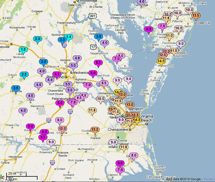
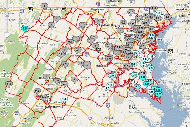