|
Mid-Atlantic Winter Storm Patterns |
| Miller A type snowstorm |
| This type of snowstorm has a low which originates in the Gulf; it intensifies and races up the east coast. EX: Superstorm 1993, Blizzard of 1996.
These tend to be more widespread in area BUT can be less favorable for historic snows in New England. However, they can clobber portions of the Mid-Atlantic. |
| Miller B type snowstorm |
| This type snowstorm has a primary low over the Appalachians while a new, secondary, and more powerful low spins up along the Gulf Stream waters off the coast of NC.
It intensifies and depending on its track can clobber areas of inland or coastal New England. These are less widespread in terms of area and usually miss the Mid-Atlantic. EX: Blizzard of 2005. |
| Type A through E by Albright and Cobb (2004) |
| This local study of Mid-Atlantic winter storms showed that there are five predominant patterns that produce four inches or more of snowfall across southeast Virginia and northeast North Carolina. There is a paper published by Albright and Cobb in the 15th Conference on Weather Analysis and Forecasting title "Synoptic Scale Climatology of Heavy Snow Events in Southeastern Virignia 1960-1995." There is also another reference: Albright, Wayne and Cobb, Hugh, 2004: Tying Mid-Atlantic Winter Storm Patterns to Composite Anomalies and Standard Deviations. |
| Tony Siebers |
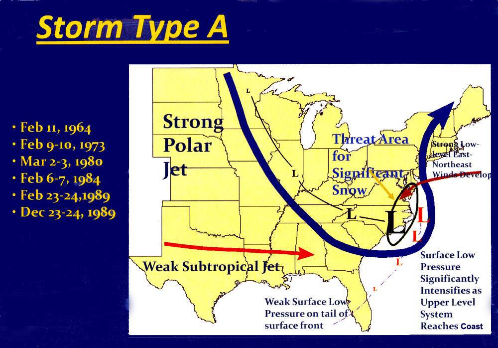 Type A |
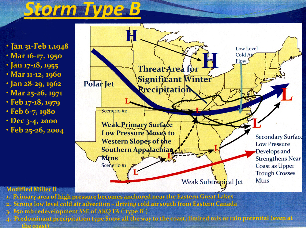 Type B |
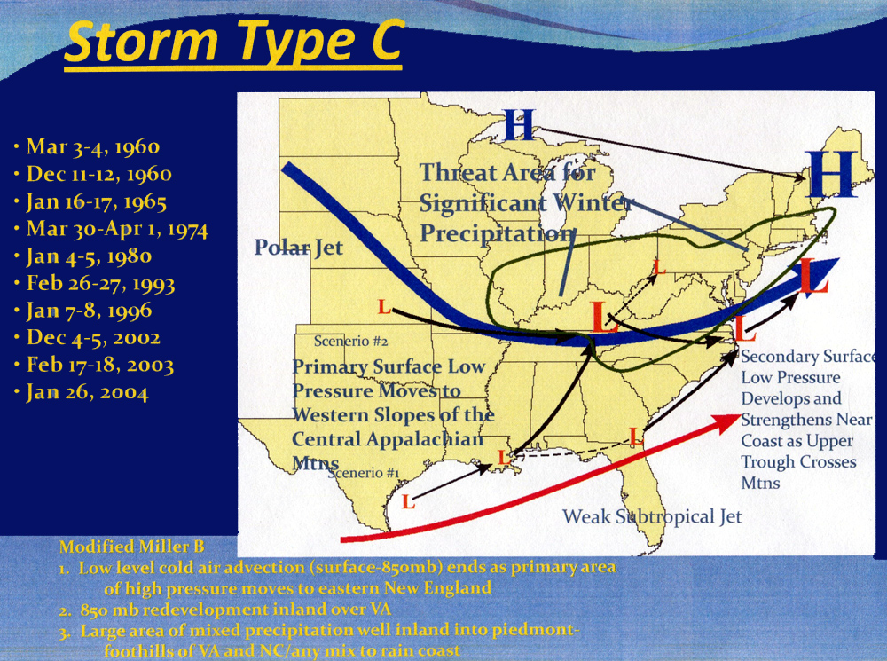 Type C |
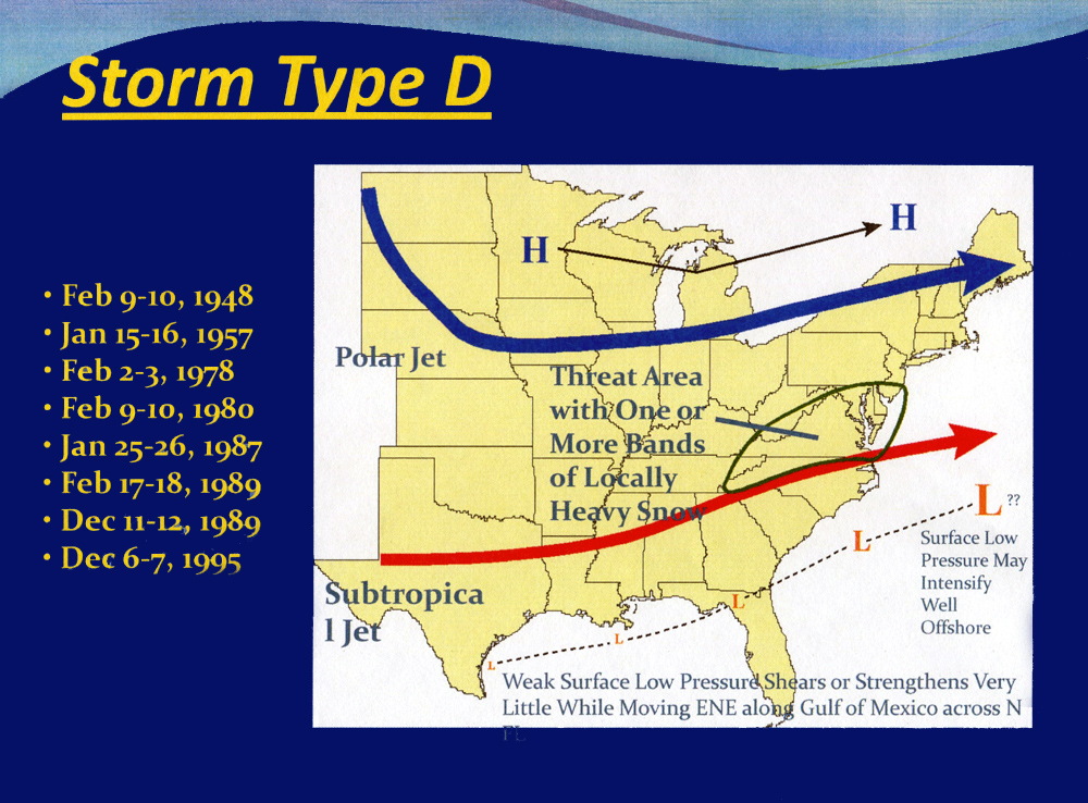 Type D |
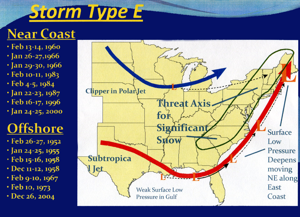 Type E |
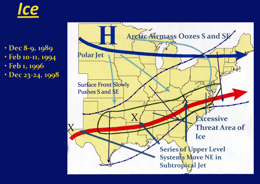 Type Ice |
BACK TO LINKS TABLE OF CONTENTS